Peñablanca, officially the Municipality of Peñablanca (Ibanag: Ili nat Peñablanca; Ilocano: Ili ti Peñablanca; Tagalog: Bayan ng Peñablanca), is a 1st class municipality in the province of Cagayan, Philippines. According to the 2020 census, it has a population of 50,300 people.[3]
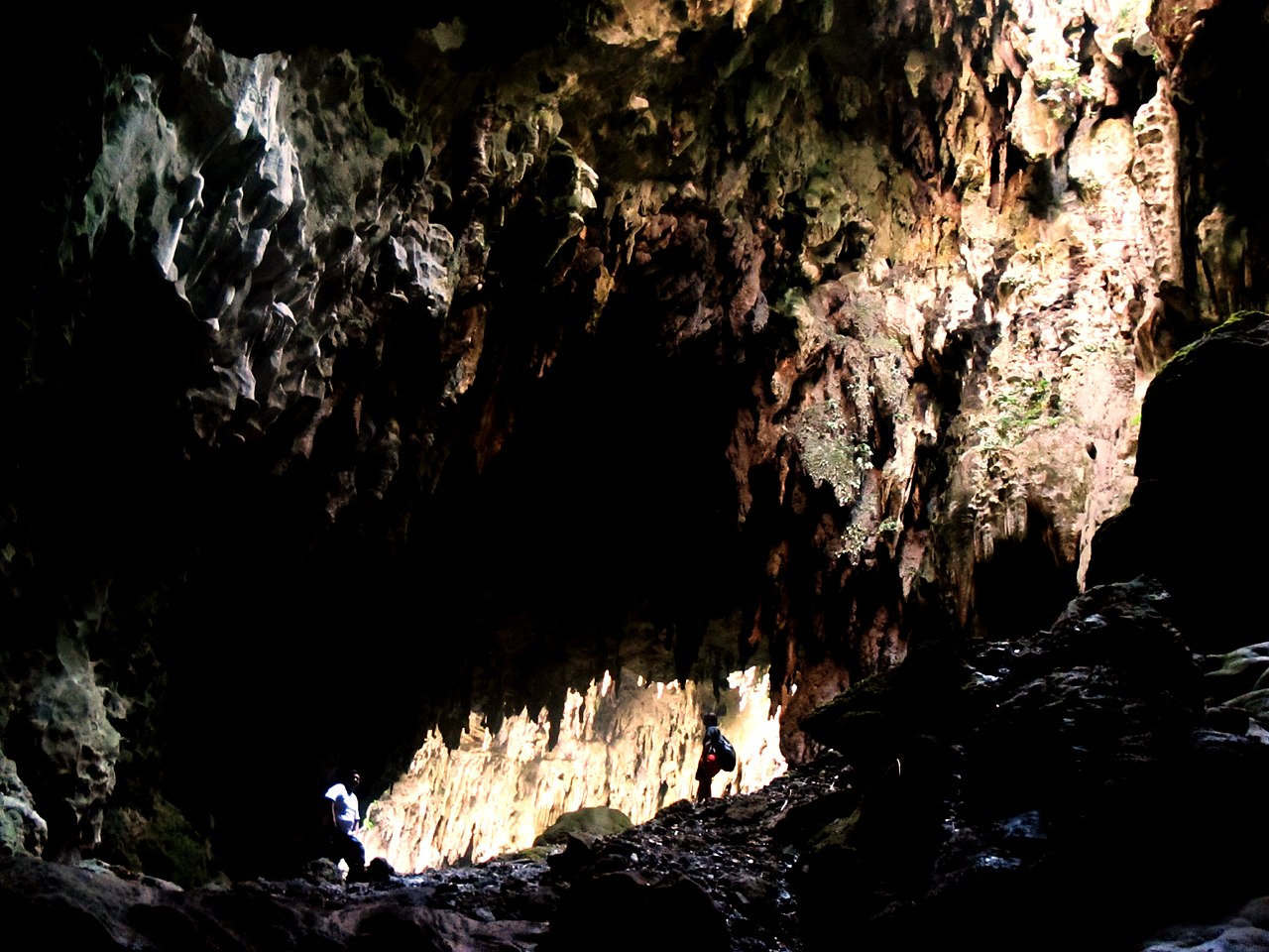
Situated 6 kilometres (3.7 mi) east of the provincial capital Tuguegarao and 475 kilometres (295 mi) north of Manila, the municipality is home to the Peñablanca Protected Landscape and Seascape which contains the Callao Cave (part of the Callao Limestone Formation Paleolithic Archaeological Site), one of the province's well-known landmarks and tourist spots.
It is also home to the charcoal-drawn Peñablanca petrographs. Both the Peñablanca petrographs and the Callao Limestone Formation are included as tentative sites of the Philippines for future inclusion in the UNESCOWorld Heritage List.[5] The Callao Limestone Formation has at least 93 archaeological sites that yielded stone tools of Paleolithic industry and bones and shells of animals still living in the vicinity.
History
Named after its prominent white rock formations, Peñablanca was formerly a barrio of Tuguegarao named Bubug. However, it also went by other names such as Alimannao, which was said to have been derived from a German rancher named Otto Weber, who, when one of his servants was asked who owned the cows in the area, responded in Itawis: cua na Aliman yao (they belong to the German). Another name for the place was camasi, from the native word for tomato, which abounded in the area.[6] Both Alimannao and Camasi are now names of barrios in the municipality.
Peñablanca was made a separate municipality by the Spaniards on 20 November 1886. Its first inhabitants were Kalingas (unbaptized Irrayas) and Negritos.[7]
Geography
Barangays
Peñablanca is divided into 24 barangays. Each barangay consists of puroks while some have sitios.
In the 2020 census, the population of Peñablanca, Cagayan, was 50,300 people,[3] with a density of 42 inhabitants per square kilometre or 110 inhabitants per square mile.
Economy
The fifth chamber of the Callao Cave, part of the Callao Limestone Formation Paleolithic Archaeological Site
Poverty incidence of Peñablanca
Government
Local government
Peñablanca, belonging to the third legislative district of the province of Cagayan, is governed by a mayor designated as its local chief executive and by a municipal council as its legislative body in accordance with the Local Government Code. The mayor, vice mayor, and the councilors are elected directly by the people through an election which is being held every three years.
Elected officials
Education
The Schools Division of Cagayan governs the town's public education system.[22] The division office is a field office of the DepEd in Cagayan Valley region.[23] The office governs the public and private elementary and public and private high schools throughout the municipality.
^"2015 Census of Population, Report No. 3 – Population, Land Area, and Population Density" (PDF). Philippine Statistics Authority. Quezon City, Philippines. August 2016. ISSN 0117-1453. Archived (PDF) from the original on May 25, 2021. Retrieved July 16, 2021.
^ a b cCensus of Population (2020). "Region II (Cagayan Valley)". Total Population by Province, City, Municipality and Barangay. Philippine Statistics Authority. Retrieved July 8, 2021.
^"PSA Releases the 2021 City and Municipal Level Poverty Estimates". Philippine Statistics Authority. April 2, 2024. Retrieved April 28, 2024.
^"Petroglyphs and Petrographs of the Philippines". whc.unesco.org. UNESCO World Heritage Centre. Retrieved March 23, 2018.
^de Rivera Castillet, Ed. Cagayan Province and her People. Community Publishers.
^Salgado, Pedro. "Other Missions in Cagayan Province". Cagayan Valley and Easter Cordillera: 1581-1898, Volume I. Rex Publishing. pp. 360–361.
^"Peñablanca, Cagayan: Average Temperatures and Rainfall". Meteoblue. Retrieved December 15, 2018.
^Census of Population (2015). "Region II (Cagayan Valley)". Total Population by Province, City, Municipality and Barangay. Philippine Statistics Authority. Retrieved June 20, 2016.
^Census of Population and Housing (2010). "Region II (Cagayan Valley)" (PDF). Total Population by Province, City, Municipality and Barangay. National Statistics Office. Retrieved June 29, 2016.
^Censuses of Population (1903–2007). "Region II (Cagayan Valley)". Table 1. Population Enumerated in Various Censuses by Province/Highly Urbanized City: 1903 to 2007. National Statistics Office.