Maramureș County (Romanian pronunciation: [maraˈmureʃ] ) is a county (județ) in Romania, in the Maramureș region. The county seat is Baia Mare.

In Hungarian it is known as Máramaros megye, in Ukrainian as Мараморо́щина, in German as Kreis Marmarosch, and in Yiddish as מאַרמאַראָש.

Maramureș County is situated in the northern part of Romania, in the historical region of Transylvania, and has a border with Ukraine. This county has a total area of 6,304 square kilometres (2,434 sq mi), of which 43% is covered by the Rodna Mountains, with its tallest peak, Pietrosul, at 2,303 metres (7,556 ft) altitude.
Together with the Gutâi and Țibleș mountain ranges, the Rodna mountains are part of the Eastern Carpathians. The rest of the county are hills, plateaus, and valleys. The county is crossed by Tisa River and its main tributaries: the Iza, Vișeu, and Mara rivers.
The neighbouring territorial units, both Romanian and foreign, to Maramureș County are listed below:

.JPG/1280px-BorsaMM_(2).JPG)

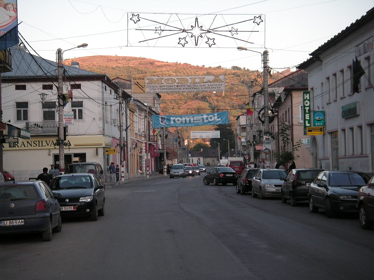
Maramureș County has 2 municipalities, 11 towns and 63 communes.
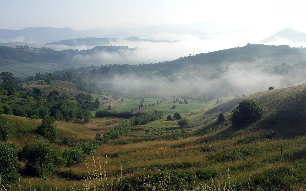
Maramureș is known for its pastoral and agricultural traditions, largely unscathed by the industrialisation campaign carried out during Romania's communist period. Ploughing, planting, harvesting, and hay making and handling are mostly done through manual labour. The county is also home to a strong mining industry of extraction of metals other than iron. The industrial plants built around Baia Mare during the communist period heavily polluted the area in the past, but recently, due to the decline of the city's industrial activity, the area has become less polluted.

The region is known for its beautiful rural scenery, local small woodwork and craftwork industry as well as for its churches and original rural architecture. There are not many paved roads in the rural areas, but most of them are usually accessible.
The county's main tourist attractions are:
Ethnic composition of Maramureș County (2021)
According to the 2021 census, the county had a population of 452,475 and the population density was 71.8/km2 (185.9/sq mi).[3]
The Maramureș County Council, elected at the 2020 local elections, consists of 34 councillors, with the following party composition:[5]
In 1920, under the Treaty of Trianon, the northern part of the county became part of newly-formed Czechoslovakia, while the southern part (including Sighetu Marmației) became part of the Kingdom of Romania.
After the administrative unification law in 1925, the county remained as it was, with an identical name and territory.
In 1938, King Carol II promulgated a new Constitution, and subsequently he had the administrative division of the Romanian territory changed. Ten ținuturi (approximate translation: "lands") were created (by merging the counties) to be ruled by rezidenți regali (approximate translation: "Royal Residents") – appointed directly by the king – instead of the prefects. Maramureș County became part of Ținutul Crișuri.
In August 1940, under the auspices of Nazi Germany, which imposed the Second Vienna Award, the county was transferred back to Hungary with the rest of Northern Transylvania. In October 1944, Romanian forces with Soviet assistance recaptured the ceded territory and reintegrated it into Romania, re-establishing the county. Romanian jurisdiction over the county per the Treaty of Trianon was reaffirmed in the Paris Peace Treaties, 1947. The counties of Romania, including Maramureș, were disestablished by the communist government of Romania in 1950 in favour of regions, and re-established in 1968 when Romania restored the county administrative system.

In 1930, the county was originally divided into three districts (plăși):[6]
Subsequently, the Iza and Sighet districts were reorganized into three districts, adding one:
According to the 1930 census, the county's population was 194,619, 57.9% Romanian, 20.9% Jews, 11.9% Ruthenians (including Ukrainians), 6.9% Hungarians, 2.0% Germans, as well as other minorities.[7] The following composition was recorded from the religious point of view: 64.4% Greek Catholic, 21.0% Jewish, 6.4% Roman Catholic, 5.3% Eastern Orthodox, 1.8% Reformed, as well as other minorities.[7]
In 1930 the county's urban population ethnically consisted of 38.6% Jews, 35.4% Romanians, 19.9% Hungarians, 4.5% Ruthenians (including Ukrainians), as well as other minorities. Yiddish was spoken by 36.6% of the urban population, followed by Romanian (33.7%), Hungarian (25.7%), Ukrainian (2.3%), as well as other minorities. From the religious point of view, the urban inhabitants were Jewish (38.9%), Greek Catholics (38.0%), Roman Catholics (12.8%), Reformed (5.7%), Eastern Orthodox (3.5%), as well as other minorities.[7]
Natives of the county include:
47°40′22″N 24°00′18″E / 47.67278°N 24.00500°E / 47.67278; 24.00500