Interstate 520 (I-520) is a 23.34-mile (37.56 km) auxiliary Interstate Highway that encircles most of Augusta, Georgia, and North Augusta, South Carolina, as a three-quarter beltway around the western, southern, and eastern parts of the main part of the Augusta metropolitan area. It begins at I-20 and State Route 232 (SR 232) in the northern part of Augusta, Georgia, and ends at I-20 in the northern part of North Augusta, South Carolina. I-520 is also known as Bobby Jones Expressway and the Deputy James D. Paugh Memorial Highway in Georgia and Palmetto Parkway in South Carolina. On the Georgia side, the road also carries the internal designationState Route 415 (SR 415).
Route description
The entire length of I-520 is part of the National Highway System, a system of routes determined to be the most important for the nation's economy, mobility, and defense.[4][5]
I-520 curves to the north-northwest, to an interchange with US 1/US 78/US 278 (only signed as "US 1"). The highway curves back to the north-northeast and has an interchange with South Carolina Highway 126 (SC 126; Clearwater Road). During a slight westward shift is an interchange with US 25/SC 121 (Edgefield Road). Just north-northeast of there, I-520 meets its eastern terminus, another interchange with I-20.
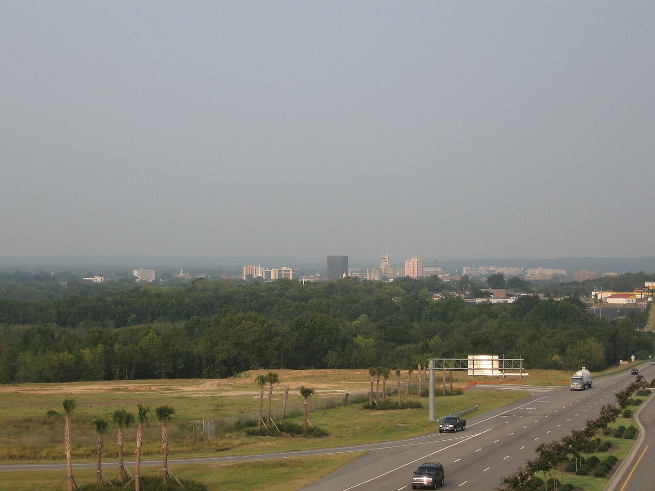
Downtown Augusta skyline as seen from the US 1/US 78/US 278 exit in North Augusta (exit 17)
Named portions
In Georgia, I-520 is known as Bobby Jones Expressway for golferBobby Jones.[6] In South Carolina, it is known as Palmetto Parkway for the sabal palmetto, the state tree. Between exits 2 and 3, the highway is known as the Deputy James D. Paugh Memorial Highway after a Richmond County sheriff's deputy who was killed at exit 3 when responding to reports of a gunman who was shooting at passing cars.[7] I-520 loses its state route designation in South Carolina, as that state does not co-number its Interstates with state highway numbers.
History
The highway that would become I-520 was under construction between May 1963 and January 1966 from its western terminus to just south of the US 1/SR 4 interchange in Augusta. Also, it was proposed to be an extension of SR 232, at least as far as US 25/SR 121.[8][9] In 1966, the highway was open and signed as SR 232 from I-20 to Wrightsboro Road. It was under construction from US 1/SR 4 to Doug Barnard Parkway.[9][10] In 1974, SR 232 was open from Wrightsboro Road to US 1/SR 4.[11][12] In 1977, the highway was redesignated as I-520.[2][3] The next year, it was open from US 1/SR 4 to Doug Barnard Parkway.[3][13] In 1986, the highway was under construction from Doug Barnard Parkway to SR 28.[14][15] In 1998, this segment was opened.[16][17] The next year, it was proposed to be extended to the South Carolina state line.[17][18] In 2004, this extension was opened.[19][20] In 2010, the highway was extended to its current eastern terminus in the northern part of North Augusta.[21][22]
In January 2015, 4.7 miles (7.6 km) of I-520 were expanded to three lanes in each direction after work started in February 2012 for a cost of $33 million.[23]
Exit list
In accordance with MUTCD guidelines for auxiliary Interstates, exit numbering is continuous across the state line and does not reset.
^Adderly, Kevin (January 30, 2018). "Table 2: Auxiliary Routes of the Dwight D. Eisenhower National System of Interstate and Defense Highways as of December 31, 2017". Route Log and Finder List. Washington, D.C: Federal Highway Administration. Retrieved June 7, 2018.
^ a bGeorgia Department of Transportation (January 1977). Official Highway Map (PDF) (Map) (1977–1978 ed.). Scale not given. Atlanta: Georgia Department of Transportation. Retrieved December 27, 2016.
^ a b cGeorgia Department of Transportation (January 1977). Official Highway Map (PDF) (Map) (1977–1978 ed.). Scale not given. Atlanta: Georgia Department of Transportation. Retrieved December 27, 2016.
^National Highway System: Augusta-Richmond County, GA--SC (PDF) (Map). Federal Highway Administration. May 9, 2019. Retrieved August 10, 2019.
^National Highway System: Augusta-Richmond County, GA--SC (PDF) (Map). Federal Highway Administration. May 9, 2019. Retrieved August 10, 2019.
^Krakow, Kenneth K. (1975). Georgia Place-Names: Their History and Origins (PDF). Macon, GA: Winship Press. p. 21. ISBN 0-915430-00-2.
^"2011-2012 Regular Session - HR 1103: Deputy James D. Paugh Memorial Highway; Richmond County; dedicate" (PDF). Atlanta: Georgia State Senate. Retrieved April 5, 2014.
^State Highway Department of Georgia (1963). State Highway System and Other Principal Connecting Roads (PDF) (Map). Scale not given. Atlanta: State Highway Department of Georgia. OCLC 5673161. Retrieved December 27, 2016. (Corrected to June 1, 1963.)
^ a bState Highway Department of Georgia (January 1966). Official Highway Map (PDF) (Map). Scale not given. Atlanta: State Highway Department of Georgia. Retrieved December 27, 2016.
^State Highway Department of Georgia (January 1967). Official Highway Map (PDF) (Map). Scale not given. Atlanta: State Highway Department of Georgia. Retrieved December 27, 2016.
^Georgia Department of Transportation (January 1974). Official Highway Map (PDF) (Map) (1974–1975 ed.). Scale not given. Atlanta: Georgia Department of Transportation. Retrieved December 27, 2016.
^Georgia Department of Transportation (January 1975). Official Highway Map (PDF) (Map) (1975–1976 ed.). Scale not given. Atlanta: Georgia Department of Transportation. Retrieved December 27, 2016.
^Georgia Department of Transportation (January 1978). Official Highway Map (PDF) (Map) (1978-79 ed.). Scale not given. Atlanta: Georgia Department of Transportation. Retrieved December 27, 2016.
^Georgia Department of Transportation (1986). Official Highway and Transportation Map (PDF) (Map) (1986–1987 ed.). Scale not given. Atlanta: Georgia Department of Transportation. Retrieved December 27, 2016.
^Georgia Department of Transportation (1987). Official Highway and Transportation Map (PDF) (Map) (1987–1988 ed.). Scale not given. Atlanta: Georgia Department of Transportation. Retrieved December 27, 2016.
^Georgia Department of Transportation (1998). Official Highway and Transportation Map (PDF) (Map) (1998–1999 ed.). Scale not given. Atlanta: Georgia Department of Transportation. Retrieved December 27, 2016.
^ a bGeorgia Department of Transportation (1999). Official Highway and Transportation Map (PDF) (Map) (1999–2000 ed.). Scale not given. Atlanta: Georgia Department of Transportation. Retrieved December 27, 2016.
^Georgia Department of Transportation (2000). Official Highway and Transportation Map (PDF) (Map) (2000–2001 ed.). Scale not given. Atlanta: Georgia Department of Transportation. Retrieved December 27, 2016.
^Georgia Department of Transportation (2004). Official Highway and Transportation Map (PDF) (Map) (2004–2005 ed.). Scale not given. Atlanta: Georgia Department of Transportation. Retrieved December 27, 2016.
^Georgia Department of Transportation (2005). Official Highway and Transportation Map (PDF) (Map) (2005–2006 ed.). Scale not given. Atlanta: Georgia Department of Transportation. Retrieved December 27, 2016.
^Georgia Department of Transportation (2009). Official Highway and Transportation Map (PDF) (Map) (2009–2010 ed.). Scale not given. Atlanta: Georgia Department of Transportation. Retrieved December 27, 2016.
^Georgia Department of Transportation (2011). Official Highway and Transportation Map (PDF) (Map) (2011–2012 ed.). Scale not given. Atlanta: Georgia Department of Transportation. OCLC 770217845. Retrieved December 27, 2016.
^"I-520 Lane Expansion and Interchange Project Complete". August, GA: WRDW-TV. January 22, 2015. Retrieved October 12, 2015.