li{counter-increment:listitem}.mw-parser-output .hlist ol>li::before{content:" "counter(listitem)"\a0 "}.mw-parser-output .hlist dd ol>li:first-child::before,.mw-parser-output .hlist dt ol>li:first-child::before,.mw-parser-output .hlist li ol>li:first-child::before{content:" ("counter(listitem)"\a0 "}">
stringtranslate.com

Портал:География

Темы портала
Деятельность
Культура
География
Здоровье
История
Математика
Природа
Люди
Философия
Религия
Общество
Технологии
Случайный портал

Географический портал

  • П:ГЕО
Физическая карта Земли​ ​

География (от древнегреческого γεωγραφία geōgraphía ; объединение 'Земля' и gráphō 'писать') - это изучение земель, особенностей, жителей и явлений Земли . География - это всеобъемлющая дисциплина, которая стремится понять Землю и ее человеческие и природные сложности - не только то, где находятся объекты, но и то, как они изменились и появились. Хотя география специфична для Земли, многие концепции могут быть применены более широко к другим небесным телам в области планетологии . Географию называют «мостом между естественными науками и социальными науками ».

Происхождение многих концепций в географии можно проследить до грека Эратосфена из Кирены, который, возможно, ввел термин «geographia» ( ок.  276 г. до н. э.  – ок.  195/194 г. до н. э. ). Первое зарегистрированное использование слова γεωγραφία было в названии книги греческого ученого Клавдия Птолемея (100 – 170 г. н. э.). Эта работа создала так называемую «птолемеевскую традицию» географии, которая включала «птолемеевскую картографическую теорию». Однако концепции географии (такие как картография ) восходят к самым ранним попыткам понять мир пространственно, причем самый ранний пример попытки создания карты мира датируется IX в. до н. э. в Древнем Вавилоне . История географии как дисциплины охватывает культуры и тысячелетия, будучи независимо разработанной несколькими группами и перекрестно опыляемой торговлей между этими группами. Основными концепциями географии, едиными для всех подходов, являются сосредоточенность на пространстве, месте, времени и масштабе.

Сегодня география — чрезвычайно широкая дисциплина с множеством подходов и модальностей. Было предпринято множество попыток организовать дисциплину, включая четыре традиции географии, и по ветвям. Используемые методы, как правило, можно разбить на количественные и качественные подходы, при этом многие исследования используют смешанные методы . Распространенные методы включают картографию , дистанционное зондирование , интервью и геодезию . ( Полная статья... )

Обновить с новыми вариантами ниже (очистить)

Избранная статья -@media screen{html.skin-theme-clientpref-night .mw-parser-output div:not(.notheme)>.tmp-color,html.skin-theme-clientpref-night .mw-parser-output p>.tmp-color,html.skin-theme-clientpref-night .mw-parser-output table:not(.notheme) .tmp-color{color:inherit!important}}@media screen и (prefers-color-scheme:dark){html.skin-theme-clientpref-os .mw-parser-output div:not(.notheme)>.tmp-color,html.skin-theme-clientpref-os .mw-parser-output p>.tmp-color,html.skin-theme-clientpref-os .mw-parser-output table:not(.notheme) .tmp-color{color:inherit!important}}загрузить новый пакет

Здесь отображаются избранные статьи , представляющие собой лучший контент английской Википедии.

  • Картина, на которой слева изображена группа кораблей, плывущих навстречу закату справа.
    Экспедиция Ла Саля в Луизиану в 1684 году , написанная в 1844 году Теодором Гюденом . La Belle находится слева, Le Joly находится в центре, а L'Aimable приземляется вдалеке справа.

    Французская колонизация Техаса началась, когда Роберт Кавелье де Ла Саль намеревался основать колонию в устье реки Миссисипи , но неточные карты и навигационные ошибки заставили его корабли вместо этого бросить якорь в 400 милях (640 км) к западу, у побережья Техаса. Колония просуществовала до 1688 года. Современный город Инес находится недалеко от места расположения форта. Колония столкнулась с многочисленными трудностями за время своего недолгого существования, включая набеги коренных американцев , эпидемии и суровые условия. С этой базы Ла Саль возглавил несколько экспедиций, чтобы найти реку Миссисипи. Они не увенчались успехом, но Ла Саль исследовал большую часть Рио-Гранде и части Восточного Техаса.

    Во время одного из его отсутствий в 1686 году последний корабль колонии потерпел крушение, в результате чего колонисты не смогли получить ресурсы из французских колоний Карибского моря . По мере ухудшения условий Ла Саль понял, что колония может выжить только с помощью французских поселений в округе Иллинойс на севере, вдоль рек Миссисипи и Иллинойс . Последняя экспедиция Ла Саля завершилась вдоль реки Бразос в начале 1687 года, когда он и пятеро его людей были убиты во время мятежа. Хотя горстка людей достигла округа Иллинойс, помощь так и не добралась до форта. Большинство оставшихся членов колонии были убиты во время набега каранкава в конце 1688 года, хотя четверо детей выжили, будучи усыновленными в качестве пленников. Хотя колония просуществовала всего три года, она установила притязания Франции на владение регионом, который сейчас является Техасом. Позже Соединенные Штаты безуспешно заявили свои права на этот регион как часть Луизианской покупки из-за ранней французской колонии. ( Полная статья... )

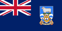
  • The Falkland Islands (/ˈfɔː(l)klənd, ˈfɒlk-/ FAW(L)K-lənd, FOLK-; Spanish: Islas Malvinas [ˈislas malˈβinas]) is an archipelago in the South Atlantic Ocean on the Patagonian Shelf. The principal islands are about 300 mi (480 km) east of South America's southern Patagonian coast and about 752 mi (1,210 km) from Cape Dubouzet at the northern tip of the Antarctic Peninsula, at a latitude of about 52°S. The archipelago, with an area of 4,700 sq mi (12,000 km2), comprises East Falkland, West Falkland, and 776 smaller islands. As a British overseas territory, the Falklands have internal self-governance, but the United Kingdom takes responsibility for their defence and foreign affairs. The capital and largest settlement is Stanley on East Falkland.

    Controversy exists over the Falklands' discovery and subsequent colonisation by Europeans. At various times, the islands have had French, British, Spanish, and Argentine settlements. Britain reasserted its rule in 1833, but Argentina maintains its claim to the islands. In April 1982, Argentine military forces invaded the islands. British administration was restored two months later at the end of the Falklands War. In a 2013 sovereignty referendum, almost all Falklanders voted in favour of remaining a UK overseas territory. The territory's sovereignty status is part of an ongoing dispute between Argentina and the UK. (Full article...)

  • Navenby village from the Viking Way

    Navenby /ˈnvənbi/ is a village and civil parish in the North Kesteven district of Lincolnshire, England. Lying 8 miles (13 km) south from Lincoln and 9 miles (14 km) north-northwest from Sleaford, Navenby had a population of 2,128 in the 2011 census and in March 2011, it was named as the 'Best Value Village' in England following a national survey.

    A Bronze Age cemetery and the remains of an Iron Age settlement have been discovered in the village. Historians also believe Navenby was a significant staging point on the Roman Ermine Street, as the Romans are reported to have maintained a small base or garrison in the village. Navenby became a market town after receiving a charter from Edward the Confessor in the 11th century. The charter was later renewed by William Rufus, Edward III and Richard II. When the market fell into disuse in the early 19th century, Navenby returned to being a village. (Full article...)

  • Interior of the former vegetable market, 2006

    Covent Garden is a district in London, on the eastern fringes of the West End, between St Martin's Lane and Drury Lane. It is associated with the former fruit-and-vegetable market in the central square, now a popular shopping and tourist site, and with the Royal Opera House, itself known as "Covent Garden". The district is divided by the main thoroughfare of Long Acre, north of which is given over to independent shops centred on Neal's Yard and Seven Dials, while the south contains the central square with its street performers and most of the historical buildings, theatres and entertainment facilities, including the London Transport Museum and the Theatre Royal, Drury Lane.

    The area was fields until briefly settled in the 7th century when it became the heart of the Anglo-Saxon trading town of Lundenwic, then abandoned at the end of the 9th century after which it returned to fields. By 1200 part of it had been walled off by the Abbot of Westminster Abbey for use as arable land and orchards, later referred to as "the garden of the Abbey and Convent", and later "the Convent Garden". Following the Dissolution of the Monasteries it was granted in 1552 by the young King Edward VI to John Russell, 1st Earl of Bedford (c.1485–1555), the trusted adviser to his father King Henry VIII. The 4th Earl commissioned Inigo Jones to build some fine houses to attract wealthy tenants. Jones designed the Italianate arcaded square along with the church of St Paul's. The design of the square was new to London and had a significant influence on modern town planning, acting as the prototype for new estates as London grew. (Full article...)

  • Map of the fleet movements prior to the Battle of Trapani

    The Battle of Trapani took place on 23 June 1266 off Trapani, Sicily, between the fleets of the Republic of Genoa and the Republic of Venice, as part of the War of Saint Sabas (1256–1270). During the war, the Venetians held the upper hand in naval confrontations, forcing the Genoese to resort to commerce raiding and avoiding fleet battles. In the 1266 campaign, the Genoese had an advantage in numbers, but this was not known to the Genoese commander, Lanfranco Borbonino. As a result, the Genoese tarried at Corsica until the end of May. The Venetian fleet under Jacopo Dondulo, was left to sail back and forth awaiting the appearance of the Genoese fleet in the waters around southern Italy and Sicily. Fearing that the other side had more ships, both sides reinforced their fleets with additional ships, but the Genoese retained a small numerical advantage.

    The two fleets met near Trapani in Sicily on 22 June. After learning of the Venetian fleet's smaller size, the Genoese war council resolved to attack, but during the night Borbonino reversed the decision and instead ordered his ships to take up a defensive position, bound together with chains, near the shore. As the Venetian fleet attacked the next day, many of the Genoese crews, mostly hired foreigners, lost heart and abandoned their ships. The battle was a crushing Venetian victory, as they sank or captured the entire Genoese fleet. On their return to Genoa, Borbonino and most of his captains were tried and fined large sums for cowardice. Despite the loss, Genoa continued the war, in which neither side was able to gain a decisive advantage, until it was ended through French mediation in 1270. (Full article...)

  • Manchester (/ˈmænɪstər, -ɛs-/ ) is a city and metropolitan borough of Greater Manchester, England, which had an estimated population of 568,996 in 2022. It contributes to the third-most populous metropolitan area in the United Kingdom as a part of Greater Manchester, which has a population of approximately 2.92 million.  It is bordered by the Cheshire Plain to the south, the Pennines to the north and east, and the neighbouring city of Salford to the west. The city borders the boroughs of Trafford, Stockport, Tameside, Oldham, Rochdale, Bury and Salford.

    The history of Manchester began with the civilian settlement associated with the Roman fort (castra) of Mamucium or Mancunium, established in about AD 79 on a sandstone bluff near the confluence of the rivers Medlock and Irwell. Throughout the Middle Ages, Manchester remained a manorial township but began to expand "at an astonishing rate" around the turn of the 19th century. Manchester's unplanned urbanisation was brought on by a boom in textile manufacture during the Industrial Revolution and resulted in it becoming the world's first industrialised city. Historically part of Lancashire, areas of Cheshire south of the River Mersey were incorporated into Manchester in the 20th century, including Wythenshawe in 1931. Manchester achieved city status in 1853. The Manchester Ship Canal opened in 1894, creating the Port of Manchester and linking the city to the Irish Sea, 36 miles (58 km) to the west. The city's fortune declined after the Second World War, owing to deindustrialisation, and the IRA bombing in 1996 led to extensive investment and regeneration. Following considerable redevelopment, Manchester was the host city for the 2002 Commonwealth Games. (Full article...)

  • Fanno Creek in Greenway Park, Beaverton

    Fanno Creek is a 15-mile (24 km) tributary of the Tualatin River in the U.S. state of Oregon. Part of the drainage basin of the Columbia River, its watershed covers about 32 square miles (83 km2) in Multnomah, Washington, and Clackamas counties, including about 7 square miles (18 km2) within the Portland city limits.

    From its headwaters in the Tualatin Mountains (West Hills) in southwest Portland, the creek flows generally west and south through the cities of Portland, Beaverton, Tigard and Durham, and unincorporated areas of Washington County. It enters the Tualatin River about 9 miles (14 km) above the Tualatin's confluence with the Willamette River at West Linn. (Full article...)

  • Battle of Rossbach, unknown artist

    The Battle of Rossbach took place on 5 November 1757 during the Third Silesian War (1756–1763, part of the Seven Years' War) near the village of Rossbach (Roßbach), in the Electorate of Saxony. It is sometimes called the Battle of, or at, Reichardtswerben, after a different nearby town. In this 90-minute battle, Frederick the Great, king of Prussia, defeated an Allied army composed of French forces augmented by a contingent of the Reichsarmee (Imperial Army) of the Holy Roman Empire. The French and Imperial army included 41,110 men, opposing a considerably smaller Prussian force of 22,000. Despite overwhelming odds, Frederick managed to defeat the Imperials and the French.

    The Battle of Rossbach marked a turning point in the Seven Years' War, not only for its stunning Prussian victory, but because France refused to send troops against Prussia again and Britain, noting Prussia's military success, increased its financial support for Frederick. Following the battle, Frederick immediately left Rossbach and marched for 13 days to the outskirts of Breslau. There he met the Austrian army at the Battle of Leuthen; he employed similar tactics to again defeat an army considerably larger than his own. (Full article...)

  • Voight, 1955 yearbook photo from Archbishop Stepinac High School

    Barry Voight (/vɔɪt/; born 1937) is an American geologist, volcanologist, author, and engineer. After earning his Ph.D. at Columbia University, Voight worked as a professor of geology at several universities, including Pennsylvania State University, where he taught from 1964 until his retirement in 2005. He remains an emeritus professor there and still conducts research, focusing on rock mechanics, plate tectonics, disaster prevention, and geotechnical engineering.

    In April 1980, Voight's publications on landslides, avalanches, and other mass movements attracted the attention of Rocky Crandell of the United States Geological Survey (USGS), who asked him to look at a growing bulge on the Mount St. Helens volcano in the state of Washington. Voight foresaw the collapse of the mountain's north flank as well as a powerful eruption. His predictions came true when St. Helens erupted in May 1980; Voight was then hired by the USGS to investigate the debris avalanche that initiated the eruption. After his work at Mount St. Helens brought him international recognition, Voight continued researching and guiding monitoring efforts at several active volcanoes throughout his career, including Nevado del Ruiz in Colombia, Mount Merapi in Indonesia, and Soufrière Hills, a volcano on the Caribbean island of Montserrat. For his research, publications, and disaster prevention work as a volcanologist and engineer, Voight has been honored with numerous awards, appointments, and medals. (Full article...)

  • The Three Sisters, looking north

    The Three Sisters are closely spaced volcanic peaks in the U.S. state of Oregon. They are part of the Cascade Volcanic Arc, a segment of the Cascade Range in western North America extending from southern British Columbia through Washington and Oregon to Northern California. Each over 10,000 feet (3,000 meters) in elevation, they are the third-, fourth- and fifth-highest peaks in Oregon. Located in the Three Sisters Wilderness at the boundary of Lane and Deschutes counties and the Willamette and Deschutes national forests, they are about 10 miles (16 kilometers) south of the nearest town, Sisters. Diverse species of flora and fauna inhabit the area, which is subject to frequent snowfall, occasional rain, and extreme temperature variation between seasons. The mountains, particularly South Sister, are popular destinations for climbing and scrambling.

    Although they are often grouped together as one unit, the three mountains have their own individual geology and eruptive history. Neither North Sister nor Middle Sister has erupted in the last 14,000 years, and it is considered unlikely that either will ever erupt again. South Sister last erupted about 2,000 years ago and could erupt in the future, threatening life within the region. After satellite imagery detected ground inflation near South Sister in 2001, the United States Geological Survey improved monitoring in the immediate area. (Full article...)

  • The Battle of Pavia, by an unknown Flemish artist

    The Italian War of 1521–1526, sometimes known as the Four Years' War, (French: Sixième guerre d'Italie) was a part of the Italian Wars. The war pitted Francis I of France and the Republic of Venice against the Holy Roman Emperor Charles V, Henry VIII of England, and the Papal States. It arose from animosity over the election of Charles as Emperor in 1519–1520 and from Pope Leo X's need to ally with Charles against Martin Luther.

    The war broke out across Western Europe late in 1521, when a French–Navarrese expedition attempted to reconquer Navarre while a French army invaded the Low Countries. A Spanish army drove the Navarrese forces back into the Pyrenees, and other Imperial forces attacked northern France, where they were stopped in turn. (Full article...)

  • Micronations and the Search for Sovereignty is a 2021 book by Australian constitutional law specialists Harry Hobbs and George Williams about micronations and their legal status. Written from an academic perspective, it is one of few works on micronational movements and the earliest-published book to focus largely on the legal aspect of micronations. The book concerns the definition of statehood, the place of micronations within international law, people's motivations for declaring them, the micronational community and the ways by which such entities mimic sovereign states. In 2022 Hobbs and Williams published a book for a broader audience, How to Rule Your Own Country: The Weird and Wonderful World of Micronations. (Full article...)

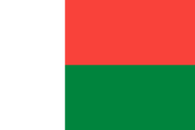
  • Madagascar, officially the Republic of Madagascar, is an island country comprising the island of Madagascar and numerous smaller peripheral islands. Lying off the southeastern coast of Africa, it is the world's fourth largest island, the second-largest island country and the 46th largest country in the world. Its capital and largest city is Antananarivo.

    Following the prehistoric breakup of the supercontinent Gondwana, Madagascar split from Africa during the Early Jurassic, around 180 million years ago, and split from the Indian subcontinent around 90 million years ago, allowing native plants and animals to evolve in relative isolation; consequently, it is a biodiversity hotspot and one of the world's 17 megadiverse countries, with over 90% of wildlife being endemic. The island has a subtropical to tropical maritime climate. Madagascar was first settled during or before the mid-first millennium AD by Austronesian peoples, presumably arriving on outrigger canoes from present-day Indonesia. These were joined around the ninth century AD by Bantu migrants crossing the Mozambique Channel from East Africa. Other groups continued to settle on Madagascar over time, each one making lasting contributions to Malagasy cultural life. Consequently, there are 18 or more classified peoples of Madagascar, the most numerous being the Merina of the central highlands. (Full article...)

  • Southern right whale breaching

    Right whales are three species of large baleen whales of the genus Eubalaena: the North Atlantic right whale (E. glacialis), the North Pacific right whale (E. japonica) and the Southern right whale (E. australis). They are classified in the family Balaenidae with the bowhead whale. Right whales have rotund bodies with arching rostrums, V-shaped blowholes and dark gray or black skin. The most distinguishing feature of a right whale is the rough patches of skin on its head, which appear white due to parasitism by whale lice. Right whales are typically 13–17 m (43–56 ft) long and weigh up to 100 short tons (91 t; 89 long tons) or more.

    All three species are migratory, moving seasonally to feed or give birth. The warm equatorial waters form a barrier that isolates the northern and southern species from one another although the southern species, at least, has been known to cross the equator. In the Northern Hemisphere, right whales tend to avoid open waters and stay close to peninsulas and bays and on continental shelves, as these areas offer greater shelter and an abundance of their preferred foods. In the Southern Hemisphere, right whales feed far offshore in summer, but a large portion of the population occur in near-shore waters in winter. Right whales feed mainly on copepods but also consume krill and pteropods. They may forage the surface, underwater or even the ocean bottom. During courtship, males gather into large groups to compete for a single female, suggesting that sperm competition is an important factor in mating behavior. Gestation tends to last a year, and calves are weaned at eight months old. (Full article...)

  • The Ming dynasty (/mɪŋ/ MING), officially the Great Ming, was an imperial dynasty of China, ruling from 1368 to 1644 following the collapse of the Mongol-led Yuan dynasty. The Ming dynasty was the last imperial dynasty of China ruled by the Han people, the majority ethnic group in China. Although the primary capital of Beijing fell in 1644 to a rebellion led by Li Zicheng (who established the short-lived Shun dynasty), numerous rump regimes ruled by remnants of the Ming imperial family—collectively called the Southern Ming—survived until 1662.

    The Ming dynasty's founder, the Hongwu Emperor (r.1368–1398), attempted to create a society of self-sufficient rural communities ordered in a rigid, immobile system that would guarantee and support a permanent class of soldiers for his dynasty: the empire's standing army exceeded one million troops and the navy's dockyards in Nanjing were the largest in the world. He also took great care breaking the power of the court eunuchs and unrelated magnates, enfeoffing his many sons throughout China and attempting to guide these princes through the Huang-Ming Zuxun, a set of published dynastic instructions. This failed when his teenage successor, the Jianwen Emperor, attempted to curtail his uncle's power, prompting the Jingnan campaign, an uprising that placed the Prince of Yan upon the throne as the Yongle Emperor in 1402. The Yongle Emperor established Yan as a secondary capital and renamed it Beijing, constructed the Forbidden City, and restored the Grand Canal and the primacy of the imperial examinations in official appointments. He rewarded his eunuch supporters and employed them as a counterweight against the Confucian scholar-bureaucrats. One eunuch, Zheng He, led seven enormous voyages of exploration into the Indian Ocean as far as Arabia and the eastern coasts of Africa. Hongwu and Yongle emperors had also expanded the empire's rule into Inner Asia. (Full article...)

Жизненно важная статья

Важнейшие статьи для понимания географии.

Размеры Африки по сравнению с другими континентами

Африка является вторым по величине и вторым по численности населения континентом в мирепосле Азии . Около 30,3 млн км 2 (11,7 млн ​​квадратных миль) включая прилегающие острова, она охватывает 20% площади суши Земли и 6% от ее общей площади поверхности. С почти 1,4 миллиарда человек по состоянию на 2021 год, она составляет около 18% от населения мира. Население Африки является самым молодым среди всех континентов; медианный возраст в 2012 году составлял 19,7 лет, когда медианный возраст в мире составлял 30,4 года. Согласно прогнозам на 2024 год, население Африки достигнет 3,8 миллиарда человек к 2099 году. Несмотря на широкий спектр природных ресурсов , Африка является наименее богатым континентом на душу населения и вторым наименее богатым по общему богатству, опережая Океанию . Ученые приписывают это различным факторам, включая географию , климат , коррупцию , колониализм , холодную войну и неоколониализм . Несмотря на эту низкую концентрацию богатства, недавний экономический рост и большое и молодое население делают Африку важным экономическим рынком в более широком глобальном контексте. Африка имеет большое количество природных ресурсов и продовольственных ресурсов, включая алмазы , сахар , соль , золото , железо , кобальт , уран , медь , бокситы , серебро , нефть , природный газ , какао-бобы и т. д. ( Полная статья... )

Связанные порталы

Примите участие

Для получения ресурсов для редакторов и сотрудничества с другими редакторами по улучшению статей Википедии, связанных с географией, посетите WikiProject Geography .

Избранные фотографии

Избранная биография

Избранные биографические статьи по географии

Лорд Эшфилд , Хью Сесил , ок. 1920 г.

Альберт Генри Стэнли, 1-й барон Эшфилд , TD , PC (8 августа 1874 — 4 ноября 1948), урождённый Альберт Генри Кнаттрисс , был британо-американским бизнесменом, который был управляющим директором, затем председателем компании Underground Electric Railways Company of London (UERL) с 1910 по 1933 год и председателем Лондонского совета по пассажирскому транспорту (LPTB) с 1933 по 1947 год.

Хотя он родился в Британии, его ранняя карьера проходила в Соединенных Штатах, где в молодом возрасте он занимал руководящие должности в развивающихся трамвайных системах Детройта и Нью-Джерси. В 1898 году он служил в ВМС США во время короткой испано-американской войны . ( Полная статья... )

Вы знали

Знаете ли вы это о географии?

Места вокруг вас

Вы можете прочитать интересные статьи в Википедии о местах вокруг вас.

Специальное предложение:Рядом

Топ-10 WikiProject Geography Популярные статьи месяца

Следующая статья по географии является одной из самых посещаемых статей WikiProject Geography . Полный список см. на Wikipedia:WikiProject Geography/Популярные страницы .

Избранные фотографии

Нажмите, чтобы увеличить и просмотреть описание.

Основные статьи

Категории

Выберите [►] для просмотра подкатегорий.

Ассоциированный Викимедиа

Более подробную информацию по этой теме можно найти в следующих родственных проектах Фонда Викимедиа :


  • Бесплатный репозиторий Commons
  • Wikibooks
    Бесплатные учебники и руководства
  • Wikidata
    Бесплатная база знаний
  • Wikinews
    Новости свободного контента
  • Wikiquote
    Коллекция цитат
  • Wikisource
    Библиотека свободного контента
  • Wikiversity
    Бесплатные инструменты обучения
  • Wikivoyage
    Бесплатный путеводитель
  • Викисловарь
    и тезаурус
Откройте для себя Википедию с помощью порталов