Графство Дублин ( ирландское : Contae Bhaile Átha Cliath [2] или Contae Átha Cliath ) — графство в Ирландии , со столицей в городе Дублин . Оно расположено на восточном побережье острова, в провинции Ленстер . До 1994 года графство Дублин (за исключением города) было единой территорией местного самоуправления ; в том году совет графства был разделён на три новых административных графства: Дун-Лэаре-Ратдаун , Фингал и Южный Дублин . Три административных графства вместе с городом Дублин образуют статистический регион NUTS III Ирландии (код IE061). [3] Графство Дублин остается единой административной единицей для целей судов (включая шерифа округа Дублин, но исключая бейливик шерифа города Дублин), а округ Дублин в сочетании с городом Дублин образует судебный округ Дублин, включающий окружной суд Дублина, регистратора округа Дублин и окружной суд Дублина. В Дублине также действуют правоохранительные органы (столичное отделение Garda Dublin) и пожарные службы ( пожарная бригада Дублина ), которые администрируются по всему графству.
Дублин — самое густонаселенное графство Ирландии , с населением 1 458 154 человек по состоянию на 2022 год [update]— примерно 28% от общей численности населения Республики Ирландия. [4] Город Дублин — столица и крупнейший город Республики Ирландия, а также крупнейший город на острове Ирландия . Примерно 9 из 10 человек в графстве Дублин живут в городе Дублин и его пригородах. [5] Несколько крупных городов, которые считаются отдельными от города, такие как Раш , Донабейт и Балбригган , расположены на крайнем севере графства. Сордс , хотя и отделен от города зеленым поясом вокруг аэропорта Дублина , считается пригородным городом и развивающимся малым городом. [6]
Третий по величине графство по площади, Дублин граничит с Митом на западе и севере, Килдэром на западе, Уиклоу на юге и Ирландским морем на востоке. Южную часть графства занимают Дублинские горы , которые возвышаются примерно на 760 метров (2500 футов) и содержат многочисленные долины, водохранилища и леса. Восточное побережье графства изрезано несколькими заливами и проливами, включая эстуарий Роджерстауна , эстуарий Бродмедоу , залив Балдойл и, что наиболее заметно, залив Дублина . Северная часть графства, сегодня известная как Фингал , чрезвычайно разнообразна по характеру: от густонаселенных пригородных городов городского пояса до плоских плодородных равнин, которые являются одними из крупнейших садоводческих и сельскохозяйственных центров страны.
Дублин — старейшее графство Ирландии, и это первая часть острова, которая была разделена на ширы после вторжения норманнов в конце 1100-х годов. Хотя это больше не территория местного самоуправления, Дублин сохраняет сильную идентичность и продолжает называться как регионом, так и графством взаимозаменяемо, в том числе на уровне органов власти. [7] [8]

Графство Дублин названо в честь города Дублин, что является англицизацией его древнескандинавского названия Dyflin . Город был основан в IX веке нашей эры поселенцами -викингами , которые основали Королевство Дублин . Поселению викингов предшествовало христианское церковное место, известное как Duiblinn , от которого Dyflin и получил свое название. Duiblinn происходит от раннего классического ирландского Dubhlind / Duibhlind — от dubh ( IPA: [d̪uβ] , IPA: [d̪uw] , IPA: [d̪uː] ), что означает «черный, темный», и lind ( IPA: [lʲiɲ(d̪ʲ)] ), «бассейн», относящийся к темному приливному бассейну. Этот приливный бассейн был расположен там, где река Поддл впадала в Лиффи , позади Дублинского замка .
Внутренние районы Дублина в скандинавский период назывались по-древнескандинавски : Dyflinnar skiíði , буквально «Дублиншир». [9] : 24
В дополнение к Dyflin , гэльское поселение, известное как Áth Cliath («брод из преград») [10] , располагалось выше по течению Лиффи, недалеко от современного моста Father Mathew Bridge . Baile Átha Cliath означает «город брода с преградами», а Áth Cliath относится к месту брода вдоль реки. Как и в случае с Duiblinn , в Áth Cliath также располагался ранний христианский монастырь , на месте, которое в настоящее время занимает кармелитская церковь Whitefriar Street .
Дублин был первым графством в Ирландии, получившим статус шира после нормандского завоевания в конце XII века. Норманны захватили королевство Дублин у его норвежско-гэльских правителей, и это название было использовано в качестве основы для официального англо-нормандского (а позднее и английского ) названия графства. Однако в современном ирландском языке регион был назван в честь гэльского поселения Baile Átha Cliath или просто Áth Cliath . В результате Дублин является одним из четырех графств в Ирландии с разным происхождением названия как для ирландского, так и для английского языка — другие — Wexford , Waterford и Wicklow , чьи английские названия также произошли от древнескандинавского.

Самые ранние зарегистрированные жители современного Дублина поселились вдоль устья реки Лиффи . Остатки пяти деревянных ловушек для рыбы были обнаружены около дока Спенсера в 2007 году. Эти ловушки были предназначены для ловли рыбы во время прилива и могли быть извлечены во время отлива. Для изготовления ловушек использовались каменные топоры с тонким лезвием, а радиоуглеродное датирование относит их к периоду позднего мезолита ( ок. 6100–5700 гг. до н. э.). [11]
Викинги вторглись в регион в середине IX века нашей эры и основали то, что впоследствии стало городом Дублин. Со временем они смешались с коренными жителями этого региона, став норвежцами-гэлами . В этот период викинги совершали набеги на Ирландию, Британию, Францию и Испанию, и под их правлением Дублин превратился в крупнейший рынок рабов в Западной Европе . [12] Хотя викинги были грозными на море, превосходство ирландских сухопутных войск вскоре стало очевидным, и норвежские правители королевства были впервые изгнаны из региона еще в 902 году. Дублин был захвачен верховным королем Ирландии Маэлем Сехнайллом II в 980 году, который освободил гэльских рабов королевства. [13] Дублин был снова побежден Маэлем Сехнайллом в 988 году и вынужден был принять законы Брегонов и платить налоги верховному королю. [14] Последовательные поражения от рук Брайана Бору в 999 году и, самое известное, в битве при Клонтарфе в 1014 году низвели Дублин до статуса меньшего королевства.

В 1170 году свергнутый король Лейнстера Диармайт Мак Мурхада и его союзники-норманны договорились захватить Дублин на военном совете в Уотерфорде . Они уклонились от перехватывающей армии верховного короля Руайдри Уа Конхобайра , пройдя через горы Уиклоу , и прибыли к стенам Дублина в конце сентября. [15] Король Дублина Аскалл Мак Рагнайлл встретился с Мак Мурхадой для переговоров; однако, пока шли переговоры, норманны под предводительством де Когана и Фицджеральда штурмовали Дублин и сокрушили его защитников, заставив Мак Рагнайлла бежать на Северные острова . [16] Отдельные попытки вернуть Дублин были предприняты как Уа Конхобайром, так и Маком Рагнайллом в 1171 году, обе из которых оказались безуспешными.
Власть над Ирландией, установленная англо-нормандским королем Генрихом II, постепенно терялась во время гэльского возрождения с 13-го века. Английское могущество настолько ослабло, что к началу 16-го века английские законы и обычаи были ограничены небольшой территорией вокруг Дублина, известной как « The Pale ». Неудачное восстание графа Килдэра в 1535 году вновь разожгло интерес Тюдоров к Ирландии, и Генрих VIII провозгласил Королевство Ирландия в 1542 году со столицей в Дублине. В течение следующих 60 лет завоевание Тюдоров распространилось на каждый уголок острова, который был полностью покорен к 1603 году .
Несмотря на суровые уголовные законы и неблагоприятные торговые ограничения, наложенные на Ирландию, Дублин процветал в 18 веке. Георгианские здания , которые по сей день определяют большую часть архитектурного ландшафта Дублина, были в основном построены в течение 50-летнего периода, охватывающего примерно с 1750 по 1800 год. Такие органы, как Комиссия по широким улицам, полностью изменили город, разрушив большую часть средневекового Дублина в процессе. [17] В эпоху Просвещения уголовные законы постепенно отменялись, и члены Протестантского господства начали считать себя гражданами отдельной ирландской нации. [18] Ирландская патриотическая партия во главе с Генри Граттаном агитировала за большую автономию от Великобритании , которая была достигнута в соответствии с Конституцией 1782 года . Эти свободы оказались недолговечными, поскольку ирландский парламент был упразднен в соответствии с Актами об унии 1800 года , а Ирландия была включена в состав Соединенного Королевства . Дублин утратил политический статус столицы и пришел в упадок на протяжении всего XIX века, что привело к широко распространенным требованиям отмены унии . [19]
Хотя в свое время Дублин был вторым городом Британской империи , [20] к концу 1800-х годов Дублин был одним из беднейших городов Европы. В городе были самые плохие жилищные условия среди всех городов Соединенного Королевства , а перенаселенность, болезни и недоедание были обычным явлением в центре Дублина. В 1901 году The Irish Times сообщила, что уровень заболеваемости и смертности в Калькутте во время вспышки бубонной чумы 1897 года «выгодно отличался от уровня Дублина в настоящее время». [21] Большинство жителей Дублина из высшего и среднего класса переехали в более богатые пригороды, а величественные георгианские дома 1700-х годов были массово преобразованы в доходные трущобы . В 1911 году более 20 000 семей в Дублине жили в однокомнатных квартирах, которые они снимали у богатых домовладельцев. [22] Улица Генриетта была особенно печально известна плотностью застройки своих многоквартирных домов: в 1911 году на улице проживало 845 человек, в том числе 19 семей — в общей сложности 109 человек — проживавших всего в одном доме. [23]

После десятилетий политических беспорядков Ирландия, казалось, оказалась на грани гражданской войны в результате кризиса гомруля . Несмотря на то, что Дублин был центром ирландского юнионизма за пределами Ольстера , подавляющее большинство выступало за гомруль. Юнионистские партии плохо выступали в графстве с 1870-х годов, что привело современного историка У. Э. Х. Леки к выводу, что «ольстерский юнионизм — единственная форма ирландского юнионизма, которая, вероятно, может считаться серьезной политической силой». [24] В отличие от своих коллег на севере, «южные юнионисты» составляли явное меньшинство в остальной части Ирландии и, как таковые, были гораздо более склонны сотрудничать с Ирландской парламентской партией (ИПП), чтобы избежать раздела . После англо-ирландского договора белфастский юнионист Доусон Бейтс осудил «экспансивные заверения в лояльности и уверенности во Временном правительстве», которые демонстрировали бывшие юнионисты в новом Ирландском свободном государстве . [25]
Вопрос о самоуправлении был отложен из-за начала Первой мировой войны , но никогда больше не возвращался к нему, поскольку ряд ошибок британского правительства, таких как казнь лидеров Пасхального восстания 1916 года и кризис воинской повинности 1918 года , подпитывали ирландский революционный период . ИПП была почти уничтожена Шинн Фейн на всеобщих выборах 1918 года , и после короткой войны за независимость 26 из 32 графств Ирландии отделились от Соединенного Королевства в декабре 1922 года, а Дублин стал столицей Ирландского свободного государства , а позднее — Республики Ирландия. [26]
Начиная с 1960-х годов, город Дублин значительно расширился из-за работ по реконструкции города и строительства крупных пригородов, таких как Таллахт , Кулок и Баллимун , которые переселили как сельскую, так и городскую бедноту графства Дублин в новое государственное жилье. [27] Дублин был движущей силой периода кельтского тигра в Ирландии , эпохи быстрого экономического роста, которая началась в начале 1990-х годов. В резком контрасте с началом 20-го века, Дублин вошел в 21-й век как один из самых богатых городов Европы, привлекая иммигрантов и инвестиции со всего мира. [28]

Дублин — третий по площади из 32 графств Ирландии и крупнейший по численности населения. Это третий по размеру из 12 графств Ленстера и крупнейший по численности населения. Дублин граничит с тремя графствами — Митом на севере и западе, Килдэром на западе и Уиклоу на юге. На востоке Дублин имеет побережье Ирландского моря , которое тянется на 155 километров (96 миль). [29] [30]
Дублин — топографически разнообразный регион. Центр города, как правило, очень низменный, а многие районы прибрежного Дублина находятся на уровне моря или около него. На юге графства рельеф круто поднимается от уровня моря на побережье до более чем 500 метров (1600 футов) всего за несколько километров. Этот естественный барьер привел к густонаселенным прибрежным поселениям в Дун-Лэаре-Ратдауне и западному городскому разрастанию в Южном Дублине . Напротив, Фингал в основном сельский по своей природе и гораздо менее густонаселен, чем остальная часть графства. Следовательно, Фингал значительно больше, чем три других местных органа власти, и занимает около 49,5% площади земель графства Дублин. Фингал также, возможно, самый плоский регион в Ирландии, с низкорасположенными холмами Наул , поднимающимися на максимальную высоту всего 176 метров (577 футов). [31]
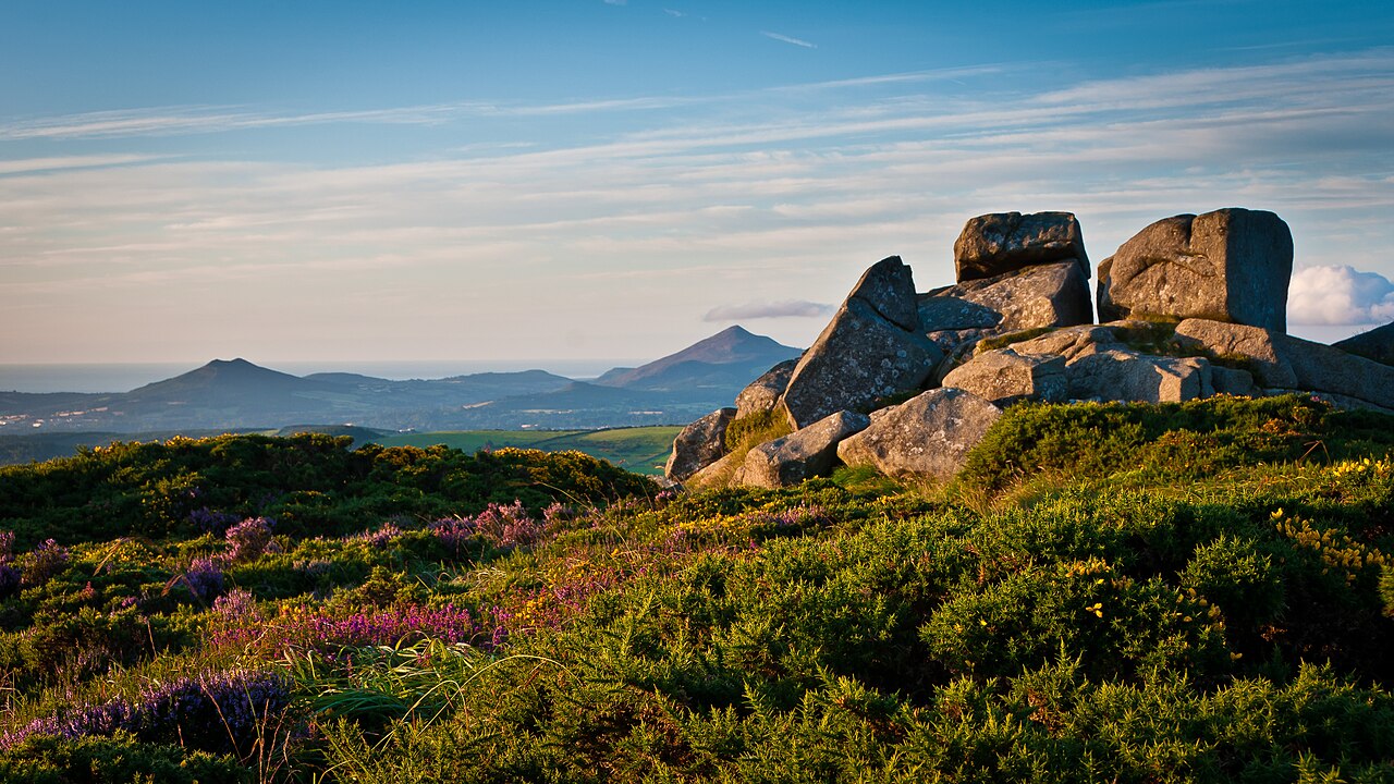
Дублин ограничен на юге горами Уиклоу . Там, где горы простираются до графства Дублин, они известны местным жителям как Дублинские горы ( Sléibhte Bhaile Átha Cliath ). Киппуре , на границе Дублина и Уиклоу, является самой высокой горой графства, высотой 757 метров (2484 фута) над уровнем моря. Пересекаемые Дублинским горным путем , они являются популярным районом отдыха, причем Ту-Рок , Три-Рок , Тибрадден , Тикнок , Монпелье-Хилл и Гленасмоле являются одними из самых посещаемых мест для пеших походов в Ирландии. Лесной покров простирается более чем на 6000 гектаров (15000 акров) в пределах графства, почти все из которых расположены в Дублинских горах. Поскольку всего 6,5% Дублина покрыто лесами, это 6-й наименее лесистый графство в Ирландии. [32]
Большая часть графства дренируется тремя его основными реками — рекой Лиффи , рекой Толка на севере Дублина и рекой Доддер на юге Дублина. Лиффи, длиной 132 километра (82 мили), является восьмой по длине рекой в Ирландии и берет начало недалеко от Тондаффа в графстве Уиклоу, достигая Ирландского моря в районе Дублинских доков . Лиффи прорезает центр города Дублин, и результирующее разделение Нортсайд - Саутсайд является часто используемым социальным, экономическим и языковым различием. Известные заливы включают центральный Дублинский залив , эстуарий Роджерстауна , эстуарий Бродмедоу и залива Киллини под холмом Киллини . Мысы включают Хоут-Хед , Драманаг и Портрейн-Шор. [33] С точки зрения биоразнообразия эти эстуарные и прибрежные регионы являются домом для богатых экологически важных территорий. В графстве Дублин находится 11 Особых природоохранных территорий (SAC), определенных ЕС , и 11 Особо охраняемых территорий (SPA). [34]
Геология коренных пород Дублина в основном состоит из известняка нижнего карбона , который лежит под примерно двумя третями всего графства, простираясь от Скеррис до Бутерстауна . Во время нижнего карбона (около 340 млн лет назад) эта область была частью теплого тропического моря, населенного обилием кораллов , криноидей и брахиопод . Самые старые породы в Дублине — это кембрийские сланцы, расположенные на мысе Хоут-Хед, которые были отложены около 500 млн лет назад. Разрушение после закрытия океана Япетус примерно 400 млн лет назад привело к образованию гранита . [35] Теперь он обнажается на поверхности от Дублинских гор до прибрежных районов Дун-Лэаре. Добыча и плавка свинца в 19 веке на свинцовых рудниках Балликорус вызвали широко распространенное отравление свинцом , и когда-то эту область называли «Долиной смерти». [36]


.jpg/1280px-Snow_in_Killiney,_Dublin_(2010).jpg)
Дублин находится в умеренно- океаническом морском регионе согласно классификации климата Кёппена . Его климат характеризуется прохладной зимой, мягким влажным летом и отсутствием экстремальных температур. Met Éireann имеет ряд метеостанций в графстве, две основные станции находятся в аэропорту Дублина и аэродроме Кейсмент .
Годовые температуры обычно находятся в узком диапазоне. В Merrion Square самым холодным месяцем является февраль со средней минимальной температурой 4,1 °C (39,4 °F), а самым теплым месяцем является июль со средней максимальной температурой 20,1 °C (68,2 °F). Из-за эффекта городского острова тепла в Дублине самые теплые летние ночи в Ирландии. Средняя минимальная температура в Merrion Square в июле составляет 13,5 °C (56,3 °F), что аналогично показателям Лондона и Берлина , а самая низкая температура июля, когда-либо зарегистрированная на станции, составила 7,8 °C (46,0 °F) 3 июля 1974 года. [37] [38] В аэропорту Дублина самым сухим месяцем является февраль со средним количеством осадков 48,8 мм (2 дюйма), а самым влажным месяцем — ноябрь со средним количеством осадков 79,0 мм (3 дюйма).
Поскольку преобладающее направление ветра в Ирландии — с юга и запада, горы Уиклоу создают дождевую тень над большей частью графства. Защищенное расположение Дублина делает его самым сухим местом в Ирландии, получая лишь около половины осадков западного побережья. В Рингсенде на юге Дублина регистрируется самое низкое количество осадков в стране, со средним годовым количеством осадков 683 мм (27 дюймов). Самая влажная область графства — долина Гленасмоле , которая получает 1159 мм (46 дюймов) осадков в год. Поскольку это умеренное прибрежное графство, снег относительно редок в низинных районах; однако Дублин особенно уязвим для сильных снегопадов в редких случаях, когда зимой преобладают холодные сухие восточные ветры. [39]
В конце лета и начале осени в Дублине могут быть атлантические штормы, которые приносят в Ирландию сильные ветры и проливные дожди. Дублин был графством, наиболее пострадавшим от урагана Чарли в 1986 году. Он вызвал сильное наводнение, особенно вдоль реки Доддер, и считается самым сильным наводнением в истории Дублина. Рекорды по количеству осадков были побиты по всему графству. В Киппуре зафиксировали 280 мм (11 дюймов) осадков за 24-часовой период, что является самым большим дневным количеством осадков, когда-либо зарегистрированным в Ирландии. Правительство выделило 6 449 000 ирландских фунтов (что эквивалентно 20,5 млн долларов США в 2020 году) на устранение ущерба, нанесенного Чарли. [40] Два водохранилища в Бохернабрине в Дублинских горах были модернизированы в 2006 году после того, как исследование последствий урагана Чарли пришло к выводу, что немного более сильный шторм мог бы привести к прорыву плотин водохранилищ, что привело бы к катастрофическим разрушениям и значительным человеческим жертвам.
В отличие от Атлантического побережья , восточное побережье Ирландии имеет относительно немного островов. Графство Дублин имеет одну из самых высоких концентраций островов на восточном побережье Ирландии. Остров Колт, остров Святого Патрика, остров Шеник и многочисленные более мелкие островки сгруппированы у побережья Скерри и вместе известны как «Зона природного наследия островов Скерри». Дальше лежит Рокабилл , который является самым изолированным островом Дублина, примерно в 6 километрах (3,7 мили) от берега. Остров Ламбей , площадью 250 гектаров (620 акров), является крупнейшим островом у восточного побережья Ирландии и самой восточной точкой графства Дублин. Ламбей поддерживает одну из крупнейших колоний морских птиц в Ирландии и, что любопытно, также поддерживает популяцию неместных красношейных валлаби . [41] К югу от Ламбея лежит меньший остров, известный как Ирландский глаз — результат неправильного перевода ирландского названия острова вторгшимися викингами .
Остров Булл — искусственный остров, лежащий примерно параллельно береговой линии, который начал формироваться после строительства стены Булл в 1825 году. Остров все еще растет и в настоящее время имеет длину 5 километров (3,1 мили) и ширину 0,8 километра (0,50 мили). В 1981 году Северный остров Булл ( Oileán an Tairbh Thuaidh ) был признан биосферным заповедником ЮНЕСКО . [42]

.png/1280px-IrelandBaronies1899Map_(Dublin_cropped).png)
Для статистических целей на европейском уровне графство в целом образует Дублинский регион – субъект NUTS III – который в свою очередь является частью Восточного и Мидлендского региона , субъекта NUTS II. Каждый из местных органов власти имеет представителей в Восточно-Мидлендской региональной ассамблее.
В графстве есть десять исторических баронств . [43] Хотя баронства продолжают оставаться официально определенными единицами, они перестали иметь какие-либо административные функции после Закона о местном самоуправлении 1898 года , и любые изменения границ графств после середины 19 века не отражаются на их размерах. Последнее изменение границ баронства в Дублине произошло в 1842 году, когда баронство Балротери было разделено на Балротери-Ист и Балротери-Уэст. Самым большим зарегистрированным баронством в Дублине в 1872 году было Апперкросс, площадью 39 032 акра (157,96 км 2 ), а самым маленьким баронством был Дублин, площадью 1 693 акра (6,85 км 2 ).
Таунленды являются наименьшими официально определенными географическими единицами в Ирландии. В Дублине 1090 таунлендов, из которых 88 являются историческими городскими границами. Эти городские границы зарегистрированы как собственные таунленды и намного больше, чем сельские таунленды. Самые маленькие сельские таунленды в Дублине имеют размер всего 1 акр, большинство из них являются прибрежными островами ( остров Клэр-Рок, остров Лэмб, Мейден-Рок, Маглинс, остров Тулла ). Самый большой сельский таунленд в Дублине составляет 2797 акров ( Кастлкелли ). Средний размер таунленда в графстве (исключая города) составляет 205 акров.
В соответствии с Законом о местном самоуправлении (Ирландия) 1898 года графство Дублин было разделено на городские округа Блэкрок , Клонтарф , Долки , Драмкондра, Клонлифф и Гласневин , Киллини и Баллибрак , Кингстаун , Нью-Килмэнхэм , Пембрук , Ратмайнс и Ратгар , а также сельские округа Балротери , Селбридж № 2, Северный Дублин, Ратдаун и Южный Дублин. [45]
Хоут, ранее входивший в состав сельского округа Дублин-Норт, стал городским округом в 1919 году. [46] Кингстаун был переименован в Дун-Лэаре в 1920 году. [47] Сельские округа были упразднены в 1930 году. [48]
В Балбриггане , в сельском округе Балротери, в соответствии с Законом о благоустройстве городов (Ирландия) 1854 года были городские комиссары . В 2002 году он стал городским советом. [49] Как и все городские советы, он был упразднен в 2014 году.
Городские районы постепенно были поглощены городом Дублин, за исключением четырех прибрежных районов Блэкрок, Долки, Дун-Лэаре, Киллини и Баллибрак, которые образовали боро Дун-Лэаре в 1930 году. [50]

Город Дублин управлялся отдельно с XIII века. Согласно Закону о местном самоуправлении (Ирландия) 1898 года , эти две области были определены как административное графство Дублин и округ-город Дублин, причем последний находился в городской зоне.
В 1985 году графство Дублин было разделено на три избирательных округа: Дублин-Белгард на юго-западе (Южный Дублин с 1991 года), Дублин-Фингал на севере (Фингал с 1991 года) и Дун-Лэаре-Ратдаун на юго-востоке. [58] [59] [60]
1 января 1994 года в соответствии с Законом о местном самоуправлении (Дублин) 1993 года графство Дублин прекратило свое существование как территория местного самоуправления, и ему на смену пришли графства Дун-Лэаре-Ратдаун , Фингал и Южный Дублин , каждое из которых граничило (с небольшими изменениями границ) с территорией соответствующего избирательного округа. [61] [62] Обсуждая законопроект, депутат Аврил Дойл сказала: «Законопроект, представленный нам сегодня, фактически упраздняет графство Дублин, и как человек, родившийся и выросший в этих частях Ирландии, я нахожу довольно странным, что мы в этой Палате отменяем графство Дублин. Я не уверена, понимают ли дублинцы, что это то, о чем мы сегодня говорим, но по сути это так». [63]
Хотя Избирательная комиссия должна, насколько это возможно, избегать нарушения границ графств при рекомендации избирательных округов для выборов в Dáil , это не включает границы города или границу между тремя графствами в Дублине. [64] Также по-прежнему существует шериф , назначаемый для графства Дублин. [65]
Термин «графство Дублин» все еще широко используется. Многие организации и спортивные команды продолжают организовываться на основе графства Дублин. Отделение названий мест Департамента туризма, культуры, искусств, гэльских татар, спорта и СМИ ведет базу данных названий мест , в которой записаны все названия мест, как прошлые, так и настоящие. [66] Графство Дублин указано в базе данных вместе с подразделениями этого графства. [67] [68] Оно также используется в качестве адреса для областей в пределах Дублина за пределами почтовой системы Дублинского округа . [69] [70]
В течение периода 2020 года во время пандемии COVID-19 , чтобы сократить контакты между людьми, правительственные постановления ограничивали деятельность «в пределах округа, в котором находится соответствующее место жительства». В рамках этих постановлений районы местного самоуправления «Дан Лири–Ратдаун, Фингал, Южный Дублин и Дублин-Сити» считались единым округом (как и город и округ Корк, а также город и округ Голуэй). [71]
Последняя карта Ordnance Survey Ireland "Discovery Series" (третье издание 2005 г.) 1:50 000 Дублинского региона, лист 50, показывает границы города и трех окружающих округов региона. Крайние точки Дублинского региона, на севере и юге региона, показаны на других листах серии, 43 и 56 соответственно.

Существует четыре местных органа власти , чья компетенция в совокупности охватывает географическую территорию графства и города Дублин. Это городской совет Дублина , совет графства Южный Дублин , совет графства Дун-Лэаре-Ратдаун и совет графства Фингал .
До 1 января 1994 года административным округом Дублин управлял Совет округа Дублин . С этой даты его функции перешли к Совету округа Дун-Лэаре-Ратдаун, Совету округа Фингал и Совету округа Южный Дублин, каждый со своим административным центром , соответственно управляющим новыми округами, созданными в эту дату. [72]
Город ранее был обозначен как округ и управлялся Корпорацией Дублина . Согласно Закону о местном самоуправлении 2001 года , страна была разделена на районы местного самоуправления городов и округов, при этом округ Дублин был обозначен как город для всех целей, теперь управляемый Городским советом Дублина . Каждый местный орган власти несет ответственность за определенные местные услуги, такие как санитария, планирование и развитие, библиотеки, сбор налога на транспортные средства, местные дороги и социальное жилье .
Дублин, включающий четыре района местного самоуправления в графстве, является стратегическим районом планирования в Восточной и Мидлендской региональной ассамблее (EMRA). [73] [74] Это регион Ирландии уровня NUTS III . Регион является одним из восьми регионов Ирландии для статистики Евростата на уровне NUTS 3. [75] Его код NUTS — IE061.
This area formerly came under the remit of the Dublin Regional Authority.[76] This Authority was dissolved in 2014.[77]
.jpeg/1280px-Cityscape_At_Sunset_Dublin_Ireland_Cityscape_Photography_(179394129).jpeg)

As of the 2022 census, the population of Dublin was 1,458,154, an 8.4% increase since the 2016 Census. The county's population first surpassed 1 million in 1981, and is projected to reach 1.8 million by 2036.[88]
Dublin is Ireland's most populous county, a position it has held since the 1926 Census, when it overtook County Antrim. As of 2022, County Dublin has over twice the population of County Antrim and two and a half times the population of County Cork. Approximately 21% of Ireland's population lives within County Dublin (28% if only the Republic of Ireland is counted). Additionally, Dublin has more people than the combined populations of Ireland's 16 smallest counties.
With an area of just 922 km2 (356 sq mi), Dublin is by far the most densely populated county in Ireland. The population density of the county is 1,582 people per square kilometre – over 7 times higher than Ireland's second most densely populated county, County Down in Northern Ireland.
During the Celtic Tiger period, a large number of Dublin natives (Dubliners) moved to the rapidly expanding commuter towns in the adjoining counties. As of 2022, approximately 27.2% (345,446) of Dubliners were living outside of County Dublin. People born within Dublin account for 28% of the population of Meath, 32% of Kildare, and 37% of Wicklow. There are 922,744 Dublin natives living within the county, accounting for 63.3% of the population. People born in other Irish counties living within Dublin account for roughly 11% of the population.[89]
Between 2016 and 2022, international migration produced a net increase of 88,300 people. Dublin has the highest proportion of international residents of any county in Ireland, with around 25% of the county's population being born outside of the Republic of Ireland.[90]
As of the 2022 census, 5.6 percent of the county's population was reported as younger than 5 years old, 25.7 percent were between 5 and 25, 55.3 percent were between 25 and 65, and 13.4 percent of the population was older than 65. Of this latter group, 48,865 people (3.4 percent) were over the age of 80, more than doubling since 2016. Across all age groups, there were slightly more females (51.06 percent) than males (48.94 percent).[91]
In 2021, there were 16,596 births within the county, and the average age of a first time mother was 31.9.[92]

Over a quarter (25.2 percent) of County Dublin's population was born outside of the Republic of Ireland. In 2022, Dublin City had the highest percentage of non-nationals in the county (27.3 percent), and South Dublin had the lowest (20.9 percent).[93] Historically, the immigrant population of Dublin was mainly from the United Kingdom and other European Union member states. However, results from the 2022 census revealed that immigrants from non-EU/UK countries were the largest source of foreign-born residents for the first time, accounting for 12.9 percent of the county's population. Those from other European Union member states accounted for 8.3 percent of Dublin's population, and those from the United Kingdom a further 4.1 percent.[94]
Prior to the 2000s, the UK was consistently the largest single source of non-nationals living in Dublin. After declining in the previous two census periods, the number of UK-born residents living in Dublin increased by 5.8 percent between 2016 and 2022. There was a large difference between the number of people living in Dublin who were born in the UK (58,586) and those who held sole-UK citizenship in the 2022 census (22,936). This discrepancy can arise for a variety of factors, such as people born in Northern Ireland claiming Irish citizenship rather than UK citizenship, Irish people born in the UK who now live in Dublin, British people who have become natural citizens, and foreign residents of Dublin who were born in the UK but are not UK citizens. Depending on an individual's responses in the census, all of these examples could result in the country of birth being registered by the CSO as the United Kingdom, but nationality being registered as Irish or a third country.
Following its accession to the EU, the Polish quickly became the fastest growing immigrant community in Dublin. Just 188 Poles applied for Irish work permits in 1999. By 2006 this number had grown to 93,787.[95] After the 2008 Irish economic downturn, as many as 3,000 Poles left Ireland each month. Despite this, Poles remain one of Dublin's largest foreign-born groups. In contrast to more recent arrivals, a large percentage of Dublin's Polish citizens (30.9 percent) also hold Irish citizenship.
Outside of Europe, Indians and Brazilians are the predominant foreign-national groups. As of 2022, Indians were the fastest growing major immigrant group in Dublin, and they are now the county's second largest foreign-born group after the UK. Dublin's Indian community grew by 155.2 percent between 2016 and 2022. There were 29,582 Indian-born residents within Dublin as of 2022, up from 9,884 in the 2011 census.[97] The influx of Indians is driven in part by multinational tech companies such as Microsoft, Google and Meta who have located their European headquarters within the county, in areas such as the Silicon Docks and Sandyford. In August 2020, the first dedicated Hindu temple in Ireland was built in Walkinstown.[98]
The number of Brazilian citizens living in Dublin more than tripled between 2011 and 2022, from 4,641 to 16,441. This increase is mainly a result of Ireland's participation in the Brazilian government's Ciência sem Fronteiras programme, which sees thousands of Brazilian students come to study in Ireland each year, many of whom remain in the country afterwards.[99]
Although not fully captured during the census period, Dublin also houses a significant number of Ukrainian refugees under the Temporary Protection Directive. As of October 2023, the number of Ukrainians living in emergency accommodation within the county is estimated to be around 14,000.[100]
According to the Central Statistics Office, in 2022 the population of County Dublin self-identified as:
By ethnicity, in 2022 the population was 80.4% white. Those who identified as White Irish constituted 68.0% of the county's population, and Irish Travellers accounted for a further 0.4%. Caucasians who did not identify as ethnically Irish accounted for 12.0% of the population.
In terms of total numbers, Dublin has the largest non-white population in Ireland, with an estimated 158,653 residents, accounting for 11.1% of the county's population. Over two-fifths (42.2 percent) of Ireland's black residents live within the county. In terms of percentage of population, Fingal has the highest percentage of both black (3.6 percent) and non-white (12.4 percent) residents of any local authority in Ireland. Conversely, Dún Laoghaire–Rathdown in the south of the county has one of Ireland's lowest percentages of black residents, with only 0.77% of the population identifying as black in 2022. Additionally, 43.3% of Ireland's multiracial population lives within County Dublin. Those who did not state their ethnicity more than doubled between 2016 and 2022, from 4.1% to 8.5%.[101][102]
.jpg/1280px-St_Patrick's_Cathedral,_Dublin_(40282975540).jpg)
The largest religious denomination by both number of adherents and as a percentage of Dublin's population in 2022 was the Roman Catholic Church, at 57.4 percent. All other Christian denominations including Church of Ireland, Eastern Orthodox, Presbyterian and Methodist accounted for 8.1 percent of Dublin's population. Together, all denominations of Christianity accounted for 65.5 percent of the county's population. According to the 2022 census, Dún Laoghaire–Rathdown is the least religious local authority in Ireland, with 23.9 percent of the population declaring themselves non-religious, followed closely by Dublin city (22.6 percent). In the county as a whole, those unaffiliated with any religion represented 20.1 percent of the population, which is the largest percentage of non-religious people of any county in Ireland. A further 9.1 percent of the population did not state their religion, up from just 4.1 percent in 2016.
Of the non-Christian religions, Islam is the largest in terms of number of adherents, with Muslims accounting for 2.6% of the population. After Islam, the largest non-Christian religions in 2022 were Hinduism (1.4 percent) and Buddhism (0.27 percent). While relatively small in absolute terms, County Dublin contains over half of Ireland's Hindu (58.7 percent) residents, and just under half of its Eastern Orthodox (45.3 percent), Islamic (45.0 percent) and Buddhist (41.7 percent) residents.[103]
Dublin and its hinterland has been a Christian diocese since 1028. For centuries, the Primacy of Ireland was disputed between Dublin, the social and political capital of Ireland, and Armagh, site of Saint Patrick's main church, which was founded in 445 AD. In 1353 the dispute was settled by Pope Innocent VI, who proclaimed that the Archbishop of Dublin was Primate of Ireland, while the Archbishop of Armagh was titled Primate of All Ireland. These two distinct titles were replicated in the Church of Ireland following the Reformation. Historically, County Dublin was the epicentre of Protestantism in Ireland outside of Ulster. Records from the 1891 census show that the county was 21.4 percent Protestant towards the end of the 19th century. By the 1911 census this had gradually declined to around 20% due to poor economic conditions, as Dublin Protestants moved to industrial Belfast. Following the War of Independence (1919–1921), Dublin's Protestant community went into a steady decline, falling to 8.5 percent of the population by 1936.[104]
Between 2016 and 2022, the fastest growing religions in Dublin were Hinduism (148.9 percent), Eastern Orthodox (51.6 percent), and Islam (27.9 percent), while the most rapidly declining religions were Evangelicalism (−10.4 percent), Catholicism (−8.7 percent), Jehovah's Witnesses (−5.9 percent) and Buddhism (−5.4 percent).
The boundaries of Dublin City Council form the urban core of the city, often referred to as "Dublin city centre", an area of 117.8 square kilometres. This encompasses the central suburbs of the city, extending as far south as Terenure and Donnybrook; as far north as Ballymun and Donaghmede; and as far west as Ballyfermot. As of 2022, there were 592,713 people living within Dublin city centre. However, as the continuous built-up area extends beyond the city boundaries, the term "Dublin city and suburbs" is commonly employed when referring to the actual extent of Dublin.

Dublin city and suburbs is a CSO-designated urban area which includes the densely populated contiguous built-up area which surrounds Dublin city centre. As of the 2022 census, Dublin city and suburbs encompassed 345 km2, expanding in size by 8.7 percent (or 27.5 km2) since the 2016 census. The population of Dublin city and suburbs grew from 1,173,179 in 2016 to 1,263,219 in 2022, an increase of 7.7 percent.[105]
Following the 2022 census, Dublin city and suburbs was designated a cross-county settlement for the first time, as the CSO included the Kribensis Manor housing development within the contiguous built-up area of the city. The houses are located in County Meath, along the R149 road between Hilltown and the village of Clonee.
Approximately 87% of County Dublin's population lives within Dublin city and suburbs as of the 2022 census. The remainder of the county covers roughly two thirds of Dublin's land area, but is home to just 196,140 people.[106]
As the city proper does not extend beyond Dublin Airport, nearby towns such as Swords, Donabate, Portmarnock and Malahide are not considered part of the city, and are recorded by the CSO as separate settlements. However, under Ireland's National Planning Framework, these towns are considered part of the Dublin Metropolitan Area Strategic Plan (MASP).[107] The MASP also includes towns outside of the county, such as Naas, Leixlip and Maynooth in County Kildare, Dunboyne in County Meath, and Bray, Kilmacanogue and Greystones in County Wicklow, but does not include Balbriggan, Lusk, Rush or Skerries, which are located in the far north of County Dublin.[108]
The Greater Dublin Area (GDA) is a commonly used planning jurisdiction which extends to the wider network of commuter towns that are economically connected to Dublin city. The GDA consists of County Dublin and its three neighboring counties, Kildare, Meath and Wicklow.[109]
With a population of 2.1 million and an area of 6,986 square kilometres, it contains 40% of the population of the State, and covers 9.9% of its land area.
Under CSO classification, an "Urban Area" is a town with a population greater than 1,500. Dublin is the most urbanised county in Ireland, with 98% of its residents residing in urban areas as of 2022. Of Dublin's three non-city local authorities, Fingal has the highest proportion of people living in rural areas (7.9%), while Dún Laoghaire–Rathdown has the lowest (1.19%). The western suburbs of Dublin city such as Tallaght and Blanchardstown have experienced rapid growth in recent decades, and both areas have a population roughly equivalent to Galway city.
.png/1280px-M50_motorway_(Ireland).png)

County Dublin has the oldest and most extensive transportation infrastructure in Ireland. The Dublin and Kingstown Railway, opened in December 1834, was Ireland's first railway line. The line, which ran from Westland Row to Dún Laoghaire, was originally intended to be used for cargo. However, it proved far more popular with passengers and became the world's first commuter railway line.[112] The line has been upgraded multiple times throughout its history and is still in use to this day, making it the oldest commuter railway route in the world.

Public transport in Dublin was managed by the Dublin Transportation Office until 2009, when it was replaced by the National Transport Authority (NTA). The three pillars currently underpinning the public transport network of the Greater Dublin Area (GDA) are Dublin Suburban Rail, the Luas and the bus system. There are six commuter lines in Dublin, which are managed by Iarnród Éireann. Five of these lines serve as routes between Dublin and towns across the GDA and beyond. The sixth route, known as Dublin Area Rapid Transit (DART), is electrified and serves only Dublin and northern Wicklow. The newest addition to Dublin's public transport network is a tram system called the Luas. The service began with two disconnected lines in 2004,[113] with three extensions opened in 2009,[114] 2010[115] and 2011[116] before a cross-city link between the lines and further extension opened in 2017.[117]
Historically, Dublin had an extensive tram system which commenced in 1871 and at its peak had over 97 km (60 mi) of active line. It was operated by the Dublin United Transport Company (DUTC) and was very advanced for its day, with near-full electrification from 1901. From the 1920s onwards, the DUTC began to acquire private bus operators and gradually closed some of its lines. Further declines in passenger numbers were driven in part by a belief at the time that trams were outdated and archaic. All tram lines terminated in 1949, except for the tram to Howth, which ran until 1959.

Dublin Bus is the county's largest bus operator, carrying 138 million passengers in 2019.[118] For much of the city, particularly west Dublin, the bus is the only public transport option available, and there are numerous smaller private bus companies in operation across County Dublin. National bus operator Bus Éireann provides long-distance routes to towns and villages located outside of Dublin city and its immediate hinterland.
In November 2005, the government announced a €34 billion initiative called Transport 21 which included a substantial expansion to Dublin's transport network. The project was cancelled in May 2011 in the aftermath of the 2008 recession. Consequently, by 2017 Hugh Creegan, deputy chief of the NTA, stated that there had been a "chronic underinvestment in public transport for more than a decade".[119] By 2019, Dublin was reportedly the 17th most congested city in the world, and had the 5th highest average commute time in the European Union.[120][121] The Luas and rail network regularly experience significant overcrowding and delays during peak hours, and in 2019 Iarnród Éireann was widely ridiculed for asking commuters to "stagger morning journeys" to alleviate the problem.[122]
The M50 is a 45.5 km (28.3 mi) orbital motorway around Dublin city, and is the busiest motorway in the country. It serves as the centre of both Dublin and Ireland's motorway network, and most of the national primary roads to other cities begin at the M50 and radiate outwards. The current route was built in various sections over the course of 27 years, from 1983 to 2010. All major roads in Ireland are managed by Transport Infrastructure Ireland (TII), which is headquartered in Parkgate Street, Dublin 8. As of 2019, there were over 550,000 cars registered in County Dublin, accounting for 25.3% of all cars registered in the State.[123] Due to the county's small area and high degree of urbanisation, there is a preference for "D" registered used cars throughout Ireland, as they are considered to have undergone less wear and tear.[124]
For international travel, around 1.7 million passengers travel by ferry through Dublin Port each year.[125] A Dún Laoghaire to Holyhead ferry was formerly operated by Stena Line, but the route was closed in 2015. Dublin Airport is Ireland's largest airport, and 32.9 million passengers passed through it in 2019, making it Europe's 12th-busiest airport.[126]
.png/1280px-Share_of_Irish_GDP_by_Region_(2018).png)
The Dublin Region, which is conterminous with County Dublin, has the largest and most highly developed economy in Ireland, accounting for over two-fifths of national Gross Domestic Product (GDP). The Central Statistics Office estimates that the GDP of the Dublin Region in 2020 was €157.2 billion ($187 billion / £141 billion at 2020 exchange rates).[127] In nominal terms, Dublin's economy is larger than roughly 140 sovereign states. The county's GDP per capita is €107,808 ($117,688 / £92,620), one of the highest regional GDPs per capita in the EU. As of 2019, Dublin also had the highest Human Development Index in Ireland at 0.965, placing it among the most developed places in the world in terms of life expectancy, education and per capita income.[128]

In 2020, average disposable income per person in Dublin was €27,686, or 118% of the national average (€23,400), the highest of any county in Ireland.[129] As Ireland's most populous county, Dublin has the highest total household income in the country, at an estimated €46.8 billion in 2017 – higher than the Border, Midlands, West and South-East regions combined. Dublin residents were the highest per capita tax contributors in the State, returning a total of €15.1 billion in taxes in 2017.[130]
Many of Ireland's most prominent political, educational, cultural and media centres are concentrated south of the River Liffey in Dublin city. Further south, areas like Dún Laoghaire, Dalkey and Killiney have long been some of Dublin's most affluent areas, and Dún Laoghaire–Rathdown consistently has the highest average house prices in Ireland. This has resulted in a perceived socio-economic divide in Dublin, between the generally less affluent Northside and the wealthier Southside. In Dublin (both city and county), residents will commonly refer to themselves as a "Northsider" or a "Southsider", and the division is often caricatured in Irish comedy, media and literature, for example Ross O'Carroll-Kelly and Damo and Ivor.[131] References to the divide have also become colloquialisms in their own right, such as "D4" (referring to the Dublin 4 postal district), which is a pejorative term for an upper middle class Irish person.[132]
While the northside-southside divide remains prevalent in popular culture, economic indices such as the Pobal HP deprivation index have shown that the distinction does not reflect economic reality. Many of Dublin's most affluent areas (Clontarf, Raheny, Howth, Portmarnock, Malahide) are located in the north of the county, and many of its most deprived areas (Jobstown, Ballyogan, Ballybrack, Dolphin's Barn, Clondalkin) are located in the south of the county.
Utilising CSO data from the past three censuses, Pobal HP revealed that there was a much higher concentration of below average, disadvantaged and very disadvantaged areas in west Dublin.[133] In 2012, Irish Times columnist Fintan O'Toole posited that the real economic divide in Dublin was not north–south, but east–west – between the older coastal areas of eastern Dublin and the newer sprawling suburbs of western Dublin – and that the perpetuation of the northside–southside "myth" was a convenient way to gloss over class division within the county. O'Toole argued that framing the city's wealth divide as a light-hearted north–south stereotype was easier than having to address the socio-economic impacts of deliberate government policy to remove working-class people from the city centre and settle them on the margins.[134]

Dublin is both a European and Global financial hub, and around 200 of the world's leading financial services firms have operations within the county. In 2017 and 2018 respectively, Dublin was ranked 5th in Europe and 31st globally in the Global Financial Centres Index (GFCI).[135][136] In the mid-1980s, parts of central Dublin had fallen into a state of dereliction and the Irish government pursued an urban regeneration programme. An 11-hectare special economic zone (SEZ) was set up in 1987, known as the International Financial Services Centre (IFSC). At the time of its establishment, the SEZ had the lowest corporate tax rate in the EU. The IFSC has since expanded into a 37.8-hectare site centred around the Dublin Docklands. As of 2020, over €1.8 trillion of funds are administered from Ireland.[137]
There was renewed interest in Dublin's financial services sector in the wake of the UK's vote to withdraw from the European Union in 2016. Many firms, including Barclays and Bank of America, pre-emptively moved some of their operations from London to Dublin in anticipation of restricted EU market access.[138] A survey conducted by Ernst & Young in 2021 found that Dublin was the most popular destination for firms in the UK considering relocating to the EU, ahead of Luxembourg and Frankfurt.[139] It is estimated that Dublin's financial sector will grow by about 25% as a direct result of Brexit, and as many as 13,000 jobs could move from the UK to County Dublin in the years immediately after its withdrawal.[140]


_(32979900775).jpg/1280px-Dublin_Port,_Co._Dublin_(507221)_(32979900775).jpg)
The economy of Dublin benefits from substantial amounts of both indigenous and foreign investment. In 2018, the Financial Times ranked Dublin the most attractive large city in the world for Foreign Direct Investment, and the city has been consistently ranked by Forbes as one of the world's most business-friendly.[141][142] The economy is centered on financial services, the pharmaceuticals and biotechnology industries, information technology, logistics and storage, professional services, agriculture and tourism. IDA Ireland, the state agency responsible for attracting foreign direct investment, was founded in Dublin in 1949.
Dublin has four power plants, all of which are concentrated in the docklands area of Dublin city. Three are natural-gas plants operated by the ESB, and the Poolbeg Incinerator is operated by Covanta Energy. The four plants have a combined capacity of 1.039 GW, roughly 12.5% of the island of Ireland's generation capacity as of 2019.[143] The disused Poolbeg chimneys are the tallest structures in the county, and were granted protection by Dublin city council in 2014.[144]
As a result of Dublin city's location within a sheltered bay at the mouth of a navigable river, shipping has been a key industry in the county since medieval times. By the 18th-century, Dublin was a bustling maritime city and large-scale engineering projects were undertaken to enhance the port's capacity, such as the Great South Wall, which was the largest sea wall in the world at the time of its construction in 1715.[145] Dublin Port was originally located along the Liffey, but gradually moved towards the coast over the centuries as vessel size increased. It is today the largest and busiest port in Ireland. It handles 50% of the Republic of Ireland's trade, and receives 60% of all vessel arrivals.[146]
Dublin Port occupies an area of 259 hectares (640 acres) in one of the most expensive places in the country, with an estimated price per acre of around €10 million. Since the 2000s, there have been calls to relocate Dublin Port out of the city and free up its land for residential and commercial development. This was first proposed by the Progressive Democrats at the height of the Celtic Tiger in 2006, who valued the land at between €25 and €30 billion, although nothing became of this proposal. During the housing crisis of the late 2010s the idea again began to attract supporters, among them economist David McWilliams.[147] Currently, there are no official plans to move the port elsewhere, and the Dublin Port Company strongly opposes relocation.[148]
Dublin hosts the headquarters of some of Ireland's largest multinational corporations, including 14 of the 20 companies which make up the ISEQ 20 index – those with the highest trading volume and market capitalisation of all Irish Stock Exchange listed companies. These are: AIB, Applegreen, Bank of Ireland, Cairn Homes, Continental Group, CRH, Dalata Hotel Group, Flutter Entertainment, Greencoat Renewables, Hibernia REIT, IRES, Origin Enterprises, Ryanair and Smurfit Kappa.

County Dublin receives by far the most overseas tourists of any county in Ireland. This is primarily due to Dublin city's status as Ireland's largest city and its transportation hub. Dublin is also Ireland's most popular destination for domestic tourists. According to Fáilte Ireland, in 2017 Dublin received nearly 6 million overseas tourists, and just under 1.5 million domestic tourists. Most of Ireland's international flights transit through Dublin Airport, and the vast majority of passenger ferry arrivals dock at Dublin Port. In 2019, the port also facilitated 158 cruise ship arrivals.[149] The tourism industry in the county is worth approximately €2.3 billion per year.[150]
As of 2019, 4 of the top 10 fee-paying tourist attractions in Ireland are located within County Dublin, as well as 5 of the top 10 free attractions. The Guinness Storehouse at St. James's Gate is Ireland's most visited tourist attraction, receiving 1.7 million visitors in 2019, and over 20 million total visits since 2000. Additionally, Dublin also contains Ireland's 3rd (Dublin Zoo), 4th (Book of Kells) and 6th (St Patrick's Cathedral) most visited fee-paying attractions. The top free attractions in Dublin are the National Gallery of Ireland, the National Botanic Gardens, the National Museum of Ireland and the Irish Museum of Modern Art, all of which receive over half a million visitors per year.[151]
.jpg/1280px-Clonshaugh_Rd,_Swords_(506156).jpg)

Despite having the smallest farmed area of any county, Dublin is one of Ireland's major agricultural producers. Dublin is the largest producer of fruit and vegetables in Ireland, the third largest producer of oilseed rape and has the fifth largest fishing industry. Fingal alone produces 55% of Ireland's fresh produce, including soft fruits and berries, apples, lettuces, peppers, asparagus, potatoes, onions, and carrots. As of 2020, the Irish Farmers' Association estimates that the total value of Dublin's agricultural produce is €205 million.[152] According to the CSO, fish landings in the county are worth a further €20 million.[153]
Approximately 41% of the county's land area (38,576 ha) is farmed. Of this, 12,578 ha (31,081 acres) is under tillage, the 9th highest in the country, and 6,500 ha (16,062 acres) is dedicated to fruit & horticulture, the 4th highest. Rural County Dublin is considered a peri-urban region, where an urban environment transitions into a rural one. Due to the growth of Dublin city and its commuter towns in the north of the county, the region is considered to be under significant pressure from urban sprawl. Between 1991 and 2010, the amount of agricultural land within the county decreased by 22.9%. In 2015, the local authorities of Fingal, South Dublin and Dún Laoghaire–Rathdown developed a joint Dublin Rural Local Development Strategy aimed at enhancing the region's agricultural output, while also managing and minimising the impact of urbanisation on biodiversity and the identity and culture of rural Dublin.[154]
The county has a small forestry industry that is based almost entirely in the upland areas of south County Dublin. According to the 2017 National Forestry Inventory, 6,011 ha (14,854 acres) of the county was under forest, of which 1,912 ha (4,725 acres) was private forestry.[155] The majority of Dublin's forests are owned by the national forestry company, Coillte. In the absence of increased private planting, the county's commercial timber capacity is expected to decrease in the coming decades, as Coillte intends to convert much of their holdings in the Dublin Mountains into non-commercial mixed forests.[156]
Dublin has 810 individual farms with an average size of 47.6 ha (118 acres), the largest average farm size of any county in Ireland. Roughly 9,400 people within the county are directly employed in either agriculture or the food and drink processing industry. Numerous Irish and multinational food and drink companies are either based in Dublin or have facilities within the county, including Mondelez, Coca-Cola, Mars, Diageo, Kellogg's, Danone, Ornua, Pernod Ricard and Glanbia. In 1954, Tayto Crisps were established in Coolock and developed into cultural phenomenon throughout much of the Republic of Ireland.[157] Its operations and headquarters have since moved to neighbouring County Meath. Another popular crisp brand, Keogh's, are based in Oldtown, Fingal.[158]
In Ireland, spending on education is controlled by the government and the allocation of funds is decided each year in the annual budget. Local authorities retain limited responsibilities such as funding for school meals, service supports costs and the upkeep of libraries.
There are hundreds of primary and secondary schools within County Dublin, most of which are English-language schools. Several international schools are based in Dublin, such as St Kilian's German School and Lycée Français d'Irlande, which teach in foreign languages. There is also a large minority of students attending gaelscoileanna (Irish-language primary schools). There are 34 gaelscoileanna and 10 gaelcholáistí (Irish-language secondary schools) in the county, with a total of 12,950 students as of 2018.[159] In terms of college acceptance rates, gaelcholáistí are consistently the best performing schools in Dublin, and among the best performing in Ireland.[160]
Although the government pays for a large majority of school costs, including teachers' salaries, the Roman Catholic Church is the largest owner of schools in Dublin, and preference is given to Catholic students over non-Catholic students in oversubscribed areas.[161] This has resulted in a growing movement towards non-denominational and co-educational schools in the county.[162]
The majority of private secondary schools in Dublin are still single sex, and continue to have religious patronages with either congregations of the Catholic Church (Spiritans, Sisters of Loreto, Jesuits) or Protestant denominations (Church of Ireland, Presbyterian). Newer private schools which cater for the Leaving Cert cycle such as the Institute of Education and Ashfield College are generally non-denominational and co-educational. In 2018, Nord Anglia International School Dublin opened in Leopardstown, becoming the most expensive private school in Ireland.[163]
As of 2023–24, four of Dublin's third level institutions are listed in the Top 500 of either the Times Higher Education Rankings or the QS World Rankings, placing them amongst the top 5% of all third level institutions in the world. TCD (81), UCD (171) and DCU (436) are within the Top 500 of the QS rankings; and TCD (161), RCSI (201–250), UCD (201–250) and DCU (451–500) and are within the Top 500 of the Times rankings. Newly amalgamated TUD also placed within the world's Top 1,000 universities in the QS rankings, and within the Top 500 for Engineering and Electronics.[164][165]
County Dublin has four public universities, as well as numerous other colleges, institutes of technology and institutes of further education. Several of Dublin's largest third level institutions and their associated abbreviations are listed below:
_p049_THE_COLLEGE_OF_SURGEONS.jpg/1280px-DUBLIN(1837)_p049_THE_COLLEGE_OF_SURGEONS.jpg)
.png/1280px-Dublin_Dail_Eireann_Constituencies_(2020).png)
For elections to Dáil Éireann, the area of the county is currently divided into eleven constituencies: Dublin Bay North, Dublin Bay South, Dublin Central, Dublin Fingal, Dublin Mid-West, Dublin North-West, Dublin Rathdown, Dublin South-Central, Dublin South-West, Dublin West, and Dún Laoghaire. Together they return 45 deputies (TDs) to the Dáil.
The first Irish Parliament convened in the small village of Castledermot, County Kildare on 18 June 1264. Representatives from seven constituencies were present, one of which was the constituency of Dublin City.[167] Dublin was historically represented in the Irish House of Commons through the constituencies of Dublin City and County Dublin. Three smaller constituencies had been created by the 17th century: Swords; which was created sometime between 1560 and 1585, with Walter Fitzsimons and Thomas Taylor being its first recorded MPs; Newcastle in the west of the county, created in 1613; and Dublin University, which was a university constituency covering Trinity College, also created in 1613.[168] While proceedings of the Irish Parliament were well-documented, many of the records from this time were lost during the shelling of the Four Courts in July 1922.[169]
Following the Acts of Union 1800, Dublin was represented in Westminster through three constituencies from 1801 to 1885: Dublin City, County Dublin and the Dublin University. A series of local government and electoral reforms in the late 19th century radically alerted the county's political map, and by 1918 there were twelve constituencies within County Dublin.[170]
Throughout the twentieth century the representation in Dublin expanded as the population grew. In the Electoral Act 1923, the first division of constituencies arranged by Irish legislation, geographical constituencies in Dublin were 23 of the 147 TDs in geographical constituencies;[171] this contrasts with 45 of 160 at the most recent division.[172]
Twenty-three Dáil Éireann constituencies have been created and abolished within the county since independence, the most recent being the constituencies of Dublin South, Dublin North, Dublin North-Central, Dublin North-East and Dublin South-East, which were abolished in 2016.
Of the fifteen people to have held the office of Taoiseach since 1922, more than half were either born or raised within County Dublin: W. T. Cosgrave, John A. Costello, Seán Lemass, Liam Cosgrave, Charles Haughey (born in County Mayo but raised in Dublin), Garret FitzGerald, Bertie Ahern and Leo Varadkar (Cosgrave held the office of President of the Executive Council; by convention, Taoisigh are numbered to include this position). Conversely, just one of Ireland's nine presidents have hailed from the county, namely Seán T. O'Kelly, who served as president from 1945 to 1959.
The four local government areas in County Dublin form the 4-seat constituency of Dublin in European Parliament elections.[173]


As the capital city, Dublin is the seat of the national parliament of Ireland, the Oireachtas. It is composed of the President of Ireland, Dáil Éireann as a house of representatives, and Seanad Éireann as an upper house. Both houses of the Oireachtas meet in Leinster House, a former ducal palace on Kildare Street. It has been the home of the Irish government since the creation of the Irish Free State. The First Dáil of the revolutionary Irish Republic met in the Round Room of the Mansion House, the present-day residence of the Lord Mayor of Dublin, in January 1919. The former Irish Parliament, which was abolished in 1801, was located at College Green; Parliament House now holds a branch of Bank of Ireland. Government Buildings, located on Merrion Street, houses the Department of the Taoiseach, the Council Chamber, the Department of Finance, and the Office of the Attorney General.[174]
The president resides in Áras an Uachtaráin in Phoenix Park, a stately ranger's lodge built in 1757. The house was bought by the Crown in 1780 to be used as the summer residence of the Lord Lieutenant of Ireland, the British viceroy in the Kingdom of Ireland. Following independence, the lodge was earmarked as the potential home of the Governor-General, but this was highly controversial as it symbolised continued British rule over Ireland, so it was left empty for many years. President Douglas Hyde "temporarily" occupied the building in 1938, as Taoiseach Éamon de Valera intended to demolish it and build a more modest presidential bungalow on the site. Those plans were scrapped during The Emergency and the lodge became the president's permanent residence.[175]
Much like Áras an Uachtaráin, many of the grand estate homes of the former aristocracy were re-purposed for State use in the 20th century. The Deerfield Residence, also in Phoenix Park, is the official residence of the United States Ambassador to Ireland, while Glencairn House in south Dublin is used as the British Ambassador's residence. Farmleigh House, one of the Guinness family residences, was acquired by the government in 1999 for use as the official Irish state guest house.
Many other prominent judicial and political organs are located within Dublin, including the Four Courts, which is the principal seat of the Supreme Court, the Court of Appeal, the High Court and the Dublin Circuit Court; and the Custom House, which houses the Department of Housing, Local Government and Heritage. Once the centuries-long seat of the British government's administration in Ireland, Dublin Castle is now only used for ceremonial purposes, such as policy launches, hosting of State visits, and the inauguration of the president.[176]
Dublin is among the most socially liberal places in Ireland, and popular sentiment on issues such as LGBT rights, abortion and divorce has often foreran the rest of the island. Referendums held on these issues have consistently received much stronger support within Dublin, particularly the south of the county, than the majority of the country.[177] While over 66% of voters nationally voted in favour of the Eighth Amendment in 1983, 58% of voters in Dún Laoghaire and 55% in Dublin South voted against it. In 2018, over 75.5% of voters in County Dublin voted to repeal the amendment, compared with 66.4% nationally.
In 1987, Dublin Senator David Norris took the Irish government to the European Court of Human Rights (see Norris v. Ireland) over the criminalisation of homosexual acts. In 1988, the Court ruled that the law criminalising same sex activities was contrary to the European Convention on Human Rights, in particular Article 8 which protects the right to respect for private life. The law was held to infringe on the right of adults to engage in acts of their own choice.[178] This led directly to the repeal of the law in 1993. Numerous LGBT events and venues are now located within the county. Dublin Pride is an annual pride parade held on the last Saturday of June and is Ireland's largest public LGBT event. In 2018, an estimated 60,000 people attended.[179] During the 2015 vote to allow same-sex marriage, 71% of County Dublin voted in favour, compared with 62% nationally.
In general, the south-eastern coastal regions of the county such as Dún Laoghaire and Dublin Bay South are a stronghold for the liberal-conservative Fine Gael party.[180] Since the late-2000s the Green Party has also developed a strong support base in these areas. The democratic socialist Sinn Féin party generally performs well in south-central and west Dublin, in areas like Tallaght and Crumlin. In recent elections Sinn Féin have increasingly taken votes in traditional Labour Party areas, whose support has been on the decline since 2016.[181] As a result of the economic crisis, centre-right Fianna Fáil failed to gain a single seat in Dublin in the 2011 general election. This was a first for the long-time dominant party of Irish politics.[182] The party regained a footing in 7 of the 11 Dublin constituencies in 2020, and were also the largest party in Dublin City, Fingal and South Dublin in the 2019 local elections.
-150293.jpg/1280px-THE_BRIDGE_TAVERN_AT_GREAT_CLARENCE_STREET_-_SUMMERHILL_PARADE_(ST_PATRICK'S_DAY_2019)-150293.jpg)
Dublin is a dual county in Gaelic games, and it competes at a similar level in both hurling/camogie and Gaelic football. The Dublin county board is the governing body for Gaelic games within the county. The county's current GAA crest, adopted in 2004, represents Dublin's four constituent areas. The castle represents Dublin city, the raven represents Fingal, the Viking longboat represents Dún Laoghaire–Rathdown and the book of Saint Tamhlacht in the centre represents South Dublin.[183]
In Gaelic football, the Dublin county team competes annually in Division 1 of the National Football League and the provincial Leinster Senior Football Championship. Dublin is the dominant force of Leinster football, with 62 Leinster Senior Championship wins. Nationally, the county is second only to Kerry for All-Ireland Senior Football Championship titles. The two counties are fierce rivals, and a meeting between them is considered the biggest game in Gaelic football.[184] Dublin has won the All-Ireland on 31 occasions, including a record 6 in a row from 2015 to 2020.
In hurling, the Dublin hurling team currently compete in Division 1B of the National Hurling League and in the Leinster Senior Hurling Championship. Dublin is the second most successful hurling county in Leinster after Kilkenny, albeit a distant second, with 24 Leinster hurling titles. The county has seen less success in the All-Ireland Senior Hurling Championship, ranking joint-fifth alongside Wexford. Dublin has been in 21 All-Ireland hurling finals, winning just 6, the most recent of which was in 1938.
Within the county, Gaelic football and hurling clubs compete in the Dublin Senior Football Championship and the Dublin Senior Hurling Championship, which were both established in 1887. St Vincents based in Marino and Faughs based in Templeogue are by far the most successful clubs in Dublin their respective sports. Four Dublin football teams have won the All-Ireland Senior Club Football Championship; St Vincents, Kilmacud Crokes, UCD and Ballyboden St Enda's. Despite their historic dominance in Dublin, Faughs have never won an All-Ireland Senior Club Hurling Championship. Since the early 2010s, Dalkey's Cuala have been the county's main hurling force, and the club won back-to-back All-Ireland's in 2017 and 2018.
.jpg/1280px-Tallaght_Stadium_(2014).jpg)
.jpeg/1280px-Avia_Stadion_Dublin_Irland_(126472271).jpeg)
Association football (soccer) is one of the most popular sports within the county. While Gaelic games are the most watched sport in Dublin, association football is the most widely played, and there are over 200 amateur football clubs in County Dublin.[185] Dalymount Park in Phibsborough is known as the "home of Irish football", as it is both the country's oldest stadium and the former home ground for the national team from 1904 until 1990.[186] The Republic of Ireland national football team is currently based in the 52,000 seater Aviva Stadium, which was built on the site of the old Lansdowne Road stadium in 2010. The Aviva Stadium has hosted the final of the UEFA Europa League twice, in 2011 and 2024. Five League of Ireland football clubs are based within County Dublin; Bohemians F.C., Shamrock Rovers, St Patrick's Athletic, University College Dublin and Shelbourne.
Shamrock Rovers, formerly of Milltown but now based in Tallaght, are the most successful club in the country, with 21 League of Ireland titles. They were also the first Irish side to reach the group stages of a European competition when they qualified for the 2011–12 UEFA Europa League group stage. The Dublin University Football Club, founded in 1854, are technically the world's oldest extant football club.[187] However, the club currently only plays rugby union. Bohemians are Ireland's third oldest club currently playing football, after Belfast's Cliftonville F.C. and Athlone Town A.F.C. The Bohemians–Shamrock Rovers rivalry not only involves Dublin's two biggest clubs, but it is also a Northside-Southside rivalry, making it the most intense derby match in the county.[188]
_-_20190511195853.jpg/1280px-County_Dublin_-_Golf_Links_Hotel_(Portmarnock)_-_20190511195853.jpg)
Rugby Union is the county's third most popular sport, after Gaelic games and football. Leinster Rugby play their competitive home games in the RDS Arena & the Aviva Stadium. Donnybrook Stadium hosts Leinster's friendlies and A games, as well as the Ireland A and Women's teams, Leinster Schools and Youths and the home club games of All Ireland League sides Old Wesley and Bective Rangers. County Dublin is home to 13 of the senior rugby union clubs in Ireland, including 5 of the 10 sides in the top division 1A.[189]
Other popular sports in the county include: cricket, hockey, golf, tennis, athletics and equestrian activities. Dublin has two ODI cricket grounds in Castle Avenue and Malahide Cricket Club Ground, and the Phoenix Cricket Club, founded in 1830, is the oldest in Ireland. As with many other sporting organisations in the county, the Fitzwilliam Lawn Tennis Club is one of the world's oldest.[190] It hosted the now-discontinued Irish Open from 1879 until 1983. Field hockey, particularly women's field hockey, is becoming increasingly popular within the county.[191] The Ireland women's national field hockey team made it to the 2018 World Cup final, and many of the players on that team were from Dublin clubs, such as UCD, Old Alex, Loreto, Monkstown, Muckross and Railway Union.[192]
The Dublin Horse Show takes place at the RDS, which hosted the Show Jumping World Championships in 1982, and the county has a horse racing track at Leopardstown which hosts the Irish Champion Stakes every September. Dublin houses the national stadium for both boxing (National Stadium) and basketball (National Basketball Arena), and the city hosted the 2003 Special Olympics. Although a small county in size, Dublin contains one third of Leinster's 168 golf courses,[193] and three-time major winner Pádraig Harrington is from Rathfarnham.
Local radio stations include 98FM, FM104, Dublin City FM, Q102, SPIN 1038, Sunshine 106.8, Raidió Na Life and Radio Nova.
Local newspapers include The Echo, and the Liffey Champion.
Most of the area can receive the five main UK television channels as well as the main Irish channels, along with Sky TV and Virgin Media Ireland cable television.

.jpg/1280px-KILLINEY-147_(1424762996).jpg)

_(25730106934).jpg/1280px-Howth_Harbour,_Co._Fingal_(506148)_(25730106934).jpg)
Height: 126m OS 1:50k Mapsheet: 43 Grid Reference: O31600 51000
53°25′N 6°15′W / 53.417°N 6.250°W / 53.417; -6.250

.jpg/1280px-Beach_on_Ireland's_Eye_(42046045192).jpg)


