Калифорния — штат на западе США , расположенный на американском побережье Тихого океана . На севере граничит с Орегоном , на востоке — с Невадой и Аризоной , на юге — с мексиканским штатом Нижняя Калифорния . С населением около 39 миллионов человек на площади 163 696 квадратных миль (423 970 км 2 ) [11] это самый густонаселенный штат США, третий по площади и самый густонаселенный субнациональный субъект в Северной Америке .
До европейской колонизации Калифорния была одной из самых культурно и лингвистически разнообразных областей в доколумбовой Северной Америке . Европейские исследования в XVI и XVII веках привели к колонизации Испанской империей . Территория стала частью Мексики в 1821 году после ее успешной войны за независимость , но была передана Соединенным Штатам в 1848 году после мексикано-американской войны . Калифорнийская золотая лихорадка началась в 1848 году и привела к социальным и демографическим изменениям, включая депопуляцию коренных народов в геноциде в Калифорнии . Затем западная часть Верхней Калифорнии была организована и принята в качестве 31-го штата в 1850 году , как свободный штат , после Компромисса 1850 года .
Районы Большого Лос-Анджелеса и залива Сан-Франциско являются вторым и пятым по численности населения городскими регионами страны , с 19 миллионами и 10 миллионами жителей соответственно. [12] Лос-Анджелес является самым густонаселенным городом штата и вторым по численности населения в стране ; столица Калифорнии - Сакраменто . Разнообразная география штата простирается от Тихоокеанского побережья и столичных районов на западе до гор Сьерра-Невада на востоке, и от лесов секвойи и пихты Дугласа на северо-западе до пустыни Мохаве на юго-востоке. Две трети риска землетрясений в стране приходится на Калифорнию. [13] Центральная долина , плодородный сельскохозяйственный район, доминирует в центре штата. Большой размер штата приводит к климату , который варьируется от влажного умеренного тропического леса на севере до засушливой пустыни во внутренних районах, а также заснеженного альпийского в горах . Засухи и лесные пожары являются постоянной проблемой. [14]
Экономика Калифорнии является крупнейшей среди всех штатов США, с валовым государственным продуктом в размере 4,0 триллиона долларов по состоянию на 2024 год [update]. [15] Это крупнейшая субнациональная экономика в мире. Сельскохозяйственная промышленность Калифорнии имеет самый высокий объем производства среди всех штатов США, [16] [17] [18] и лидирует среди молочных продуктов , миндаля и винограда . [19] С самым загруженным портом в стране ( Лос-Анджелес ), Калифорния играет ключевую роль в глобальной цепочке поставок, перевозя около 40% товаров, импортируемых в США. [20] Известный вклад в популярную культуру , начиная от развлечений , спорта , музыки и моды , берет свое начало в Калифорнии. Калифорния является родиной Голливуда , старейшей и одной из крупнейших киноиндустрий в мире, глубоко влияющей на мировые развлечения. Районы залива Сан-Франциско и Большого Лос-Анджелеса считаются центрами мировой технологической и киноиндустрии США соответственно. [21]
_(cropped).gif/1280px-Detail_of_Queen_Califia_in_the_%22California's_Name%22_mural_(Lucile_Lloyd,_1937)_(cropped).gif)
Испанцы дали название Las Californias полуострову Нижняя Калифорния (в современной Мексике). По мере того, как испанские исследователи и поселенцы продвигались на север и вглубь страны, регион, известный как Калифорния , или Las Californias , разрастался. В конечном итоге он включил земли к северу от полуострова, Верхнюю Калифорнию , часть которых стала современным американским штатом Калифорния.
В законодательном документе штата от 2017 года говорится: «Существует множество теорий относительно происхождения и значения слова «Калифорния » », и все, что известно, это то, что название было добавлено на карту в 1541 году, «предположительно, испанским мореплавателем». [22]
Название, скорее всего, произошло от мифического острова Калифорния из вымышленной истории королевы Калафии , как записано в произведении 1510 года «Приключения Эспландиана» Гарси Родригеса де Монтальво . [23] Королевство королевы Калафии, как говорили, было отдаленной землей, богатой золотом и жемчугом, населенной красивыми черными женщинами, которые носили золотые доспехи и жили как амазонки , а также грифонами и другими странными зверями. [23] [24] [25]
Официальные сокращения названия штата включают CA, Cal., Calif. и US-CA .

Калифорния была одной из самых культурно и лингвистически разнообразных областей в доколумбовой Северной Америке . [26] Историки в целом сходятся во мнении, что до европейской колонизации в Калифорнии проживало не менее 300 000 человек. [27] Коренные народы Калифорнии включали более 70 различных этнических групп , населявших различные среды: от гор и пустынь до островов и лесов секвойи. [28]
Проживая в этих разнообразных географических районах, коренные народы разработали сложные формы управления экосистемами, включая лесное садоводство , чтобы обеспечить постоянную доступность продовольствия и лекарственных растений . [29] [30] Это была форма устойчивого сельского хозяйства . [31] Чтобы смягчить разрушительные крупные лесные пожары, разрушающие природную среду, коренные народы разработали практику контролируемого сжигания . [32] Эта практика была признана за ее преимущества правительством Калифорнии в 2022 году. [33]
Эти группы также были разнообразны по своей политической организации, с группами, племенами, деревнями и, на богатых ресурсами побережьях, крупными вождествами , такими как Чумаш , Помо и Салинан . Торговля, смешанные браки, специалисты по ремеслам и военные союзы способствовали социальным и экономическим отношениям между многими группами. Хотя нации иногда воевали, большинство вооруженных конфликтов происходило между группами людей из-за мести . Приобретение территории обычно не было целью этих мелких сражений. [34]
Мужчины и женщины, как правило, играли разные роли в обществе. Женщины часто отвечали за ткачество, сбор урожая, обработку и приготовление пищи, в то время как мужчины за охоту и другие формы физического труда. В большинстве обществ также были роли для людей, которых испанцы называли joyas , [35] которых они считали «мужчинами, одетыми как женщины». [36] Joyas были ответственны за ритуалы смерти , погребения и траура , и они выполняли женские социальные роли. [36] В коренных обществах для их обозначения использовались такие термины, как «двудушные» . Чумаши называли их «aqi». [36] Ранние испанские поселенцы ненавидели их и стремились уничтожить. [37]
.jpg/1280px-The_landing_of_Cabrillo_on_California_(detail_from_mural_by_Daniel_Sayre_Groesbeck_at_the_Santa_Barbara_County_Courthouse).jpg)
Первыми европейцами, исследовавшими побережье Калифорнии, были члены испанской морской экспедиции под руководством португальского капитана Хуана Родригеса Кабрильо в 1542 году. Кабрильо был уполномочен Антонио де Мендосой , вице-королем Новой Испании , возглавить экспедицию вдоль побережья Тихого океана в поисках торговых возможностей; они вошли в залив Сан-Диего 28 сентября 1542 года и достигли, по крайней мере, острова Сан-Мигель на севере . [38] Капер и исследователь Фрэнсис Дрейк исследовал и заявил права на неопределенную часть побережья Калифорнии в 1579 году, высадившись к северу от будущего города Сан-Франциско . Первые азиаты, ступившие на землю будущих Соединенных Штатов, произошли в 1587 году, когда филиппинские моряки прибыли на испанских кораблях в залив Морро . [39] [40] По совпадению, потомки мусульманского халифа Хасана ибн Али в бывшей исламской Маниле , которые обратились, а затем смешали христианство с исламом, после испанского завоевания, прошли через Калифорнию (названную в честь халифа) по пути в Герреро, Мексика [41] , где они сыграли будущую роль в войнах за независимость . Себастьян Вискайно исследовал и нанес на карту побережье Калифорнии в 1602 году для Новой Испании , высадившись в Монтерее . [42] Несмотря на наземные исследования Калифорнии в 16 веке, идея Родригеса о Калифорнии как об острове сохранялась. Такие изображения появлялись на многих европейских картах вплоть до 18 века. [43]
Экспедиция Портола 1769–70 годов стала ключевым событием в испанской колонизации Калифорнии, приведя к созданию многочисленных миссий, пресидио и пуэбло . Военный и гражданский контингент экспедиции возглавлял Гаспар де Портола , который путешествовал по суше из Соноры в Калифорнию, в то время как религиозный компонент возглавлял Хуниперо Серра , который прибыл морем из Нижней Калифорнии . В 1769 году Портола и Серра основали миссию Сан-Диего-де-Алкала и пресидио Сан-Диего , первые религиозные и военные поселения, основанные испанцами в Калифорнии. К концу экспедиции в 1770 году они основали пресидио Монтерей и миссию Сан-Карлос-Борромео-де-Кармело в заливе Монтерей.

После экспедиции Портола испанские миссионеры во главе с отцом-президентом Серрой приступили к созданию 21 испанской миссии в Калифорнии вдоль Эль Камино Реал («Королевской дороги») и вдоль побережья Калифорнии, 16 мест для которых были выбраны во время экспедиции Портола. Многочисленные крупные города Калифорнии выросли из миссий, включая Сан-Франциско ( Миссия Сан-Франциско-де-Асис ), Сан-Диего ( Миссия Сан-Диего-де-Алкала ), Вентура ( Миссия Сан-Буэнавентура ) или Санта-Барбара ( Миссия Санта-Барбара ) и другие.
Хуан Баутиста де Анса возглавил аналогичную важную экспедицию по всей Калифорнии в 1775–76 годах, которая простиралась глубже вглубь и на север Калифорнии. Экспедиция Анса выбрала многочисленные места для миссий, пресидио и пуэбло, которые впоследствии были основаны поселенцами. Габриэль Морага , участник экспедиции, также окрестил многие известные реки Калифорнии их именами в 1775–1776 годах, такие как река Сакраменто и река Сан-Хоакин . После экспедиции сын Габриэля, Хосе Хоакин Морага , основал пуэбло Сан-Хосе в 1777 году, сделав его первым городом в Калифорнии, основанным гражданскими лицами.
.jpg/1280px-San_Juan_Capistrano,_California_(c._1806).jpg)
В этот же период моряки из Российской империи исследовали северное побережье Калифорнии. В 1812 году Российско-американская компания основала торговый пост и небольшое укрепление в Форт-Россе на Северном побережье . [44] [45] Форт-Росс в основном использовался для снабжения российских колоний на Аляске продовольствием. Поселение не имело большого успеха, не сумев привлечь поселенцев или установить долгосрочную торговую жизнеспособность, и было заброшено к 1841 году.
Во время войны за независимость Мексики Альта Калифорния была в значительной степени не затронута и не вовлечена в революцию, [46] хотя многие калифорнийцы поддерживали независимость от Испании , которая, как многие считали, пренебрегала Калифорнией и ограничивала ее развитие. [47] Торговая монополия Испании на Калифорнию ограничивала местные торговые перспективы. После обретения Мексикой независимости порты Калифорнии могли свободно торговать с иностранными торговцами. Губернатор Пабло Висенте де Сола руководил переходом от испанского колониального правления к независимому мексиканскому правлению.

В 1821 году Мексиканская война за независимость дала Мексиканской империи (включавшей Калифорнию) независимость от Испании. В течение следующих 25 лет Альта Калифорния оставалась отдаленным, малонаселенным, северо-западным административным округом новой независимой страны Мексика, которая вскоре после обретения независимости стала республикой. Миссии , которые контролировали большую часть лучших земель в штате, были секуляризированы к 1834 году и стали собственностью мексиканского правительства. [48] Губернатор предоставил много квадратных лиг земли другим лицам с политическим влиянием. Эти огромные ранчо или скотоводческие ранчо стали доминирующими институтами мексиканской Калифорнии. Ранчо развивались под властью калифорнийцев (испаноговорящих уроженцев Калифорнии), которые торговали коровьими шкурами и жиром с бостонскими торговцами. Говядина не стала товаром до калифорнийской золотой лихорадки 1849 года .
С 1820-х годов охотники и поселенцы из Соединенных Штатов и Канады начали прибывать в Северную Калифорнию. Эти новоприбывшие использовали тропу Сискию , Калифорнийскую тропу , Орегонскую тропу и Старую испанскую тропу, чтобы пересечь суровые горы и суровые пустыни в Калифорнии и вокруг нее. Раннее правительство новой независимой Мексики было крайне нестабильным, и в качестве отражения этого, с 1831 года Калифорния также пережила ряд вооруженных конфликтов, как внутренних, так и с центральным мексиканским правительством. [49] В этот бурный политический период Хуан Баутиста Альварадо смог обеспечить себе пост губернатора в 1836–1842 годах. [50] Военные действия, которые впервые привели Альварадо к власти, на мгновение объявили Калифорнию независимым государством, и им помогали англо-американские жители Калифорнии, [51] включая Айзека Грэма . [52] В 1840 году сто жителей, не имевших паспортов, были арестованы, что привело к делу Грэма , которое было частично урегулировано благодаря заступничеству должностных лиц Королевского флота . [51]

Одним из крупнейших владельцев ранчо в Калифорнии был Джон Марш . Не сумев добиться справедливости против сквоттеров на своей земле от мексиканских судов, он решил, что Калифорния должна стать частью Соединенных Штатов. Марш провел кампанию по написанию писем, в которых отстаивал климат Калифорнии, почву и другие причины поселиться там, а также лучший маршрут, который стал известен как «маршрут Марша». Его письма читали, перечитывали, передавали и печатали в газетах по всей стране, и с них начались первые караваны фургонов, направлявшиеся в Калифорнию. [53] После начала периода организованной эмиграции в Калифорнию Марш оказался вовлеченным в военное сражение между ненавистным мексиканским генералом Мануэлем Мичелтореной и губернатором Калифорнии, которого он сменил, Хуаном Баутистой Альварадо. В битве при Провиденсии недалеко от Лос-Анджелеса он убедил каждую из сторон, что у них нет причин сражаться друг с другом. В результате действий Марша они отказались от борьбы, Мичелторена был побежден, а уроженец Калифорнии Пио Пико был возвращен на пост губернатора. Это проложило путь к окончательному приобретению Калифорнии Соединенными Штатами. [54] [55] [56] [57] [58]
.jpg/1280px-Fremont_Raising_the_Bear_Flag_(engraved,_c._1860).jpg)
В 1846 году группа американских поселенцев в Сономе и ее окрестностях восстала против мексиканского правления во время восстания «Медвежьего флага » . После этого повстанцы подняли в Сономе флаг «Медвежий » (с изображением медведя, звезды, красной полосы и словами «Республика Калифорния»). Единственным президентом республики был Уильям Б. Айд [59] , сыгравший ключевую роль во время восстания «Медвежьего флага». Это восстание американских поселенцев послужило прелюдией к последующему американскому военному вторжению в Калифорнию и было тесно координировано с находившимися поблизости американскими военными командирами.
Калифорнийская республика просуществовала недолго; [60] в том же году началась мексикано -американская война (1846–1848). [61]
Коммодор ВМС США Джон Д. Слоат прибыл в залив Монтерей в 1846 году и начал военное вторжение США в Калифорнию , при этом Северная Калифорния капитулировала менее чем за месяц перед войсками США. [62] В Южной Калифорнии калифорнийцы продолжали сопротивляться американским войскам. Известные военные сражения завоевания включают битву при Сан-Паскуале и битву при Домингес-Ранчо в Южной Калифорнии, а также битву при Оломпали и битву при Санта-Кларе в Северной Калифорнии. После серии оборонительных сражений на юге 13 января 1847 года калифорнийцы подписали Договор Кауэнга , обеспечивший осуждение и установивший фактический американский контроль в Калифорнии. [63]

После Договора Гваделупе-Идальго (2 февраля 1848 г.), положившего конец войне, самая западная часть аннексированной мексиканской территории Альта-Калифорния вскоре стала американским штатом Калифорния, а оставшаяся часть старой территории была затем разделена на новые американские территории Аризона, Невада, Колорадо и Юта . Еще более слабозаселенный и засушливый нижний регион старой Нижней Калифорнии остался частью Мексики. В 1846 г. общая численность поселенцев западной части старой Альта-Калифорнии оценивалась не более чем в 8000 человек, плюс около 100000 коренных американцев, что ниже примерно 300000 человек до испаноязычного поселения в 1769 г. [64]
В 1848 году, всего за неделю до официальной американской аннексии этого региона, в Калифорнии было обнаружено золото, и это событие навсегда изменило как демографию штата, так и его финансы. Вскоре после этого в этот район хлынул массовый приток иммигрантов, так как сюда прибывали тысячи старателей и шахтеров. Население увеличилось за счет граждан Соединенных Штатов, европейцев, выходцев с Ближнего Востока, китайцев и других иммигрантов во время великой калифорнийской золотой лихорадки . К моменту подачи заявления Калифорнии на статус штата в 1850 году численность поселенцев Калифорнии увеличилась до 100 000 человек. К 1854 году численность поселенцев превысила 300 000 человек. [65] В период с 1847 по 1870 год население Сан-Франциско увеличилось с 500 до 150 000 человек. [66]
С 1777 по 1845 год резиденция правительства Калифорнии под испанским, а затем и мексиканским правлением находилась в Монтерее. [48] Пио Пико, последний мексиканский губернатор Верхней Калифорнии, в 1845 году на короткое время перенес столицу в Лос-Анджелес. Консульство Соединенных Штатов также располагалось в Монтерее под руководством консула Томаса О. Ларкина .
В 1849 году Конституционный съезд штата впервые состоялся в Монтерее. Среди первых задач съезда было решение о месте для новой столицы штата. Первые полноценные законодательные сессии состоялись в Сан-Хосе (1850–1851). Последующие места проведения съездов включали Вальехо (1852–1853) и близлежащую Бенисию (1853–1854); эти места в конечном итоге также оказались неподходящими. Столица находится в Сакраменто с 1854 года [67] с небольшим перерывом в 1862 году, когда законодательные сессии проводились в Сан-Франциско из-за наводнения в Сакраменто . После того, как Конституционный съезд штата завершил работу над конституцией штата, он подал в Конгресс США заявку на прием в штат . 9 сентября 1850 года в рамках Компромисса 1850 года Калифорния стала свободным штатом , а 9 сентября — государственным праздником .
Во время Гражданской войны в США (1861–1865) Калифорния отправляла золотые грузы на восток в Вашингтон в поддержку Союза . [68] Однако из-за существования большого контингента сторонников Юга в пределах штата, штат не смог собрать полные военные полки для отправки на восток для официальной службы в военных действиях Союза. Тем не менее, несколько более мелких воинских частей в армии Союза, такие как «California 100 Company» , были неофициально связаны со штатом Калифорния, поскольку большинство их членов были из Калифорнии.
На момент вступления Калифорнии в Союз, путешествие между Калифорнией и остальной частью континентальных Соединенных Штатов было трудоемким и опасным делом. Девятнадцать лет спустя, и семь лет после того, как президент Линкольн дал ей зеленый свет, первая трансконтинентальная железная дорога была завершена в 1869 году. До Калифорнии тогда можно было добраться из восточных штатов за неделю.
Большая часть штата была чрезвычайно хорошо приспособлена для выращивания фруктов и сельского хозяйства в целом. Выращивались огромные площади пшеницы, других зерновых культур, овощных культур, хлопка, ореховых и фруктовых деревьев (включая апельсины в Южной Калифорнии), и была заложена основа для колоссального сельскохозяйственного производства штата в Центральной долине и в других местах.
В девятнадцатом веке большое количество мигрантов из Китая приехало в штат в рамках золотой лихорадки или в поисках работы. [69] Несмотря на то, что китайцы оказались незаменимыми в строительстве трансконтинентальной железной дороги из Калифорнии в Юту, предполагаемая конкуренция за рабочие места с китайцами привела к антикитайским беспорядкам в штате, и в конечном итоге США прекратили миграцию из Китая частично в ответ на давление со стороны Калифорнии с помощью Закона об исключении китайцев 1882 года . [70]
.jpg/1280px-%22Protecting_The_Settlers%22_Illustration_by_JR_Browne_for_his_work_%22The_Indians_Of_California%22_1864_(cropped).jpg)
При более раннем испанском и мексиканском правлении коренное коренное население Калифорнии стремительно сокращалось, прежде всего, из-за евразийских болезней, к которым коренные жители Калифорнии еще не выработали естественный иммунитет. [73] При новой американской администрации первый губернатор Калифорнии Питер Хардеман Бернетт ввел политику, которая была описана как санкционированная государством политика уничтожения коренных жителей Калифорнии. [74] Бернетт объявил в 1851 году в своем Втором ежегодном послании Законодательному собранию: «Следует ожидать, что война на истребление будет продолжаться между расами до тех пор, пока индейская раса не вымрет. Хотя мы не можем предвидеть результат, кроме как с болезненным сожалением, неизбежная судьба расы находится за пределами сил и мудрости человека, чтобы предотвратить ее». [75]
Как и в других американских штатах, коренные народы были насильно выселены со своих земель американскими поселенцами , такими как шахтеры, скотоводы и фермеры. Хотя Калифорния вошла в Американский союз как свободный штат, «бродячие или осиротевшие индейцы» были фактически порабощены своими новыми англо-американскими хозяевами в соответствии с Законом 1850 года об управлении и защите индейцев . [76] Один из таких фактических аукционов рабов был одобрен городским советом Лос-Анджелеса и продолжался почти двадцать лет. [77] Было много резни, в которой сотни коренных жителей были убиты поселенцами за их землю. [78]
Между 1850 и 1860 годами правительство штата Калифорния заплатило около 1,5 миллионов долларов (около 250 000 из которых было возмещено федеральным правительством) [79] для найма ополченцев с заявленной целью защиты поселенцев, однако эти ополченцы совершили многочисленные расправы над коренными народами. [72] [78] Коренные народы также были насильно перемещены в резервации и ранчерии, которые часто были небольшими и изолированными и не имели достаточных природных ресурсов или финансирования от правительства для адекватного поддержания населения, проживающего на них. [72] В результате колониализм поселенцев стал бедствием для коренных народов. Несколько ученых и активистов коренных американцев, включая Бенджамина Мэдли и Эда Кастильо , описали действия правительства Калифорнии как геноцид , [72] [71] а также 40-й губернатор Калифорнии Гэвин Ньюсом . [80] Бенджамин Мэдли подсчитал, что с 1846 по 1873 год было убито от 9 492 до 16 092 коренных жителей, в том числе от 1 680 до 3 741 человека, убитых армией США. [71]
.jpg/1280px-Post-and-Grant-Avenue-Look_(cropped).jpg)
В 20 веке тысячи японцев мигрировали в Калифорнию. В 1913 году штат принял Закон об иностранцах , лишивший азиатских иммигрантов права владеть землей. [81] Во время Второй мировой войны японо-американцы в Калифорнии были интернированы в концентрационные лагеря; [82] в 2020 году Калифорния извинилась. [83]
Миграция в Калифорнию ускорилась в начале 20-го века с завершением трансконтинентальных автомагистралей, таких как Route 66. С 1900 по 1965 год население выросло с менее чем одного миллиона до самого большого в Союзе. В 1940 году Бюро переписи населения сообщило, что население Калифорнии составляет 6% испаноязычных, 2,4% азиатских и 90% неиспаноязычных белых. [84]
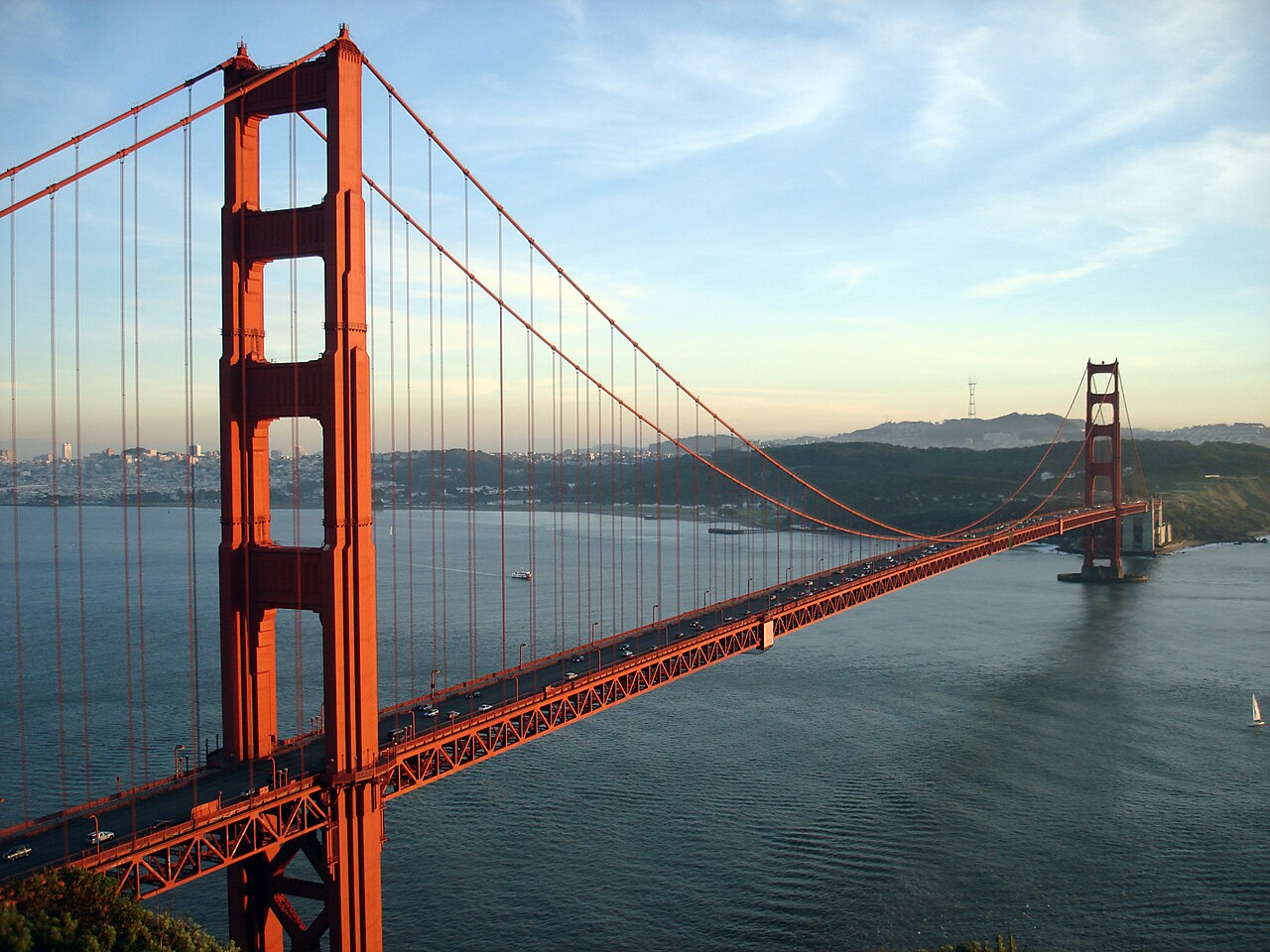
Чтобы удовлетворить потребности населения, были построены такие инженерные подвиги, как Калифорнийский и Лос-Анджелесский акведуки ; плотины Оровилл и Шаста ; мосты Бэй и Золотые Ворота . Правительство штата приняло Калифорнийский генеральный план высшего образования в 1960 году для разработки эффективной системы государственного образования.
.jpg/1280px-Paramount_Pictures_studio_gate,_c._1940_(cropped).jpg)
Между тем, привлеченные мягким средиземноморским климатом, дешевой землей и географическим разнообразием штата, кинематографисты основали студийную систему в Голливуде в 1920-х годах. Калифорния производила 9% вооружений США, произведенных во время Второй мировой войны , занимая третье место после Нью-Йорка и Мичигана . [85] Калифорния легко заняла первое место по производству военных кораблей на доках в Сан-Диего, Лос-Анджелесе и районе залива Сан-Франциско. [86] [87] [88] [89] Благодаря возможностям трудоустройства, которые Калифорния предлагала во время конфликта, население увеличилось за счет иммиграции, которую она получила из-за работы на своих военных заводах, военных базах и учебных центрах. [90] После Второй мировой войны экономика Калифорнии расширилась за счет сильных аэрокосмических и оборонных отраслей, [91] размер которых уменьшился после окончания холодной войны . [91] [92] Стэнфордский университет начал поощрять преподавателей и выпускников оставаться, а не уезжать из штата, и развивать высокотехнологичный регион, теперь известный как Кремниевая долина . [93] В результате этого Калифорния является мировым центром индустрии развлечений и музыки, технологий, машиностроения и аэрокосмической промышленности, а также центром сельскохозяйственного производства США. [94] Незадолго до краха Dot Coms Калифорния имела пятую по величине экономику в мире. [95]
В середине и конце двадцатого века произошли инциденты, связанные с расой. Напряженность между полицией и афроамериканцами в сочетании с безработицей и бедностью в центральных районах городов привела к беспорядкам, таким как беспорядки Родни Кинга 1992 года. [96] [97] Калифорния была центром Партии черных пантер , известной тем, что вооружала афроамериканцев для защиты от расовой несправедливости. [98] [99] Мексиканские, филиппинские и другие мигранты-рабочие ферм объединились в штате вокруг Сесара Чавеса, требуя лучшей оплаты в 1960-х и 70-х годах. [100]

В 20 веке произошло две великие катастрофы: землетрясение в Сан-Франциско в 1906 году и наводнение на плотине Святого Франциска в 1928 году , которые остаются самыми смертоносными в истории США. [101]
Хотя загрязнение воздуха сократилось, проблемы со здоровьем, связанные с загрязнением, продолжаются. Коричневый туман, известный как « смог », существенно уменьшился после введения федеральных и государственных ограничений на выхлопные газы автомобилей. [102] [103] Энергетический кризис 2001 года привел к веерным отключениям электроэнергии , резкому росту тарифов на электроэнергию и импорту электроэнергии из соседних штатов. Southern California Edison и Pacific Gas and Electric Company подверглись жесткой критике. [104]
Цены на жилье в городских районах продолжали расти; скромный дом, который в 1960-х годах стоил 25 000 долларов, к 2005 году обошелся бы в полмиллиона долларов или больше в городских районах. Все больше людей тратили больше времени на дорогу, чтобы позволить себе жилье в сельской местности, получая при этом более высокую зарплату в городских районах. Спекулянты покупали дома, ожидая получить огромную прибыль за несколько месяцев, а затем пролонгировали ее, покупая больше недвижимости. Ипотечные компании были послушны, поскольку люди предполагали, что цены будут продолжать расти. Пузырь лопнул в 2007–2008 годах, когда цены начали падать. Сотни миллиардов в стоимости недвижимости исчезли, а количество случаев лишения права выкупа заложенного имущества резко возросло, поскольку финансовые учреждения и инвесторы сильно пострадали. [105] [106]
.jpg/1280px-Steve_Jobs_presents_iPhone_(cropped).jpg)
В 21 веке произошли засухи и частые лесные пожары, связанные с изменением климата. [107] [108] С 2011 по 2017 год постоянная засуха была самой сильной за всю историю наблюдений. [109] Сезон лесных пожаров 2018 года стал самым смертоносным и разрушительным в штате. [110]
Один из первых подтверждённых случаев COVID-19 в Соединённых Штатах произошёл в Калифорнии 26 января 2020 года. [111] [112] Чрезвычайное положение было объявлено в штате 4 марта 2020 года и действовало до тех пор, пока губернатор Гэвин Ньюсом не отменил его в феврале 2023 года. [113] Обязательный приказ оставаться дома по всему штату был издан 19 марта 2020 года и был отменён в январе 2021 года. [114]
Усилия по возрождению культуры и языка среди коренных жителей Калифорнии достигли прогресса среди племен по состоянию на 2022 год. [115] [116] Произошел возврат некоторых земель под управление коренных народов. [117] [118] [119] В 2022 году было объявлено о крупнейшем в истории США проекте по удалению плотины и восстановлению реки на реке Кламат , что стало победой калифорнийских племен. [120] [121]

Занимая площадь в 163 696 кв. миль (423 970 км 2 ), Калифорния является третьим по величине штатом в Соединенных Штатах по площади после Аляски и Техаса . [122] Калифорния является одним из самых географически разнообразных штатов в союзе и часто географически делится на два региона, Южную Калифорнию , включающую десять самых южных округов, [123] [124] и Северную Калифорнию , включающую 48 самых северных округов. [125] [126] Она граничит с Орегоном на севере, Невадой на востоке и северо-востоке, Аризоной на юго-востоке, Тихим океаном на западе и разделяет международную границу с мексиканским штатом Нижняя Калифорния на юге (с которым она составляет часть региона Калифорния в Северной Америке , наряду с Нижней Калифорнией Южной ).
В середине штата находится Калифорнийская Центральная долина , ограниченная Сьерра-Невада на востоке, прибрежными горными хребтами на западе, Каскадным хребтом на севере и горами Техачапи на юге. Центральная долина является продуктивным сельскохозяйственным сердцем Калифорнии.
Разделенная на две части дельтой реки Сакраменто-Сан-Хоакин , северная часть, долина Сакраменто, служит водоразделом реки Сакраменто , в то время как южная часть, долина Сан-Хоакин, является водоразделом реки Сан-Хоакин . Обе долины получили свои названия от рек, которые протекают через них. Благодаря дноуглубительным работам, реки Сакраменто и Сан-Хоакин остались достаточно глубокими, чтобы несколько городов внутри страны стали морскими портами .


The Sacramento-San Joaquin River Delta is a critical water supply hub for the state. Water is diverted from the delta and through an extensive network of pumps and canals that traverse nearly the length of the state, to the Central Valley and the State Water Projects and other needs. Water from the Delta provides drinking water for nearly 23 million people, almost two-thirds of the state's population as well as water for farmers on the west side of the San Joaquin Valley.
Suisun Bay lies at the confluence of the Sacramento and San Joaquin Rivers. The water is drained by the Carquinez Strait, which flows into San Pablo Bay, a northern extension of San Francisco Bay, which then connects to the Pacific Ocean via the Golden Gate strait.
The Channel Islands are located off the Southern coast, while the Farallon Islands lie west of San Francisco.
The Sierra Nevada (Spanish for "snowy range") includes the highest peak in the contiguous 48 states, Mount Whitney, at 14,505 feet (4,421 m).[3][4][note 1] The range embraces Yosemite Valley, famous for its glacially carved domes, and Sequoia National Park, home to the giant sequoia trees, the largest living organisms on Earth, and the deep freshwater lake, Lake Tahoe, the largest lake in the state by volume.
To the east of the Sierra Nevada are Owens Valley and Mono Lake, an essential migratory bird habitat. In the western part of the state is Clear Lake, the largest freshwater lake by area entirely in California. Although Lake Tahoe is larger, it is divided by the California/Nevada border. The Sierra Nevada falls to Arctic temperatures in winter and has several dozen small glaciers, including Palisade Glacier, the southernmost glacier in the United States.

.jpg/1280px-San-miguel-cuyler-hike_(cropped).jpg)
The Tulare Lake was the largest freshwater lake west of the Mississippi River. A remnant of Pleistocene-era Lake Corcoran, Tulare Lake dried up by the early 20th century after its tributary rivers were diverted for agricultural irrigation and municipal water uses.[127]
About 45 percent of the state's total surface area is covered by forests,[128] and California's diversity of pine species is unmatched by any other state. California contains more forestland than any other state except Alaska. Many of the trees in the California White Mountains are the oldest in the world; an individual bristlecone pine is over 5,000 years old.[129][130]
In the south is a large inland salt lake, the Salton Sea. The south-central desert is called the Mojave; to the northeast of the Mojave lies Death Valley, which contains the lowest and hottest place in North America, the Badwater Basin at −279 feet (−85 m).[5] The horizontal distance from the bottom of Death Valley to the top of Mount Whitney is less than 90 miles (140 km). Indeed, almost all of southeastern California is arid, hot desert, with routine extreme high temperatures during the summer. The southeastern border of California with Arizona is entirely formed by the Colorado River, from which the southern part of the state gets about half of its water.
A majority of California's cities are located in either the San Francisco Bay Area or the Sacramento metropolitan area in Northern California; or the Los Angeles area, the Inland Empire, or the San Diego metropolitan area in Southern California. The Los Angeles Area, the Bay Area, and the San Diego metropolitan area are among several major metropolitan areas along the California coast.
As part of the Ring of Fire, California is subject to tsunamis, floods, droughts, Santa Ana winds, wildfires, and landslides on steep terrain; California also has several volcanoes. It has many earthquakes due to several faults running through the state, the largest being the San Andreas Fault. About 37,000 earthquakes are recorded each year; most are too small to be felt.[131] Among Americans at risk of serious harm from a major earthquake, two-thirds of that population are residents of California.[13]

Most of the state has a Mediterranean climate. The cool California Current offshore often creates summer fog near the coast. Farther inland, there are colder winters and hotter summers. The maritime moderation results in the shoreline summertime temperatures of Los Angeles and San Francisco being the coolest of all major metropolitan areas of the United States and uniquely cool compared to areas on the same latitude in the interior and on the east coast of the North American continent. Even the San Diego shoreline bordering Mexico is cooler in summer than most areas in the contiguous United States. Just a few miles inland, summer temperature extremes are significantly higher, with downtown Los Angeles being several degrees warmer than at the coast. The same microclimate phenomenon is seen in the climate of the Bay Area, where areas sheltered from the ocean experience significantly hotter summers and colder winters in contrast with nearby areas closer to the ocean.[132][133][134]

Northern parts of the state have more rain than the south. California's mountain ranges also influence the climate: some of the rainiest parts of the state are west-facing mountain slopes. Coastal northwestern California has a temperate climate, and the Central Valley has a Mediterranean climate but with greater temperature extremes than the coast. The high mountains, including the Sierra Nevada, have an alpine climate with snow in winter and mild to moderate heat in summer.
California's mountains produce rain shadows on the eastern side, creating extensive deserts. The higher elevation deserts of eastern California have hot summers and cold winters, while the low deserts east of the Southern California mountains have hot summers and nearly frostless mild winters. Death Valley, a desert with large expanses below sea level, is considered the hottest location in the world; the highest temperature in the world,[135][136] 134 °F (56.7 °C), was recorded there on July 10, 1913. The lowest temperature in California was −45 °F (−43 °C) on January 20, 1937, in Boca.[137]
The table below lists average temperatures for January and August in a selection of places throughout the state; some highly populated and some not. This includes the relatively cool summers of the Humboldt Bay region around Eureka, the extreme heat of Death Valley, and the mountain climate of Mammoth in the Sierra Nevada.
The wide range of climates leads to a high demand for water. Over time, droughts have been increasing due to climate change and overextraction,[139] becoming less seasonal and more year-round, further straining California's electricity supply[140] and water security[141][142] and having an impact on California business, industry, and agriculture.[143]
In 2022, a new state program was created in collaboration with indigenous peoples of California to revive the practice of controlled burns as a way of clearing excessive forest debris and making landscapes more resilient to wildfires. Native American use of fire in ecosystem management was outlawed in 1911, yet has now been recognized.[14]

California is one of the ecologically richest and most diverse parts of the world, and includes some of the most endangered ecological communities. California is part of the Nearctic realm and spans a number of terrestrial ecoregions.[144]
California's large number of endemic species includes relict species, which have died out elsewhere, such as the Catalina ironwood (Lyonothamnus floribundus). Many other endemics originated through differentiation or adaptive radiation, whereby multiple species develop from a common ancestor to take advantage of diverse ecological conditions such as the California lilac (Ceanothus).[citation needed] Many California endemics have become endangered, as urbanization, logging, overgrazing, and the introduction of exotic species have encroached on their habitat.

California boasts several superlatives in its collection of flora: the largest trees, the tallest trees, and the oldest trees. California's native grasses are perennial plants,[145] and there are close to hundred succulent species native to the state.[citation needed] After European contact, these were generally replaced by invasive species of European annual grasses; and, in modern times, California's hills turn a characteristic golden-brown in summer.[146]
Because California has the greatest diversity of climate and terrain, the state has six life zones which are the lower Sonoran Desert; upper Sonoran (foothill regions and some coastal lands), transition (coastal areas and moist northeastern counties); and the Canadian, Hudsonian, and Arctic Zones, comprising the state's highest elevations.[147]
Plant life in the dry climate of the lower Sonoran zone contains a diversity of native cactus, mesquite, and paloverde. The Joshua tree is found in the Mojave Desert. Flowering plants include the dwarf desert poppy and a variety of asters. Fremont cottonwood and valley oak thrive in the Central Valley. The upper Sonoran zone includes the chaparral belt, characterized by forests of small shrubs, stunted trees, and herbaceous plants. Nemophila, mint, Phacelia, Viola, and the California poppy (Eschscholzia californica, the state flower) also flourish in this zone, along with the lupine, more species of which occur here than anywhere else in the world.[147]
The transition zone includes most of California's forests with the redwood (Sequoia sempervirens) and the "big tree" or giant sequoia (Sequoiadendron giganteum), among the oldest living things on earth (some are said to have lived at least 4,000 years). Tanbark oak, California laurel, sugar pine, madrona, broad-leaved maple, and Douglas-fir also grow here. Forest floors are covered with swordfern, alumnroot, barrenwort, and trillium, and there are thickets of huckleberry, azalea, elder, and wild currant. Characteristic wild flowers include varieties of mariposa, tulip, and tiger and leopard lilies.[148]
.jpg/1280px-California_sea_lion_in_La_Jolla_(70568).jpg)
The high elevations of the Canadian zone allow the Jeffrey pine, red fir, and lodgepole pine to thrive. Brushy areas are abundant with dwarf manzanita and ceanothus; the unique Sierra puffball is also found here. Right below the timberline, in the Hudsonian zone, the whitebark, foxtail, and silver pines grow. At about 10,500 feet (3,200 m), begins the Arctic zone, a treeless region whose flora include a number of wildflowers, including Sierra primrose, yellow columbine, alpine buttercup, and alpine shooting star.[147][149]
Palm trees are a well-known feature of California, particularly in Southern California and Los Angeles; many species have been imported, though the Washington filifera (commonly known as the California fan palm) is native to the state, mainly growing in the Colorado Desert oases.[150] Other common plants that have been introduced to the state include the eucalyptus, acacia, pepper tree, geranium, and Scotch broom. The species that are federally classified as endangered are the Contra Costa wallflower, Antioch Dunes evening primrose, Solano grass, San Clemente Island larkspur, salt marsh bird's beak, McDonald's rock-cress, and Santa Barbara Island liveforever. As of December 1997[update], 85 plant species were listed as threatened or endangered.[147]

In the deserts of the lower Sonoran zone, the mammals include the jackrabbit, kangaroo rat, squirrel, and opossum. Common birds include the owl, roadrunner, cactus wren, and various species of hawk. The area's reptilian life include the sidewinder viper, desert tortoise, and horned toad. The upper Sonoran zone boasts mammals such as the antelope, brown-footed woodrat, and ring-tailed cat. Birds unique to this zone are the California thrasher, bushtit, and California condor.[147][151][152][153]
In the transition zone, there are Colombian black-tailed deer, black bears, gray foxes, cougars, bobcats, and Roosevelt elk. Reptiles such as the garter snakes and rattlesnakes inhabit the zone. In addition, amphibians such as the water puppy and redwood salamander are common too. Birds such as the kingfisher, chickadee, towhee, and hummingbird thrive here as well.[147][154]
The Canadian zone mammals include the mountain weasel, snowshoe hare, and several species of chipmunks. Conspicuous birds include the blue-fronted jay, mountain chickadee, hermit thrush, American dipper, and Townsend's solitaire. As one ascends into the Hudsonian zone, birds become scarcer. While the gray-crowned rosy finch is the only bird native to the high Arctic region, other bird species such as Anna's hummingbird and Clark's nutcracker. Principal mammals found in this region include the Sierra coney, white-tailed jackrabbit, and the bighorn sheep. As of April 2003[update], the bighorn sheep was listed as endangered by the U.S. Fish and Wildlife Service. The fauna found throughout several zones are the mule deer, coyote, mountain lion, northern flicker, and several species of hawk and sparrow.[147]

Aquatic life in California thrives, from the state's mountain lakes and streams to the rocky Pacific coastline. Numerous trout species are found, among them rainbow, golden, and cutthroat. Migratory species of salmon are common as well. Deep-sea life forms include sea bass, yellowfin tuna, barracuda, and several types of whale. Native to the cliffs of northern California are seals, sea lions, and many types of shorebirds, including migratory species.[147]
As of April 2003[update], 118 California animals were on the federal endangered list; 181 plants were listed as endangered or threatened. Endangered animals include the San Joaquin kitfox, Point Arena mountain beaver, Pacific pocket mouse, salt marsh harvest mouse, Morro Bay kangaroo rat (and five other species of kangaroo rat), Amargosa vole, California least tern, California condor, loggerhead shrike, San Clemente sage sparrow, San Francisco garter snake, five species of salamander, three species of chub, and two species of pupfish. Eleven butterflies are also endangered[155] and two that are threatened are on the federal list.[156][157] Among threatened animals are the coastal California gnatcatcher, Paiute cutthroat trout, southern sea otter, and northern spotted owl. California has a total of 290,821 acres (1,176.91 km2) of National Wildlife Refuges.[147] As of September 2010[update], 123 California animals were listed as either endangered or threatened on the federal list.[158] Also, as of the same year[update], 178 species of California plants were listed either as endangered or threatened on this federal list.[158]

The most prominent river system within California is formed by the Sacramento River and San Joaquin River, which are fed mostly by snowmelt from the west slope of the Sierra Nevada, and respectively drain the north and south halves of the Central Valley. The two rivers join in the Sacramento–San Joaquin River Delta, flowing into the Pacific Ocean through San Francisco Bay. Many major tributaries feed into the Sacramento–San Joaquin system, including the Pit River, Feather River and Tuolumne River.
The Klamath and Trinity Rivers drain a large area in far northwestern California. The Eel River and Salinas River each drain portions of the California coast, north and south of San Francisco Bay, respectively. The Mojave River is the primary watercourse in the Mojave Desert, and the Santa Ana River drains much of the Transverse Ranges as it bisects Southern California. The Colorado River forms the state's southeast border with Arizona.
Most of California's major rivers are dammed as part of two massive water projects: the Central Valley Project, providing water for agriculture in the Central Valley, and the California State Water Project diverting water from Northern to Southern California. The state's coasts, rivers, and other bodies of water are regulated by the California Coastal Commission.


California is traditionally separated into Northern California and Southern California, divided by a straight border which runs across the state, separating the northern 48 counties from the southern 10 counties. Despite the persistence of the northern-southern divide, California is more precisely divided into many regions, multiple of which stretch across the northern-southern divide.
The state has 483 incorporated cities and towns,[159] of which 461 are cities and 22 are towns. Under California law, the terms "city" and "town" are explicitly interchangeable; the name of an incorporated municipality in the state can either be "City of (Name)" or "Town of (Name)".[160]
Sacramento became California's first incorporated city on February 27, 1850.[161] San Jose, San Diego, and Benicia tied for California's second incorporated city, each receiving incorporation on March 27, 1850.[162][163][164] Mountain House became the state's most recent and 483rd incorporated municipality on July 1, 2024.[159]The majority of these cities and towns are within one of five metropolitan areas: the Los Angeles Metropolitan Area, the San Francisco Bay Area, the Riverside-San Bernardino Area, the San Diego metropolitan area, or the Sacramento metropolitan area.
Presently, close to one out of every nine United States residents lives in California.[171][172] The United States Census Bureau reported that the population of California was 39.54 million on April 1, 2020, a 6.13% increase since the 2010 census.[169] During that decade, the state's population grew more slowly than the rest of the nation, resulting in the loss of one seat on the US House of Representatives, the first loss in its entire history.[171] The estimated state population in 2023 was 38.94 million.[172] For well over a century (1900–2020), California experienced steady population growth. Even while the rate of growth began to slow by the 1990s, some growth continued into the first two decades of the 21st century; California added an average of around 400,000 people per year to its population during the period 1940–2020.[173][174][175] Then in 2020, the state began to experience population declines continuing every year, attributable mostly to moves out of state but also due to declining birth rates, COVID-19 pandemic deaths, and less internal migration from other states to California.[171][176] According to the U.S. Census Bureau, between 2021 and 2022, 818,000 California residents moved out of state[177] with emigrants listing high cost of living,[178] high taxes,[179][180] and a difficult business environment as the motivation.[180] The net loss of population in California between July 2020 and July 2023 was 433,000.[171]
.jpg/1280px-Population_density_of_California_counties_(2020).jpg)
The Greater Los Angeles Area is the second-largest metropolitan area in the United States (U.S.), while Los Angeles is the second-largest city in the U.S. Conversely, San Francisco is the most densely-populated city in California and one of the most densely populated cities in the U.S.. Also, Los Angeles County has held the title of most populous U.S. county for decades, and it alone is more populous than 42 U.S. states.[181][182] Including Los Angeles, four of the top 20 most populous cities in the U.S. are in California: Los Angeles (2nd), San Diego (8th), San Jose (10th), and San Francisco (17th). The center of population of California is located four miles west-southwest of the city of Shafter, Kern County.[note 3]
As of 2019, California ranked second among states by life expectancy, with a life expectancy of 80.9 years.[184]
Starting in the year 2010, for the first time since the California Gold Rush, California-born residents made up the majority of the state's population.[185] Along with the rest of the United States, California's immigration pattern has also shifted over the course of the late 2000s to early 2010s.[186] Immigration from Latin American countries has dropped significantly with most immigrants now coming from Asia.[187] In total for 2011, there were 277,304 immigrants. Fifty-seven percent came from Asian countries versus 22% from Latin American countries.[187] Net immigration from Mexico, previously the most common country of origin for new immigrants, has dropped to zero / less than zero since more Mexican nationals are departing for their home country than immigrating.[186]
The state's population of undocumented immigrants has been shrinking in recent years, due to increased enforcement and decreased job opportunities for lower-skilled workers.[188] The number of migrants arrested attempting to cross the Mexican border in the Southwest decreased from a high of 1.1 million in 2005 to 367,000 in 2011.[189] Despite these recent trends, illegal aliens constituted an estimated 7.3 percent of the state's population, the third highest percentage of any state in the country,[190][note 4] totaling nearly 2.6 million.[191] In particular, illegal immigrants tended to be concentrated in Los Angeles, Monterey, San Benito, Imperial, and Napa Counties—the latter four of which have significant agricultural industries that depend on manual labor.[192] More than half of illegal immigrants originate from Mexico.[191] The state of California and some California cities, including Los Angeles, Oakland, and San Francisco,[193] have adopted sanctuary policies.[194]
According to HUD's 2022 Annual Homeless Assessment Report, there were an estimated 171,521 homeless people in California.[195][196]

According to the United States Census Bureau in 2022 the population self-identified as (alone or in combination): 56.5% White (including Hispanic Whites),[202] 33.7% non-Hispanic white,[203] 18.1% Asian,[204] 7.3% Black or African American,[205] 3.2% Native American and Alaska Native,[206] 0.9% Native Hawaiian or Pacific Islander,[207] and 34.3% some other race.[208] These numbers add up to more than 100% because respondents can select multiple racial identities. 19% of Californians identified as two or more races in 2022, although excluding respondents who selected "some other race", only 5% identified as two or more races.[209]
By ethnicity, in 2018 the population was 60.7% non-Hispanic (of any race) and 39.3% Hispanic or Latino (of any race). Hispanics are the largest single ethnic group in California.[210] Non-Hispanic whites constituted 36.8% of the state's population.[210] Californios are the Hispanic residents native to California, who make up the Spanish-speaking community that has existed in California since 1542, of varying Mexican American/Chicano, Criollo Spaniard, and Mestizo origin.[211] However, they make up only a small part of California's Hispanic population today, estimated at 500,000. California has the largest Mexican, Salvadoran, and Guatemalan population, together making up over 90% of the state's Latino population.[212]
According to 2022 estimates from the American Community Survey, 32.4% of the population had Mexican ancestry, 6.6% had German ancestry, 6.1% had English ancestry, 5.6% had Irish ancestry, 4.9% had Chinese ancestry, 4.3% had Filipino ancestry, 4% had Central American ancestry (Mostly Salvadoran and Guatemalan), 3.4% had Italian ancestry, 2.8% listed themselves as American, and 2.5% had Indian ancestry.[213][214][215]

As of 2011[update], 75.1% of California's population younger than age 1 were minorities, meaning they had at least one parent who was not non-Hispanic white (white Hispanics are counted as minorities).[216]
In terms of total numbers, California has the largest population of White Americans in the United States, an estimated 22,200,000 residents including people identifying as white in combination with any other race. The state has the 5th largest population of African Americans in the United States, an estimated 2,250,000 residents. California's Asian American population is estimated at 7.1 million, constituting a third of the nation's total. California's Native American population of 504,000 is the most of any state, with 103,030 identifying as Non-Hispanic and belonging mostly to the Indigenous peoples of California.[217][218] Most of the state's Native American population identifies as Hispanic and belongs to Indigenous Mexican or Central American ethnic groups, including 185,200 identifying as Mexican American Indian and 67,904 identifying as Central American Indian.[219]
According to estimates from 2011, California has the largest minority population in the United States by numbers, making up 60% of the state population.[220] Over the past 25 years, the population of non-Hispanic whites has declined, while Hispanic and Asian populations have grown. Between 1970 and 2011, non-Hispanic whites declined from 80% of the state's population to 40%, while Hispanics grew from 32% in 2000 to 38% in 2011.[221] It is currently projected that Hispanics will rise to 49% of the population by 2060, primarily due to domestic births rather than immigration.[222] With the decline of immigration from Latin America, Asian Americans now constitute the fastest growing racial/ethnic group in California; this growth is primarily driven by immigration from China, India, and the Philippines, respectively.[223]
Most of California's immigrant population are born in Mexico (3.9 million), the Philippines (825,200), China (768,400), India (556,500), and Vietnam (502,600).[224]
California has the largest multiracial population in the United States.[225] Mexican is the most common ancestry in California, followed by English, German, and Irish.[226]
English serves as California's de jure and de facto official language. According to the 2021 American Community Survey conducted by the United States Census Bureau, 56.08% (20,763,638) of California residents age 5 and older spoke only English at home, while 43.92% spoke another language at home. 60.35% of people who speak a language other than English at home are able to speak English "well" or "very well", with this figure varying significantly across the different linguistic groups.[227] Like most U.S. states (32 out of 50), California law enshrines English as its official language, and has done so since the passage of Proposition 63 by California voters in 1986. Various government agencies do, and are often required to, furnish documents in the various languages needed to reach their intended audiences.[228][229][230]
Spanish is the most commonly spoken language in California, behind English, spoken by 28.18% (10,434,308) of the population (in 2021).[227] The Spanish language has been spoken in California since 1542 and is deeply intertwined with California's cultural landscape and history.[231][232][233] Spanish was the official administrative language of California through the Spanish and Mexican eras, until 1848. Following the U.S. Conquest of California and the Treaty of Guadalupe-Hidalgo, the U.S. Government guaranteed the rights of Spanish-speaking Californians. The first Constitution of California was written in both languages at the Monterey Constitutional Convention of 1849 and protected the rights of Spanish speakers to use their language in government proceedings and mandating that all government documents be published in both English and Spanish.[234]
Despite the initial recognition of Spanish by early American governments in California, the revised 1879 constitution stripped the rights of Spanish speakers and the official status of Spanish.[235] The growth of the English-only movement by the mid-20th century led to the passage of 1986 California Proposition 63, which enshrined English as the only official language in California and ended Spanish language instruction in schools.[236] 2016 California Proposition 58 reversed the prohibition on bilingual education, though there are still many barriers to the proliferation of Spanish bilingual education, including a shortage of teachers and lack of funding.[237][236][238] The government of California has since made efforts to promote Spanish language access and bilingual education,[239][240] as have private educational institutions in California.[241] Many businesses in California promote the usage of Spanish by their employees, to better serve both California's Hispanic population and the larger Spanish-speaking world.[242][243]
California has historically been one of the most linguistically diverse areas in the world, with more than 70 indigenous languages derived from 64 root languages in six language families.[244][245] A survey conducted between 2007 and 2009 identified 23 different indigenous languages among California farmworkers.[246] All of California's indigenous languages are endangered, although there are now efforts toward language revitalization.[note 6] California has the highest concentration nationwide of Chinese, Vietnamese and Punjabi speakers.
As a result of the state's increasing diversity and migration from other areas across the country and around the globe, linguists began noticing a noteworthy set of emerging characteristics of spoken American English in California since the late 20th century. This variety, known as California English, has a vowel shift and several other phonological processes that are different from varieties of American English used in other regions of the United States.[247]
Religious self-identification, per Public Religion Research Institute's 2021 American Values Survey[248]
The largest religious denominations by number of adherents as a percentage of California's population in 2014 were the Catholic Church with 28 percent, Evangelical Protestants with 20 percent, and Mainline Protestants with 10 percent. Together, all kinds of Protestants accounted for 32 percent. Those unaffiliated with any religion represented 27 percent of the population. The breakdown of other religions is 1% Muslim, 2% Hindu and 2% Buddhist.[249] This is a change from 2008, when the population identified their religion with the Catholic Church with 31 percent; Evangelical Protestants with 18 percent; and Mainline Protestants with 14 percent. In 2008, those unaffiliated with any religion represented 21 percent of the population. The breakdown of other religions in 2008 was 0.5% Muslim, 1% Hindu and 2% Buddhist.[250] The American Jewish Year Book placed the total Jewish population of California at about 1,194,190 in 2006.[251] According to the Association of Religion Data Archives (ARDA) the largest denominations by adherents in 2010 were the Catholic Church with 10,233,334; The Church of Jesus Christ of Latter-day Saints with 763,818; and the Southern Baptist Convention with 489,953.[252]
.jpg/1280px-Cathedral_of_San_Carlos_Borromeo_(cropped2).jpg)
California has a large Catholic population due to the large numbers of Mexicans and Central Americans living within its borders. California has twelve dioceses and two archdioceses, the Archdiocese of Los Angeles and the Archdiocese of San Francisco, the former being the largest archdiocese in the United States.
A Pew Research Center survey revealed that California is somewhat less religious than the rest of the states: 62 percent of Californians say they are "absolutely certain" of their belief in God, while in the nation 71 percent say so. The survey also revealed 48 percent of Californians say religion is "very important", compared to 56 percent nationally.[254]
.jpg/1280px-Hollywood_Sign_(Zuschnitt).jpg)
The culture of California is a Western culture and has its modern roots in the culture of the United States, but also, historically, many Hispanic Californio and Mexican influences. As a border and coastal state, California culture has been greatly influenced by several large immigrant populations, especially those from Latin America and Asia.[255]
California has long been a subject of interest in the public mind and has often been promoted by its boosters as a kind of paradise. In the early 20th century, fueled by the efforts of state, the building projects during the Great Depression and local boosters, many Americans saw the Golden State as an ideal resort destination, sunny and dry all year round with easy access to the ocean and mountains. In the 1960s, popular music groups such as the Beach Boys promoted the image of Californians as laid-back, tanned beach-goers.
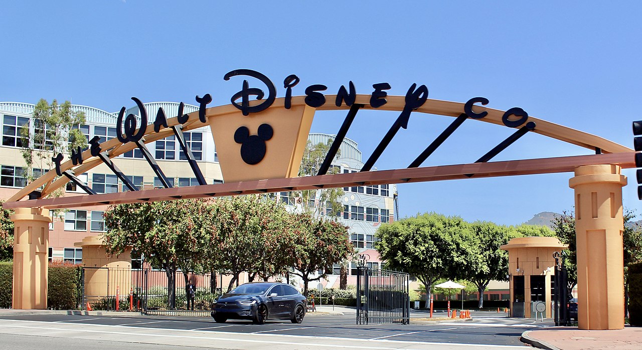
Hollywood and the rest of the Los Angeles area is a major global center for entertainment, with the U.S. film industry's "Big Five" major film studios (Columbia, Disney, Paramount, Universal, and Warner Bros.) as well as many minor film studios being based in or around the area. Many animation studios are also headquartered in the state.
The four major American television commercial broadcast networks (ABC, CBS, NBC, and Fox) as well as other networks all have production facilities and offices in the state. All the four major commercial broadcast networks, plus the two major Spanish-language networks (Telemundo and Univision) each have at least three owned-and-operated TV stations in California, including at least one in Los Angeles and at least one in San Francisco.[note 7]
.JPG/1280px-Twitter_headquarters_in_San_Francisco_(TK2).JPG)

One of the oldest radio stations in the United States still in existence, KCBS (AM) in the San Francisco Bay Area, was founded in 1909. Universal Music Group, one of the "Big Four" record labels, is based in Santa Monica, while Warner Records is based in Los Angeles. Many independent record labels, such as Mind of a Genius Records, are also headquartered in the state. California is also the birthplace of several international music genres, including the Bakersfield sound, Bay Area thrash metal, alternative rock, g-funk, nu metal, glam metal, thrash metal, psychedelic rock, stoner rock, punk rock, hardcore punk, metalcore, pop punk, surf music, third wave ska, west coast hip hop, west coast jazz, jazz rap, and many other genres. Other genres such as pop rock, indie rock, hard rock, hip hop, pop, rock, rockabilly, country, heavy metal, grunge, new wave and disco were popularized in the state. In addition, many British bands, such as Led Zeppelin, Deep Purple, Black Sabbath, and the Rolling Stones settled in the state after becoming internationally famous.
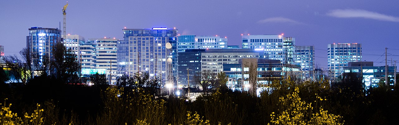
As the home of Silicon Valley, the Bay Area is the headquarters of several prominent internet media, social media, and other technology companies. Three of the "Big Five" technology companies (Apple, Meta, and Google) are based in the area as well as other services such as Netflix, Pandora Radio, Twitter, Yahoo!, and YouTube. Other prominent companies that are headquartered here include HP inc. and Intel. Microsoft and Amazon also have offices in the area.
California, particularly Southern California,[256] is considered the birthplace of modern car culture.[257]
Several fast food, fast casual, and casual dining chains were also founded California, including some that have since expanded internationally like California Pizza Kitchen, Denny's, IHOP, McDonald's, Panda Express, and Taco Bell.


California has nineteen major professional sports league franchises, far more than any other state. The San Francisco Bay Area has six major league teams spread in its three major cities: San Francisco, San Jose, and Oakland, while the Greater Los Angeles Area is home to ten major league franchises. San Diego and Sacramento each have one major league team. The NFL Super Bowl has been hosted in California 12 times at five different stadiums: Los Angeles Memorial Coliseum, the Rose Bowl, Stanford Stadium, Levi's Stadium, and San Diego's Qualcomm Stadium. A thirteenth, Super Bowl LVI, was held at SoFi Stadium in Inglewood on February 13, 2022.[258]
California has long had many respected collegiate sports programs. California is home to the oldest college bowl game, the annual Rose Bowl, among others.
The NFL has three teams in the state: the Los Angeles Rams, Los Angeles Chargers, and San Francisco 49ers.
MLB has five teams in the state: the San Francisco Giants, Oakland Athletics, Los Angeles Dodgers, Los Angeles Angels, and San Diego Padres.[259]
The NBA has four teams in the state: the Golden State Warriors, Los Angeles Clippers, Los Angeles Lakers, and Sacramento Kings. Additionally, the WNBA also has one team in the state: the Los Angeles Sparks.
The NHL has three teams in the state: the Anaheim Ducks, Los Angeles Kings, and San Jose Sharks.
MLS has three teams in the state: the Los Angeles Galaxy, San Jose Earthquakes, and Los Angeles Football Club.
MLR has one team in the state: the San Diego Legion.
California is the only U.S. state to have hosted both the Summer and Winter Olympics. The 1932 and 1984 summer games were held in Los Angeles. Squaw Valley Ski Resort (now Palisades Tahoe) in the Lake Tahoe region hosted the 1960 Winter Olympics. Los Angeles will host the 2028 Summer Olympics, marking the fourth time that California will have hosted the Olympic Games.[260] Multiple games during the 1994 FIFA World Cup took place in California, with the Rose Bowl hosting eight matches (including the final), while Stanford Stadium hosted six matches.
In addition to the Olympic games, California also hosts the California State Games.
Many sports, such as surfing, snowboarding, and skateboarding, were invented in California, while others like volleyball, beach soccer, and skiing were popularized in the state.
Other sports that are big in the state include golf, rodeo, tennis, mountain climbing, marathon running, horse racing, bowling, mixed martial arts, boxing, and motorsports, especially NASCAR and Formula One.

.jpg/1280px-Santa_Barbara_Senior_High_School_(cropped).jpg)
California has the most school students in the country, with over 6.2 million in the 2005–06 school year, giving California more students in school than 36 states have in total population and one of the highest projected enrollments in the country.[261]Public secondary education consists of high schools that teach elective courses in trades, languages, and liberal arts with tracks for gifted, college-bound and industrial arts students. California's public educational system is supported by a unique constitutional amendment that requires a minimum annual funding level for grades K–12 and community colleges that grows with the economy and student enrollment figures.[262]
In 2016, California's K–12 public school per-pupil spending was ranked 22nd in the nation ($11,500 per student vs. $11,800 for the U.S. average).[263]
For 2012, California's K–12 public schools ranked 48th in the number of employees per student, at 0.102 (the U.S. average was 0.137), while paying the 7th most per employee, $49,000 (the U.S. average was $39,000).[264][265][266]


California public postsecondary education is organized into three separate systems:
California is also home to notable private universities such as Stanford University, the California Institute of Technology (Caltech), the University of Southern California, the Claremont Colleges, Santa Clara University, Loyola Marymount University, the University of San Diego, the University of San Francisco, Chapman University, Pepperdine University, Occidental College, and University of the Pacific, among numerous other private colleges and universities, including many religious and special-purpose institutions. California has a particularly high density of arts colleges, including the California College of the Arts, California Institute of the Arts, San Francisco Art Institute, Art Center College of Design, and Academy of Art University, among others.
California's economy ranks among the largest in the world. As of 2024[update], the gross state product (GSP) is $4.0 trillion ($102,500 per capita), the largest in the United States. [15] California is responsible for one seventh of the nation's gross domestic product (GDP).[275] As of 2018[update], California's nominal GDP is larger than all but four countries.[276] In terms of purchasing power parity (PPP),[277] it is larger than all but eight countries.[278] California's economy is larger than Africa and Australia and is almost as large as South America.[279] The state recorded total, non-farm employment of 16,677,800[280] as of September 2021[update] among 966,224 employer establishments.[281]

As the largest and second-largest U.S. ports respectively, the Port of Los Angeles and the Port of Long Beach in Southern California collectively play a pivotal role in the global supply chain, together hauling in about 40% of all imports to the United States by TEU volume.[20] The Port of Oakland and Port of Hueneme are the 10th and 26th largest seaports in the U.S., respectively, by number of TEUs handled.[282]
The five largest sectors of employment in California are trade, transportation, and utilities; government; professional and business services; education and health services; and leisure and hospitality. In output, the five largest sectors are financial services, followed by trade, transportation, and utilities; education and health services; government; and manufacturing.[283] California has an unemployment rate of 3.9% as of September 2022[update].[280]
California's economy is dependent on trade and international related commerce accounts for about one-quarter of the state's economy, and representing 7% of their GDP; California's biggest trade partner is Mexico. In 2008, California exported $144 billion worth of goods, up from $134 billion in 2007 and $127 billion in 2006.[284] Vehicles, computers and electronic products are California's top export, accounting for 42 percent of all the state's exports in 2008; over 50 car companies operate in California, such as Tesla and Mazda.[284]

Agriculture is an important sector in California's economy. According to the USDA in 2011, the three largest California agricultural products by value were milk and cream, shelled almonds, and grapes.[19] Farming-related sales more than quadrupled over the past three decades, from $7.3 billion in 1974 to nearly $31 billion in 2004.[285] This increase has occurred despite a 15 percent decline in acreage devoted to farming during the period, and water supply suffering from chronic instability. Factors contributing to the growth in sales-per-acre include more intensive use of active farmlands and technological improvements in crop production.[285] In 2008, California's 81,500 farms and ranches generated $36.2 billion products revenue.[286] In 2011, that number grew to $43.5 billion products revenue.[287] The agriculture sector accounts for two percent of the state's GDP and employs around three percent of its total workforce.[288]

Per capita GDP in 2021 was $85,546, ranking fourth in the nation. Per capita income varies widely by geographic region and profession.[291] The Central Valley is the most impoverished, with migrant farm workers making less than minimum wage. According to a 2005 report by the Congressional Research Service, the San Joaquin Valley was characterized as one of the most economically depressed regions in the United States, on par with the region of Appalachia.[292]
Using the supplemental poverty measure, California has a poverty rate of 23.5%, the highest of any state in the country.[293] However, using the official measure the poverty rate was only 13.3% as of 2017.[294] Many coastal cities include some of the wealthiest per-capita areas in the United States. The high-technology sectors in Northern California, specifically Silicon Valley, in Santa Clara and San Mateo counties, have emerged from the economic downturn caused by the dot-com bust.
In 2019, there were 1,042,027 millionaire households in the state, more than any other state in the nation.[295] In 2010, California residents were ranked first among the states with the best average credit score of 754.[296]
![California counties by GDP (2021)[298]](http://upload.wikimedia.org/wikipedia/commons/thumb/f/f8/California_counties_by_GDP_2021.png/1280px-California_counties_by_GDP_2021.png)
.svg/1280px-California_economic_regions_map_(labeled_and_colored).svg.png)
State spending increased from $56 billion in 1998 to $127 billion in 2011.[299][300] California has the third highest per capita spending on welfare among the states, as well as the highest spending on welfare at $6.67 billion.[301] In January 2011, California's total debt was at least $265 billion.[302] On June 27, 2013, Governor Jerry Brown signed a balanced budget (no deficit) for the state, its first in decades; however, the state's debt remains at $132 billion.[303][304]
With the passage of Proposition 30 in 2012 and Proposition 55 in 2016, California now levies a 13.3% maximum marginal income tax rate with ten tax brackets, ranging from 1% at the bottom tax bracket of $0 annual individual income to 13.3% for annual individual income over $1,000,000 (though the top brackets are only temporary until Proposition 55 expires at the end of 2030). While Proposition 30 also enacted a minimum state sales tax of 7.5%, this sales tax increase was not extended by Proposition 55 and reverted to a previous minimum state sales tax rate of 7.25% in 2017. Local governments can and do levy additional sales taxes in addition to this minimum rate.[305]
All real property is taxable annually. Property tax increases are capped at 2% annually or the rate of inflation (whichever is lower), per Proposition 13.

Because it is the most populous state in the United States, California is one of the country's largest users of energy. The state has extensive hydro-electric energy generation facilities, however, moving water is the single largest energy use in the state. Also, due to high energy rates, conservation mandates, mild weather in the largest population centers and strong environmental movement, its per capita energy use is one of the smallest of any state in the United States.[306] Due to the high electricity demand, California imports more electricity than any other state, primarily hydroelectric power from states in the Pacific Northwest (via Path 15 and Path 66) and coal- and natural gas-fired production from the desert Southwest via Path 46.[307]
The state's crude oil and natural gas deposits are located in the Central Valley and along the coast, including the large Midway-Sunset Oil Field. Natural gas-fired power plants typically account for more than one-half of state electricity generation.
_(cropped).jpg/1280px-Ho_000155_170593_515241_4578_(35974057893)_(cropped).jpg)
As a result of the state's strong environmental movement, California has some of the most aggressive renewable energy goals in the United States. The Clean Energy, Jobs and Affordability Act of 2022 commits the state to running its operations on clean, renewable energy resources by 2035, and SB 1203 also requires the state to achieve net-zero operations for all agencies. Currently, several solar power plants such as the Solar Energy Generating Systems facility are located in the Mojave Desert. California's wind farms include Altamont Pass, San Gorgonio Pass, and Tehachapi Pass. The Tehachapi area is also where the Tehachapi Energy Storage Project is located.[308] Several dams across the state provide hydro-electric power. It would be possible to convert the total supply to 100% renewable energy, including heating, cooling and mobility, by 2050.[309]
California has one major nuclear power plant (Diablo Canyon) in operation. The San Onofre nuclear plant was shut down in 2013. More than 1,700 tons of radioactive waste are stored at San Onofre,[310] and sit on the coast where there is a record of past tsunamis.[311] Voters banned the approval of new nuclear power plants since the late 1970s because of concerns over radioactive waste disposal.[312][note 8] Several cities such as Oakland, Berkeley and Davis have declared themselves as nuclear-free zones.
California's vast terrain is connected by an extensive system of controlled-access highways ('freeways'), limited-access roads ('expressways'), and highways. California is known for its car culture, giving California's cities a reputation for severe traffic congestion. Construction and maintenance of state roads and statewide transportation planning are primarily the responsibility of the California Department of Transportation, nicknamed "Caltrans". The rapidly growing population of the state is straining all of its transportation networks, and California has some of the worst roads in the United States.[314][315] The Reason Foundation's 19th Annual Report on the Performance of State Highway Systems ranked California's highways the third-worst of any state, with Alaska second, and Rhode Island first.[316]
.jpg/1280px-San_Francisco_Bay_Ferry_Hydrus_May_2017_(cropped).jpg)
The state has been a pioneer in road construction. One of the state's more visible landmarks, the Golden Gate Bridge, was the longest suspension bridge main span in the world at 4,200 feet (1,300 m) between 1937 (when it opened) and 1964. With its orange paint and panoramic views of the bay, this highway bridge is a popular tourist attraction and also accommodates pedestrians and bicyclists. The San Francisco–Oakland Bay Bridge (often abbreviated the "Bay Bridge"), completed in 1936, transports about 280,000 vehicles per day on two-decks. Its two sections meet at Yerba Buena Island through the world's largest diameter transportation bore tunnel, at 76 feet (23 m) wide by 58 feet (18 m) high.[317] The Arroyo Seco Parkway, connecting Los Angeles and Pasadena, opened in 1940 as the first freeway in the Western United States.[318] It was later extended south to the Four Level Interchange in downtown Los Angeles, regarded as the first stack interchange ever built.[319]
The California Highway Patrol is the largest statewide police agency in the United States in employment with more than 10,000 employees. They are responsible for providing any police-sanctioned service to anyone on California's state-maintained highways and on state property.
By the end of 2021, 30,610,058 people in California held a California Department of Motor Vehicles-issued driver's licenses or state identification card, and there were 36,229,205 registered vehicles, including 25,643,076 automobiles, 853,368 motorcycles, 8,981,787 trucks and trailers, and 121,716 miscellaneous vehicles (including historical vehicles and farm equipment).[320]
.jpg/1280px-TheThemeBuildingLosAngeles_(cropped2).jpg)
Los Angeles International Airport (LAX), the 4th busiest airport in the world in 2018, and San Francisco International Airport (SFO), the 25th busiest airport in the world in 2018, are major hubs for trans-Pacific and transcontinental traffic. There are about a dozen important commercial airports and many more general aviation airports throughout the state.

Inter-city rail travel is provided by Amtrak California; the three routes, the Capitol Corridor, Pacific Surfliner, and San Joaquin, are funded by Caltrans. These services are the busiest intercity rail lines in the United States outside the Northeast Corridor and ridership is continuing to set records. The routes are becoming increasingly popular over flying, especially on the LAX-SFO route.[321] Integrated subway and light rail networks are found in Los Angeles (Los Angeles Metro Rail) and San Francisco (Muni Metro). Light rail systems are also found in San Jose (VTA light rail), San Diego (San Diego Trolley), Sacramento (SacRT light rail), and Northern San Diego County (Sprinter). Furthermore, commuter rail networks serve the San Francisco Bay Area (Altamont Corridor Express, Bay Area Rapid Transit, Caltrain, Sonoma–Marin Area Rail Transit), Greater Los Angeles (Metrolink), and San Diego County (Coaster).
The California High-Speed Rail Authority was authorized in 1996 by the state legislature to plan a California High-Speed Rail system to put before the voters. The plan they devised, 2008 California Proposition 1A, connecting all the major population centers in the state, was approved by the voters at the November 2008 general election.[322] The first phase of construction was begun in 2015, and the first segment 171 miles (275 km) long, is planned to be put into operation by the end of 2030. Planning and work on the rest of the system is continuing, with funding for completing it is an ongoing issue.[323] California's 2023 integrated passenger rail master plan includes a high speed rail system.[324]
Nearly all counties operate bus lines, and many cities operate their own city bus lines as well. Intercity bus travel is provided by Greyhound, Megabus, and Amtrak Thruway.
.jpg/1280px-Aerial_view_of_Shasta_Dam_and_Shasta_Lake_(2019).jpg)
California's interconnected water system is the world's largest, managing over 40,000,000 acre-feet (49 km3) of water per year, centered on six main systems of aqueducts and infrastructure projects.[325] Water use and conservation in California is a politically divisive issue, as the state experiences periodic droughts and has to balance the demands of its large agricultural and urban sectors, especially in the arid southern portion of the state. The state's widespread redistribution of water also invites the frequent scorn of environmentalists.
The California Water Wars, a conflict between Los Angeles and the Owens Valley over water rights, is one of the most well-known examples of the struggle to secure adequate water supplies.[326] Former California Governor Arnold Schwarzenegger said:
We've been in crisis for quite some time because we're now 38 million people and not anymore 18 million people like we were in the late 60s. So it developed into a battle between environmentalists and farmers and between the south and the north and between rural and urban. And everyone has been fighting for the last four decades about water.[327]

The capital city of California is Sacramento.[328]The state is organized into three branches of government—the executive branch consisting of the governor[329] and the other independently elected constitutional officers; the legislative branch consisting of the Assembly and Senate;[330] and the judicial branch consisting of the Supreme Court of California and lower courts.[331] The state also allows ballot propositions: direct participation of the electorate by initiative, referendum, recall, and ratification.[332] Before the passage of Proposition 14 in 2010, California allowed each political party to choose whether to have a closed primary or a primary where only party members and independents vote. After June 8, 2010, when Proposition 14 was approved, excepting only the United States president and county central committee offices,[333] all candidates in the primary elections are listed on the ballot with their preferred party affiliation, but they are not the official nominee of that party.[334] At the primary election, the two candidates with the top votes will advance to the general election regardless of party affiliation.[334] If at a special primary election, one candidate receives more than 50% of all the votes cast, they are elected to fill the vacancy and no special general election will be held.[334]
_(cropped).jpg/1280px-Stanford_Mansion_-_Sacramento,_California_(6007570640)_(cropped).jpg)
The California executive branch consists of the governor and seven other elected constitutional officers: lieutenant governor, attorney general, secretary of state, state controller, state treasurer, insurance commissioner, and state superintendent of public instruction. They serve four-year terms and may be re-elected only once.[335]
The many California state agencies that are under the governor's cabinet are grouped together to form cabinet-level entities that are referred to by government officials as "superagencies". Those departments that are directly under the other independently elected officers work separately from these superagencies.[336][337]
The California State Legislature consists of a 40-member Senate and 80-member Assembly.[338] Senators serve four-year terms and Assembly members two. Members of the Assembly are subject to term limits of six terms, and members of the Senate are subject to term limits of three terms.
.jpg/1280px-Supremecourtofcaliforniamaincourthouse_(cropped).jpg)
California's legal system is explicitly based upon English common law[339] but carries many features from Spanish civil law, such as community property. California's prison population grew from 25,000 in 1980 to over 170,000 in 2007.[340] Capital punishment is a legal form of punishment and the state has the largest "Death Row" population in the country (though Oklahoma and Texas are far more active in carrying out executions).[341][342] California has performed 13 executions since 1976, with the last being in 2006.[343]
California's judiciary system is the largest in the United States with a total of 1,600 judges (the federal system has only about 840). At the apex is the seven-member Supreme Court of California, while the California Courts of Appeal serve as the primary appellate courts and the California Superior Courts serve as the primary trial courts. Justices of the Supreme Court and Courts of Appeal are appointed by the governor, but are subject to retention by the electorate every 12 years.
The administration of the state's court system is controlled by the Judicial Council, composed of the chief justice of the California Supreme Court, 14 judicial officers, four representatives from the State Bar of California, and one member from each house of the state legislature.
In fiscal year 2020–2021, the state judiciary's 2,000 judicial officers and 18,000 judicial branch employees processed approximately 4.4 million cases.[344]

California has an extensive system of local government that manages public functions throughout the state. Like most states, California is divided into counties, of which there are 58 (including San Francisco) covering the entire state. Most urbanized areas are incorporated as cities. School districts, which are independent of cities and counties, handle public education. Many other functions, such as fire protection and water supply, especially in unincorporated areas, are handled by special districts.
California is divided into 58 counties. Per Article 11, Section 1, of the Constitution of California, they are the legal subdivisions of the state. The county government provides countywide services such as law enforcement, jails, elections and voter registration, vital records, property assessment and records, tax collection, public health, health care, social services, libraries, flood control, fire protection, animal control, agricultural regulations, building inspections, ambulance services, and education departments in charge of maintaining statewide standards.[345][346] In addition, the county serves as the local government for all unincorporated areas. Each county is governed by an elected board of supervisors.[347]
.jpg/1280px-Los_Angeles_City_Hall_01_(cropped).jpg)
Incorporated cities and towns in California are either charter or general-law municipalities.[160] General-law municipalities owe their existence to state law and are consequently governed by it; charter municipalities are governed by their own city or town charters. Municipalities incorporated in the 19th century tend to be charter municipalities. All ten of the state's most populous cities are charter cities. Most small cities have a council–manager form of government, where the elected city council appoints a city manager to supervise the operations of the city. Some larger cities have a directly elected mayor who oversees the city government. In many council-manager cities, the city council selects one of its members as a mayor, sometimes rotating through the council membership—but this type of mayoral position is primarily ceremonial. The Government of San Francisco is the only consolidated city-county in California, where both the city and county governments have been merged into one unified jurisdiction.

About 1,102 school districts, independent of cities and counties, handle California's public education.[348] California school districts may be organized as elementary districts, high school districts, unified school districts combining elementary and high school grades, or community college districts.[348]
There are about 3,400 special districts in California.[349] A special district, defined by California Government Code § 16271(d) as "any agency of the state for the local performance of governmental or proprietary functions within limited boundaries", provides a limited range of services within a defined geographic area. The geographic area of a special district can spread across multiple cities or counties, or could consist of only a portion of one. Most of California's special districts are single-purpose districts, and provide one service.

The state of California sends 52 members to the House of Representatives,[350] the nation's largest congressional state delegation. Consequently, California also has the largest number of electoral votes in national presidential elections, with 54. The former speaker of the House of Representatives is the representative of California's 20th district, Kevin McCarthy.[351]
California is represented in the United States Senate by Alex Padilla and Laphonza Butler.
,_USS_Ronald_Reagan_(CVN-76)_and_USS_John_C._Stennis_(CVN-74)_at_NAS_North_Island_in_June_2015_(cropped).JPG/1280px-USS_Carl_Vinson_(CVN-70),_USS_Ronald_Reagan_(CVN-76)_and_USS_John_C._Stennis_(CVN-74)_at_NAS_North_Island_in_June_2015_(cropped).JPG)
In California, as of 2009[update], the U.S. Department of Defense had a total of 117,806 active duty servicemembers of which 88,370 were Sailors or Marines, 18,339 were Airmen, and 11,097 were Soldiers, with 61,365 Department of Defense civilian employees. Additionally, there were a total of 57,792 Reservists and Guardsman in California.[352]
In 2010, Los Angeles County was the largest origin of military recruits in the United States by county, with 1,437 individuals enlisting in the military.[353] However, as of 2002[update], Californians were relatively under-represented in the military as a proportion to its population.[354]
In 2000, California, had 2,569,340 veterans of United States military service.[355] As of 2010[update], there were 1,942,775 veterans living in California, of which 1,457,875 served during a period of armed conflict, and just over four thousand served before World War II (the largest population of this group of any state).[356]
California's military forces consist of the Army and Air National Guard, the naval and state military reserve (militia), and the California Cadet Corps.
California has an idiosyncratic political culture compared to the rest of the country, and is sometimes regarded as a trendsetter.[358] In socio-cultural mores and national politics, Californians are perceived as more liberal than other Americans, especially those who live in the inland states. In the 2016 United States presidential election, California had the third highest percentage of Democratic votes behind the District of Columbia and Hawaii.[359] In the 2020 United States presidential election, it had the 6th highest behind the District of Columbia, Vermont, Massachusetts, Maryland, and Hawaii. According to the Cook Political Report, California contains five of the 15 most Democratic congressional districts in the United States.
California was the second state to recall their state governor, the second state to legalize abortion, and the only state to ban marriage for gay couples twice by vote (including Proposition 8 in 2008). Voters also passed Proposition 71 in 2004 to fund stem cell research, making California the second state to legalize stem cell research, and Proposition 14 in 2010 to completely change the state's primary election process. California has also experienced disputes over water rights; and a tax revolt, culminating with the passage of Proposition 13 in 1978, limiting state property taxes. California voters have rejected affirmative action on multiple occasions, most recently in November 2020.
The state's trend towards the Democratic Party and away from the Republican Party can be seen in state elections. From 1899 to 1939, California had exclusively Republican governors. Since 1990, California has generally elected Democratic candidates to federal, state and local offices, including current Governor Gavin Newsom; however, the state has elected Republican Governors, though many of its Republican Governors, such as Arnold Schwarzenegger, tend to be considered moderate Republicans and more centrist than the national party.

Several political movements have advocated for California independence. The California National Party and the California Freedom Coalition both advocate for California independence along the lines of progressivism and civic nationalism.[360] The Yes California movement attempted to organize an independence referendum via ballot initiative for 2019, which was then postponed.[361]
The Democrats also hold a supermajority in both houses of the state legislature. There are 62 Democrats and 18 Republicans in the Assembly; and 32 Democrats and eight Republicans in the Senate.
From 1952 through 1988, California was a Republican-leaning state, as the party carried the state's electoral votes in nine of ten elections, with 1964 as the sole exception. Southern California Republicans Richard Nixon and Ronald Reagan were both elected twice as the 37th and 40th U.S. Presidents, respectively. However, Democrats have won all of California's electoral votes for the last eight elections, starting in 1992.
In the United States House, the Democrats held a 34–19 edge in the California delegation of the 110th United States Congress in 2007. As the result of gerrymandering, the districts in California were usually dominated by one or the other party, and few districts were considered competitive. In 2008, Californians passed Proposition 20 to empower a 14-member independent citizen commission to redraw districts for both local politicians and Congress. After the 2012 elections, when the new system took effect, Democrats gained four seats and held a 38–15 majority in the delegation. Following the 2018 midterm House elections, Democrats won 46 out of 53 congressional house seats in California, leaving Republicans with seven.
.jpg/1280px-Protest_at_Los_Angeles_City_Hall_(6248466227).jpg)
In general, Democratic strength is centered in the populous coastal regions of the Los Angeles metropolitan area and the San Francisco Bay Area. Republican strength is still greatest in eastern parts of the state. Orange County had remained largely Republican until the 2016 and 2018 elections, in which a majority of the county's votes were cast for Democratic candidates.[362][363] One study ranked Berkeley, Oakland, Inglewood and San Francisco in the top 20 most liberal American cities; and Bakersfield, Orange, Escondido, Garden Grove, and Simi Valley in the top 20 most conservative cities.[364]
In October 2022, out of the 26,876,800 people eligible to vote, 21,940,274 people were registered to vote.[365] Of the people registered, the three largest registered groups were Democrats (10,283,258), Republicans (5,232,094), and No Party Preference (4,943,696).[365]
California retains the death penalty, though it has not been used since 2006.[366]
California has region twinning arrangements with:
CALIFORNIA IS HOME TO TWO-THIRDS OF OUR NATION'S EARTHQUAKE RISK.
But despite its glitzy image, L.A. is home to the busiest port in the Western Hemisphere. It plays a major role in the global supply chain
Estimates of the Native population in 1776 range from 300,000 to one million.
Though actual battles with numerous combatants were sometimes fought, most armed conflict concerned small groups of men bent on revenge. Acquiring territory was not usually the goal of warfare.
{{cite book}}: CS1 maint: location missing publisher (link)The institution of berdaches or women-men is one of frequent occurrence among the California natives... Among the coastal stocks south of San Francisco the custom flourished, and the individuals, termed 'joyas' by the Spanish...
In 1775, Alta California Governor Pedro Fages observed that there were two to three joyas in each village, and that all Indians were consequently addicted to 'this abominable vice.'
{{cite book}}: CS1 maint: location missing publisher (link)In 1987, California accounted for one in four aerospace jobs nationally, and in Los Angeles County, the share was one in ten. Following the collapse of the Soviet Union and the end of the Cold War, the Department of Defense (DOD) sharply curtailed procurement spending. In 1995, DOD spending fell below $50 billion for the first time since 1982. Nowhere in the country were the changes in Pentagon outlays more apparent than in Southern California.
This micro-economy—the world's fifth largest economy in its own right—started to feel the pain of the new technology meltdown first.
{{cite web}}: |last= has generic name (help)In 1986, California voters amended the state constitution to provide that the Legislature and officials of the State of California shall take all steps necessary to insure that the role of English as the common language of the State of California is preserved and enhanced. The Legislature shall make no law which diminishes or ignores the role of English as the common language of California.
Spanish is deeply intertwined in our society
Ask anyone who's involved in the automotive hobby where they'd suggest heading for some really thick car culture, and Southern California would surely be mentioned.
There are a total of five different MLB franchises that are currently located on the west coast, with the Los Angeles Dodgers, Los Angeles Angels, Oakland Athletics, San Diego Padres and the San Francisco Giants.
NOTE: Adult education, community services and other nonelementary-secondary program expenditures are excluded.
This chart includes two places, District of Columbia, and the U.S. average, so the number rankings rank 52 total entities; this needs to be understood when viewing these rankings.
For state and local government spending, we rely primarily on the U.S. Census Bureau's Census of Governments Annual Survey of State and Local Government Finances for fiscal year 2012, as revised and released on October 23, 2015.1 For state and local government employment and payroll, we draw from the U.S. Census Bureau's Census of Governments Government Employment and Payroll survey for full-time equivalent employees in March 2012.
California spending per resident on K-12 schools was about average among the states, but while teacher pay was among the highest, the state trailed others in teachers and support staff per student.
37°N 120°W / 37°N 120°W / 37; -120 (State of California)